- Mevo Beitar
-
Mevo Beitar Hebrew מְבוֹא בֵּיתָר Name meaning Beitar Gateway Founded 24 April 1950 Founded by Beitar members Council Mateh Yehuda Region Jerusalem corridor District Jerusalem Affiliation Mishkei Herut Beitar Coordinates 31°43′20.64″N 35°6′24.11″E / 31.7224°N 35.1066972°ECoordinates: 31°43′20.64″N 35°6′24.11″E / 31.7224°N 35.1066972°E Population 327 (2007) 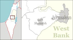
 Mevo Beitar
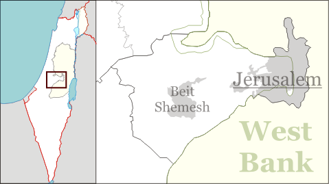
Mevo Beitar (Hebrew: מְבוֹא בֵּיתָר, lit. Beitar Gateway) is a moshav shitufi in central Israel. Located ten kilometres south-west of Jerusalem, it falls under the jurisdiction of Mateh Yehuda Regional Council. In 2007 it had a population of 327.[citation needed]
The village was established on 24 April 1950 by native Israelis and immigrants from Argentina who were members of the Beitar movement, including Matityahu Drobles, later a member of the Knesset. Located around a kilometre from the Green Line, it was a border settlement until the Six-Day War.
The settlement was founded on the land of the depopulated Palestinian village of Qabu.[1]
References
- ^ Khalidi, 1992, p.308
Bibliography
- Khalidi, Walid (1992), All That Remains: The Palestinian Villages Occupied and Depopulated by Israel in 1948, Washington D.C.: Institute for Palestine Studies, ISBN 0-88728-224-5
Mateh Yehuda Regional Council Kibbutzim Harel · Kiryat Anavim · Ma'ale HaHamisha · Nahshon · Netiv HaLamed-Heh · Ramat Rachel · Tzora · TzovaMoshavim Aderet · Agur · Aminadav · Aviezer · Bar Giora · Beit Zayit · Beit Meir · Beit Nekofa · Bekoa · Eshtaol · Even Sapir · Gefen · Giv'at Ye'arim · Givat Yeshayahu · Kfar Uria · Ksalon · Luzit · Mevo Beitar · Mata · Mahsia · Mesilat Zion · Naham · Nehusha · Nes Harim · Neve Ilan · Neve Michael · Ora · Ramat Raziel · Sdot Micha · Sho'eva · Shoresh · Ta'oz · Tal Shahar · Tarum · Tirosh · Tzafririm · Tzelafon · Yad HaShmona · Yish'i · Zanoah · ZekhariaCommunal settlements Jewish villages Arab villages Other villages Categories:- Mateh Yehuda Regional Council
- Moshavim
- Populated places established in 1950
Wikimedia Foundation. 2010.