- Jerusalem corridor
-
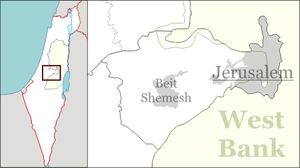
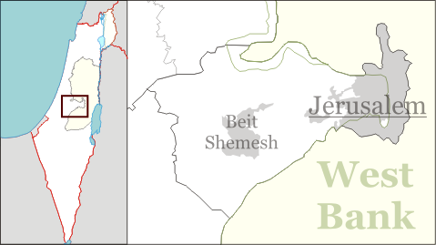
The Jerusalem corridor (Hebrew: פרוזדור ירושלים, Prozdor Yerushalayim) is a segment of Israeli territory between the Shephelah and Jerusalem which is home to over 700,000 Israeli Jews.[citation needed] Not including the Arab population[dubious ] of annexed East Jerusalem the areas population is almost 99% Jewish.[citation needed] Roughly stretching from Latrun in the west to Jerusalem in the east, it is bounded by the West Bank to the north and south. The corridor is largely covered by Mateh Yehuda Regional Council, and also contains the towns of Abu Ghosh, Kiryat Ye'arim and Mevaseret Zion. The top 6 settlements in population in this region area Jerusalem (747,600) (including East Jerusalem), Beit Shemesh (75,900), Mevasseret Zion (23,600), Abu Gosh (5,700), Tzur Hadassah (4,700), and Kiryat Ye'arim (3,400).
History
During efforts at renewed Jewish settlement in the later part of the nineteenth century in Palestine , it became necessary to maintain free passage between the coastal plain and Jerusalem. Without free passage Jerusalem was under constant threat of siege. Even so, at the outset of the 1948 Arab-Israeli War there were few Jewish settlements in the corridor.
According to the 1947 United Nations Partition Plan for Palestine, the area was supposed to be under control of the Arab state. It gained significance in the war, being the site of some of the most well-known and bloodiest battles and massacres of the war.
The importance of the corridor lay in its status as the only means of access for the Israeli forces to besieged Jerusalem. Jerusalem was home to about a sixth of the Jewish population in the Land of Israel at the time,[citation needed] and also held religious significance as the holiest city in Judaism. Much of the area was overlooked by the Jordanian fortress of Latrun on the western side of the corridor. Jewish forces attempted to capture this strategic point during several battles, in order to free up a supply route to Jerusalem. After failing, an alternate route was discovered and the Burma Road was laid there.
The Hadassah medical convoy massacre and Deir Yassin massacre are associated with the Jewish and Israeli struggle to free the Jerusalem corridor and the Convoy of 35 was also killed in the area.[citation needed]
At the end of the war, Jewish forces held control of most of the corridor (including the Burma Road), and these areas, as well as some Jordanian-controlled areas, became part of the State of Israel following the 1949 Armistice Agreements.[dubious ][citation needed]
Today
Today, in addition to the Jerusalem – Tel Aviv highway (Highway 1), a number of additional routes lead to Jerusalem; route 443 covers the northern part of the corridor. Route 395 leads from Ein Kerem to the coast, via Ramat Raziel and Bet Shemesh, and continues south. Route 386 leads to the Ella Valley, via Bar Giora and Tzur Hadassa. A railway line is active in the corridor, next to the Sorek Stream, which is part of the historical Jaffa–Jerusalem railway.
Categories:- Regions of Israel
- Jerusalem District
Wikimedia Foundation. 2010.