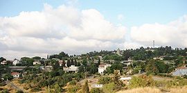
- Beit Meir
-
Beit Meir 
Founded 1950 Council Mateh Yehuda Region Jerusalem hills Affiliation Hapoel HaMizrachi Website www.ormeir.co.il Beit Meir (Hebrew: בֵּית מֵאִיר, lit. House of Meir) is a religious moshav in central Israel. Located in the Jerusalem hills around nine miles from Jerusalem, just off the Jerusalem-Tel Aviv highway, it falls under the jurisdiction of Mateh Yehuda Regional Council. In 2006 it had a population of 546.[citation needed]
The moshav was established on the land of the depopulated Palestinian village named Bayt Mahsir in 1950.[1][2]
The moshav was named after Rabbi Meir Bar-Ilan.[citation needed] Predominantly an Ashkenazi moshav, there are a number of Sephardi families residing in the village. The moshav is composed of almost entirely religious Jews, and the males members predominantly wear "kipot s'rugot" (knitted kippot), although there are a number of "black hat" and Hassidic families.[citation needed]
The moshav seemingly makes a large proportion of income through farming. There are farms located in Beit Meir, though their size and utility need to be ascertained so as to ensure that the quality of this article is not compromised. As would be expected from a small community only a matter of miles away from a big city, it would seem that a good percentage of the moshav's residents commute to Jerusalem on a daily basis in order to work. On the moshav, though, there are warehouses and a winery. The moshav is also located in close proximity to Hamasrek Nature Reserve.[citation needed]
A religious Yeshiva called Yeshivat Ohr Yerushalayim, aimed primarily at post-High School American students is also based in Moshav Beit Meir. The Yeshiva does not involve itself much with the local community, but does fit in with the local religious perspective that places high value on learning Torah.[citation needed]
References
Bibliography
- Khalidi, Walid (1992), All That Remains: The Palestinian Villages Occupied and Depopulated by Israel in 1948, Washington D.C.: Institute for Palestine Studies, ISBN 0-88728-224-5
- Morris, Benny (2004). The Birth of the Palestinian Refugee Problem Revisited. Cambridge University Press. ISBN 9780521009676. http://books.google.com/?id=uM_kFX6edX8C&printsec=frontcover&dq=benny+morris&q.
External links
Mateh Yehuda Regional Council Kibbutzim Harel · Kiryat Anavim · Ma'ale HaHamisha · Nahshon · Netiv HaLamed-Heh · Ramat Rachel · Tzora · TzovaMoshavim Aderet · Agur · Aminadav · Aviezer · Bar Giora · Beit Zayit · Beit Meir · Beit Nekofa · Bekoa · Eshtaol · Even Sapir · Gefen · Giv'at Ye'arim · Givat Yeshayahu · Kfar Uria · Ksalon · Luzit · Mevo Beitar · Mata · Mahsia · Mesilat Zion · Naham · Nehusha · Nes Harim · Neve Ilan · Neve Michael · Ora · Ramat Raziel · Sdot Micha · Sho'eva · Shoresh · Ta'oz · Tal Shahar · Tarum · Tirosh · Tzafririm · Tzelafon · Yad HaShmona · Yish'i · Zanoah · ZekhariaCommunal settlements Jewish villages Arab villages Other villages Coordinates: 31°47′38.76″N 35°2′13.56″E / 31.7941°N 35.0371°E
Categories:- Mateh Yehuda Regional Council
- Moshavim
- Populated places established in 1950
- Religious Israeli communities
Wikimedia Foundation. 2010.
