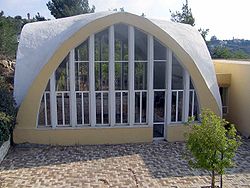
- Nataf
-
Nataf Founded 1982 Council Mateh Yehuda Region Jerusalem corridor Coordinates 31°49′56.28″N 35°4′4.44″E / 31.8323°N 35.0679°ECoordinates: 31°49′56.28″N 35°4′4.44″E / 31.8323°N 35.0679°E Website natafnik.com Nataf (Hebrew: נָטָף) is a communal settlement in the Judean Mountains, 12 miles west of Jerusalem, Israel. It is under the jurisdiction of Mateh Yehuda Regional Council. In 2006, Nataf had a population of 387.[1]
Contents
Geography
Nataf is situated on a ridge bounded by Kefira Valley to the north and Hamisha Valley to the south; the elevation is around 500m above MSL. It lies at the end of a 3-mile road that passes through Abu Ghosh.
History
Nataf was founded in 1982 on private land purchased from residents of Abu Ghosh. [2]It overlooks Nataf Valley, a popular hiking destination. Nataf spring is watered all year round and has a number of small freshwater pools. The name Nataf is of biblical origins and referred to the incense Stacte. Many of the residents are Modern Orthodox. The village has a unique unaffiliated synagogue with three sections for prayer: a men's section, a women's section and a mixed section.[citation needed]
Notable residents
- Avram Burg
References
Mateh Yehuda Regional Council Kibbutzim Harel · Kiryat Anavim · Ma'ale HaHamisha · Nahshon · Netiv HaLamed-Heh · Ramat Rachel · Tzora · TzovaMoshavim Aderet · Agur · Aminadav · Aviezer · Bar Giora · Beit Zayit · Beit Meir · Beit Nekofa · Bekoa · Eshtaol · Even Sapir · Gefen · Giv'at Ye'arim · Givat Yeshayahu · Kfar Uria · Ksalon · Luzit · Mevo Beitar · Mata · Mahsia · Mesilat Zion · Naham · Nehusha · Nes Harim · Neve Ilan · Neve Michael · Ora · Ramat Raziel · Sdot Micha · Sho'eva · Shoresh · Ta'oz · Tal Shahar · Tarum · Tirosh · Tzafririm · Tzelafon · Yad HaShmona · Yish'i · Zanoah · ZekhariaCommunal settlements Nataf · Srigim · Tzur HadassahJewish villages Arab villages Other villages Categories:- Mateh Yehuda Regional Council
- Community settlements in Israel
- Populated places established in 1982
Wikimedia Foundation. 2010.


