- Motza Illit
-
Motza Illit Founded 1933 Founded by Motza residents Council Mateh Yehuda Region Jerusalem corridor Coordinates 31°47′35.03″N 35°9′28.29″E / 31.7930639°N 35.1578583°ECoordinates: 31°47′35.03″N 35°9′28.29″E / 31.7930639°N 35.1578583°E 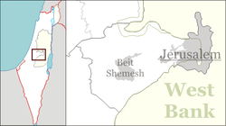
 Motza Illit
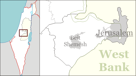
Motza Illit (Hebrew: מוֹצָא עִלִּית, מוצא עילית, lit. Upper Motza) is a rural community on the outskirts of Jerusalem, Israel. It falls under the jurisdiction of Mateh Yehuda Regional Council. In 2006 it had a population of 785.
Motza Illit was established as a moshav in 1933 by residents of Motza.
References
Mateh Yehuda Regional Council Kibbutzim Harel · Kiryat Anavim · Ma'ale HaHamisha · Nahshon · Netiv HaLamed-Heh · Ramat Rachel · Tzora · TzovaMoshavim Aderet · Agur · Aminadav · Aviezer · Bar Giora · Beit Zayit · Beit Meir · Beit Nekofa · Bekoa · Eshtaol · Even Sapir · Gefen · Giv'at Ye'arim · Givat Yeshayahu · Kfar Uria · Ksalon · Luzit · Mevo Beitar · Mata · Mahsia · Mesilat Zion · Naham · Nehusha · Nes Harim · Neve Ilan · Neve Michael · Ora · Ramat Raziel · Sdot Micha · Sho'eva · Shoresh · Ta'oz · Tal Shahar · Tarum · Tirosh · Tzafririm · Tzelafon · Yad HaShmona · Yish'i · Zanoah · ZekhariaCommunal settlements Jewish villages Gizo · Motza Illit · Neve ShalomArab villages Other villages Categories:- Mateh Yehuda Regional Council
- Villages in Israel
- Former moshavim
- Populated places established in 1933
Wikimedia Foundation. 2010.