- U.S. Route 730
-
U.S. Route 730
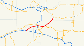
US 730 highlighted in red.Route information Maintained by Oregon DOT and WSDOT Length: 41.78 mi[1][2] (67.24 km) Existed: 1926 – present Major junctions West end: 
 I-84 / US 30 near Boardman, OR
 I-82 / US 395 in Umatilla, OR
East end:  US 12 near Wallula, WA
Highway system United States Numbered Highways
List • Bannered • Divided • Replaced←  OR 569
OR OR 3  →
→←  SR 706
WA SR 821  →
→U.S. Route 730 is a U.S. highway in the U.S. states of Oregon and Washington. It is numbered as a spur of U.S. Route 30, which runs from Astoria, Oregon to Atlantic City, New Jersey. US 730 stretches 42 miles (68 km) from Interstate 84 and U.S. Route 30 east of Boardman, Oregon northeast to U.S. Route 12 near Wallula, Washington. In Oregon, US 730 is officially known as part of the Columbia River Highway No. 2 (see Oregon highways and routes).[3][4][5][6]
Contents
Route description
Oregon
Lengths mi km OR 35.7 57.45 WA 6.08 9.78 Total 41.78 67.24 US 730 starts at an interchange with Interstate 84 and U.S. Route 30 east of the city of Boardman. From the interchange, US 730 goes northeast to Irrigon, where it forms the city's main street.[7] From Irrigon, the highway goes east into Umatilla, where it intersects I-82 and US 395.[8] At the interchange, US 395 joins US 730 for a short distance before going south just outside of Umatilla. From the split, US 730 continues east and intersects Oregon Route 207 before going into Cold Springs Junction, where it intersects Oregon Route 37.[9] From Cold Springs Junction, US 730 goes northeast into Washington.[10]
Washington
US 730 continues from the Oregon border along the Columbia River towards Wallula, Washington. After going northeast along the coasts of the Columbia River and Lake Wallula, US 730 turns east to intersect U.S. Route 730 Spur and end at U.S. Route 12.[11] Legally, the Washington section of US 730 is defined in Washington Revised Code § 47.17.821.[12]
U.S. Route 730 Spur

U.S. Route 730 Spur
Location: Wallula, Washington U.S. Route 730 Spur (US 730 Spur) is a 0.30-mile[2] (0.48 km) route that runs from US 730 to US 12 westbound towards Downtown Wallula, Washington and Pasco, Washington. Along the road, there is a weigh station operated by the Washington State Patrol.[13][14]
History
In the original 1926 plan for the U.S. highway system, US 730 went from U.S. Route 30 east of Umatilla, Oregon to U.S. Route 410 south of Wallula, Washington. In 1945, a new section of US 30 was built, which made US 730's west end at US 30 in Boardman, Oregon. Later in 1962, there was a plan to extend U.S. Route 12 westward towards the Pacific Ocean. One of the plans involved using US 730 as part of US 12, therefore removing US 730 from the system. Another plan, which used US 410 in Washington instead of US 730, was accepted in 1967. In 1966, US 730's terminus was changed to its current western end at I-84/US 30.
From 1937 to 1986, U.S. Route 395 was co-signed with US 730 from Umatilla to Wallula.[15][16][17] The portion of US 730 in Washington state was signed as the Wallula branch of Primary State Highway 3.
Major intersections
County Location Mile[1][2] Destinations Notes Morrow 0.00 I-84 / US 30 – Boardman, Portland, Pendleton0.00 Lexington, Heppner (Bombing Range Road) Umatilla Umatilla 16.53 I-82 / US 395 north to I-84 – Kennewick, Spokane, Pendleton, PortlandInterchange; west end of US 395 overlap 17.29 US 395 south to I-84 east – Hermiston, Pendleton, McNary DamEast end of US 395 overlap 23.76  OR 207 south – Hermiston, Heppner
Cold Springs Junction 25.88  OR 37 south – Holdman, Pendleton, Warehouse Beach Recreation Area
35.70 State line Walla Walla 41.78 US 12 – Pasco, Walla WallaReferences
- ^ a b Oregon Department of Transportation, Public Road Inventory (primarily the Digital Video Log), accessed March 2008
- ^ a b c Washington State Department of Transportation, State Highway Log, 2006
- ^ Oregon Department of Transportation (2008-06-24). "Digital Video Log". https://keiko36.odot.state.or.us/whalecomf839440f71e71a949ce46a399d3edd592434698662/whalecom0/cf/dvl/index.cfm. Retrieved 2008-08-27.
- ^ Oregon Department of Transportation (2007). State of Oregon State Highway System (Map). http://egov.oregon.gov/ODOT/TD/TDATA/rics/docs/NumRouteMap.pdf. Retrieved 2008-08-27.
- ^ Oregon Department of Transportation. "Routes to State Highway Cross Reference". http://www.oregon.gov/ODOT/TD/asset_mgmt/docs/OTMS/Routes2HwyCrossRef.pdf. Retrieved 2008-08-27.
- ^ Oregon Department of Transportation (1988). "1988 Oregon Milage Report". http://www.oregon.gov/ODOT/TD/TDATA/rics/docs/1998_OMR.pdf. Retrieved 2008-08-27.
- ^ Google, Inc. Google Maps – U.S. Route 730 (Boardman Jct. to Irrigon) (Map). Cartography by Google, Inc. http://maps.google.com/maps?f=d&hl=en&geocode=323952065150351765,45.895370,-119.493940&saddr=45.833225,-119.625771&daddr=Columbia+River+Hwy%2FS+Main+Ave+%4045.895370,+-119.493940&mra=mi&mrsp=0&sz=16&doflg=ptm&sll=45.834436,-119.62487&sspn=0.004261,0.008411&ie=UTF8&ll=45.864194,-119.54155&spn=0.136273,0.269165&z=11. Retrieved 2008-07-23.
- ^ Google, Inc. Google Maps – U.S. Route 730 Map (Irrigon to Umatilla) (Map). Cartography by Google, Inc. http://maps.google.com/maps?f=d&hl=en&geocode=12952278827241329457,45.895534,-119.493940%3B11859855606703444558,45.918210,-119.321265&saddr=45.895295,-119.493957&daddr=6th+St%2FColumbia+River+Hwy%2FUS-395%2FUS-730+%4045.918210,+-119.321265&mra=dme&mrcr=0&mrsp=0&sz=15&doflg=ptm&sll=45.895414,-119.490652&sspn=0.008512,0.016823&ie=UTF8&z=15. Retrieved 2008-07-23.
- ^ Google, Inc. Google Maps – U.S. Route 730 Map (Utamilla to Cold Springs Jct.) (Map). Cartography by Google, Inc. http://maps.google.com/maps?f=d&hl=en&geocode=3591621024234616768,45.914055,-119.137976&saddr=45.918244,-119.321265&daddr=Columbia+River+Hwy%2FUS-730+%4045.914055,+-119.137976&mra=mi&mrsp=0&sz=16&doflg=ptm&sll=45.918527,-119.321136&sspn=0.004254,0.008411&ie=UTF8&ll=45.943988,-119.238739&spn=0.136077,0.269165&z=11. Retrieved 2008-07-23.
- ^ Google, Inc. Google Maps – U.S. Route 730 Map (Cold Springs Jct. to Washington border) (Map). Cartography by Google, Inc. http://maps.google.com/maps?f=d&hl=en&geocode=10209604430219913647,46.000270,-118.976200&saddr=45.914004,-119.137931&daddr=US-730+%4046.000270,+-118.976200&mra=mi&mrsp=0&sz=16&doflg=ptm&sll=45.914706,-119.137888&sspn=0.004255,0.008411&ie=UTF8&ll=45.96022,-119.054718&spn=0.136038,0.269165&z=11. Retrieved 2008-07-23.
- ^ Google, Inc. Google Maps – U.S. Route 730 Map (Oregon border to Wallula Jct.) (Map). Cartography by Google, Inc. http://maps.google.com/maps?f=d&hl=en&geocode=15477954963749931305,46.000234,-118.976242&saddr=US-730+%4046.000234,+-118.976242&daddr=46.057509,-118.909492&mra=mi&mrsp=1,0&sz=12&doflg=ptm&sll=46.050361,-118.928719&sspn=0.067908,0.134583&ie=UTF8&ll=46.033679,-118.940735&spn=0.067929,0.134583&z=12. Retrieved 2008-07-23.
- ^ Washington State Legislature (1985). "RCW 47.17.821: State route No. 730". http://apps.leg.wa.gov/RCW/default.aspx?cite=47.17.821. Retrieved 2008-07-23.
- ^ Google, Inc. Google Maps – U.S. Route 730 Spur Map (Map). Cartography by Google, Inc. http://maps.google.com/maps?f=d&hl=en&geocode=2600036221954967939,46.056620,-118.913823%3B11061363958795047026,46.058270,-118.909910&saddr=US-730+%4046.056620,+-118.913823&daddr=46.0587,-118.909986&mra=dme&mrcr=0&mrsp=1&sz=17&doflg=ptm&sll=46.058611,-118.909235&sspn=0.002122,0.004206&ie=UTF8&z=17. Retrieved 2008-07-23.
- ^ U.S. Highways. "Spur Routes of the U.S. Highway System". http://www.us-highways.com/spurus.htm. Retrieved 2008-07-23.
- ^ Session Laws of the State of Washington. 1985 chapter 177. "An act relating to state highway routes; amending RCW 47.17.055, 47.17.060, 47.17.455, and 47.17.575; adding a new section to chapter 47.17 RCW; and repealing RCW 47.17.281 and 47.17.867."
- ^ Department of Highways, Highway Map: State of Washington, Revised to April 1, 1933
- ^ Department of Highways, Highways of the State of Washington (Rand McNally), 1939
External links
U.S. Routes related to US 30 
 U.S. Routes in WashingtonCategories:
- Three-digit U.S. Highways
- U.S. Highways in Oregon
- U.S. Route 30
- Transportation in Walla Walla County, Washington
- Transportation in Umatilla County, Oregon
- Transportation in Morrow County, Oregon


Wikimedia Foundation. 2010.