- Lexington, Oregon
Infobox Settlement
official_name = Lexington, Oregon
settlement_type =Town
nickname =
motto =
imagesize =
image_caption =
image_
imagesize =
image_caption =
image_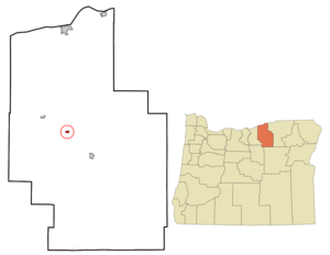
mapsize = 250px
map_caption = Location inOregon
mapsize1 =
map_caption1 =
subdivision_type = Country
subdivision_name =United States
subdivision_type1 = State
subdivision_name1 =Oregon
subdivision_type2 = County
subdivision_name2 = Morrow
government_type =
leader_title =Mayor
leader_name = Valerie Doherty
established_title = Incorporated
established_date = 1903
area_magnitude =
area_total_sq_mi = 0.4
area_total_km2 = 1.1
area_land_sq_mi = 0.4
area_land_km2 = 1.1
area_water_sq_mi = 0
area_water_km2 = 0
area_urban_sq_mi =
area_urban_km2 =
area_metro_sq_mi =
area_metro_km2 =
population_as_of = 2000
population_note =
population_total = 263
population_metro =
population_urban =
population_density_km2 = 247.7
population_density_sq_mi = 637.9
timezone = Pacific
utc_offset = -8
timezone_DST = Pacific
utc_offset_DST = -7
latd = 45 |latm = 26 |lats = 43 |latNS = N
longd = 119 |longm = 41 |longs = 17 |longEW = W
elevation_m = 443.2
elevation_ft = 1454
website =
postal_code_type =ZIP code
postal_code = 97839
area_code = 541
blank_name = FIPS code
blank_info = 41-42200GR|2
blank1_name = GNIS feature ID
blank1_info = 1136476GR|3
footnotes =Lexington is a city in Morrow County,
Oregon ,United States . The population was 263 at the 2000 census. It is part of the Pendleton–Hermiston Micropolitan Statistical Area.Geography
Lexington is located at coor dms|45|26|43|N|119|41|17|W|city (45.445235, -119.688044)GR|1.
According to the
United States Census Bureau , the city has a total area of 0.4square mile s (1.1km² ), all of it land.Demographics
As of the
census GR|2 of 2000, there were 263 people, 102 households, and 72 families residing in the city. Thepopulation density was 637.9 people per square mile (247.7/km²). There were 111 housing units at an average density of 269.2/sq mi (104.5/km²). The racial makeup of the city was 96.96% White, 1.14% Native American, 0.76% Asian, 0.38% from other races, and 0.76% from two or more races. Hispanic or Latino of any race were 0.38% of the population.There were 102 households out of which 29.4% had children under the age of 18 living with them, 64.7% were married couples living together, 4.9% had a female householder with no husband present, and 29.4% were non-families. 20.6% of all households were made up of individuals and 12.7% had someone living alone who was 65 years of age or older. The average household size was 2.58 and the average family size was 3.03.
In the city the population was spread out with 24.3% under the age of 18, 6.8% from 18 to 24, 28.1% from 25 to 44, 24.7% from 45 to 64, and 16.0% who were 65 years of age or older. The median age was 42 years. For every 100 females there were 107.1 males. For every 100 females age 18 and over, there were 103.1 males.
The median income for a household in the city was $43,125, and the median income for a family was $50,625. Males had a median income of $37,969 versus $24,688 for females. The
per capita income for the city was $23,152. About 6.7% of families and 12.0% of the population were below thepoverty line , including 20.6% of those under the age of eighteen and 7.1% of those sixty five or over.Population Decay
The population of Lexington has decayed at a rate of about 10% per decade since about 1960. This is in contrast to Morrow County as a whole, which has seen its population more than double since 1960. Most population movement is to the nearby city of Heppner, or to larger cities such as Portland. As a result, Lexington's only school closed down after the 1997 school year with less than 50 students, who now attend Heppner Elementary School or Heppner Jr/Sr High School. The population decay has caused many problems, chief among them real estate values for the area. The average home value in the Lexington is about $60,000 and declining steadily. About 10% of actively upkept homes are vacant, with several dozen more homes existing in decrepit states after decades of vacancy. Source:
United States Census Bureau , 1960-2000 census reports..Transportation
References
External links
* [http://bluebook.state.or.us/local/cities/lr/lexington.htm Oregon Blue Book entry for Lexington]
Wikimedia Foundation. 2010.