- McNary Dam
-
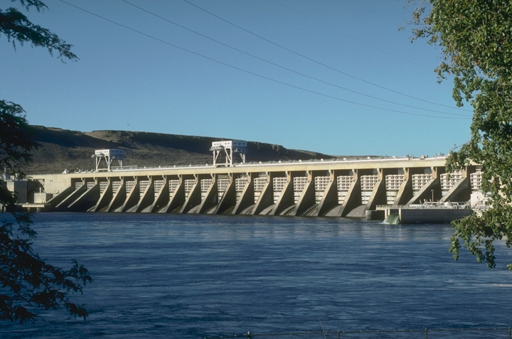
McNary Dam 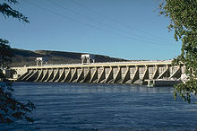
Spillway view from the southwest, Oregon side of the Columbia RiverLocation Benton County, Washington / Umatilla County, Oregon, USA Coordinates 45°55′47″N 119°17′46″W / 45.92972°N 119.29611°WCoordinates: 45°55′47″N 119°17′46″W / 45.92972°N 119.29611°W Construction began 1947 Opening date 1954 (Partial Activation)
1957 (Full Activation)Dam and spillways Type of dam Concrete gravity, run-of-the-river Height 183 feet (56 m) Length 7,365 feet (2,245 m) Impounds Columbia River Type of spillway Service, gate-controlled Reservoir Creates Lake Wallula Capacity 1,350,000 acre·ft (1.67 km3) Power station Turbines 14 Installed capacity 1,127 MW Maximum capacity 980 MW McNary Dam is a 1.4-mile (2.2-km) long concrete gravity run-of-the-river dam which spans the Columbia River. It joins Umatilla County, Oregon with Benton County, Washington, 292 miles (470 km) upriver from the mouth of the Columbia at Astoria, Oregon.[1] It is operated by the U.S. Army Corps of Engineers' McNary Lock and Dam office. The dam is located a mile (2 km) east of the town of Umatilla, Oregon, and 8 miles (13 km) north of Hermiston, Oregon. The dam was originally planned to be named Umatilla Dam, but the Flood Control Act of 1945 renamed the dam in honor of Senator Charles L. McNary of Oregon, who had died the previous year.
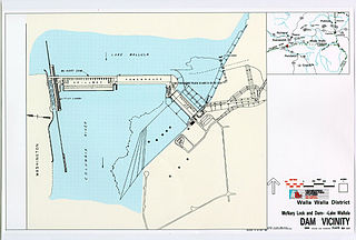
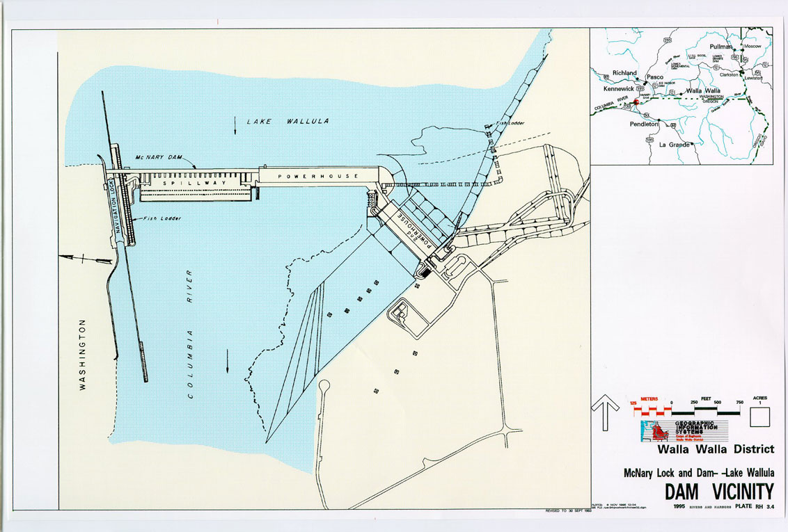
The dam provides for slackwater navigation, hydroelectric power generation, recreation, wildlife habitat, and incidental irrigation.
Bills for the construction of a dam were introduced in the United States Congress as early as 1931.[2] The United States House of Representatives rivers and harbors committee initially approved the project in April 1941; navigation, power generation, and national security were the major reasons cited for construction of the dam.[3] Construction began in 1947, and was completed in 1954. Activation of all generating units was completed in 1957. Its capacity is 980 MW. There are two fish ladders for salmon and steelhead passage, one on each shore of the dam. The Washington side also has an 86 foot (26 m) wide, 683 foot (208 m) long navigation lock that lifts boats an average of 75 feet (23 m). The dam flooded the Umatilla Rapids, forming a reservoir called Lake Wallula. The lake extends 64 miles (103 km) up the Columbia to the US DOE Hanford Site. It also extends up the Snake River to the Ice Harbor Dam.
This dam has a unique feature: two additional turbines whose purpose is to power the dam itself. That is, this dam is entirely self-sustaining; and if some large event caused the entire grid to go down, McNary would be key in getting it back on. These two "station service" turbines are only capable of providing about three MW, compared to the 70 MW of the other 14 turbines. These two turbines alternate service duty to provide the dam with its energy requirements.
 Plans for a second powerhouse submitted in 1986, which were cancelled in 1991
McNary Dam is part of the Columbia River Basin system of dams.
Stats:
- Location: 45.9298548 -119.2961275
(45°55′47″N 119°17′46″W / 45.92972°N 119.29611°W) - Altitude: 344 feet (105 m) above sea level
- Height: 183 feet (56 m)
- Length: 7,365 feet (2,245 m)
- Navigation lock:
- Single-lift
- 86 feet (26 m) wide
- 683 feet (208 m) long
- Powerhouse
- Fourteen 70,000-kilowatt units
- Total capacity: 980 megawatts
- Overload capacity: 1,127 MW
- Spillway
- Gates: 22
- Length: 1,310 feet (400 m)
See also
- Hydroelectric dams on the Columbia River
- McNary Dam Heliport
- Hat Rock State Park
References
- ^ "The Columbia River System Inside Story". BPA.gov. pp. 14–15. http://www.bpa.gov/power/pg/columbia_river_inside_story.pdf. Retrieved 17 July 2010.
- ^ Julius Meier's Governor's Message, 1931
- ^ "Umatilla Rapids dam approved by House group". The Hermiston Herald. May 1, 1941. http://www.ccrh.org/comm/umatilla/primary/approval.htm.
External links
Hydroelectric dams on the Columbia River Bonneville · The Dalles · John Day · McNary · Priest Rapids · Wanapum · Rock Island · Rocky Reach · Wells · Chief Joseph · Grand Coulee · Keenleyside · Revelstoke · Mica
Crossings of the Columbia River Upstream
Union Pacific Rail BridgeMcNary Dam Downstream
Umatilla Bridge

 Categories:
- Buildings and structures in Benton County, Washington
- Dams on the Columbia River
- Dams in Oregon
- Dams in Washington (state)
- Hydroelectric power plants in Washington (state)
- Hydroelectric power plants in Oregon
- Buildings and structures in Umatilla County, Oregon
- Run-of-the-river power stations
- Location: 45.9298548 -119.2961275
Wikimedia Foundation. 2010.