Wells Dam

Wells Dam

Infobox_Dam
dam_name=Wells Dam

caption=
official_name=
crosses=
reservoir=
locale=
maint=
length=
height=
width=
began=
open=
closed=
cost=
reservoir_capacity=
reservoir_catchment=
reservoir_surface=
bridge_carries=
bridge_width=
bridge_clearance=
bridge_traffic=
bridge_toll=
bridge_id=
map_cue=
map_

map_text=
map_width=
coordinates=
lat=
long=
extra=

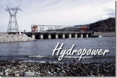
Wells Dam (coord|47|56|43.44|N|119|51|57.6|W|) is a hydroelectric dam located on the Columbia River, downstream from the confluence of the Okanogan River, Methow River and the Columbia, in the United States of America. The dam and associated structures and machinery make up the Wells Hydroelectric Project. It is operated by Douglas County, Washington Public Utility District (PUD), who owns 92% of the project. Okanogan County, Washington Public Utility District (PUD) owns 8%.

It has produced electricity since August 22, 1967. Its operating license from the US Federal Energy Regulatory Commission is next up for renewal in 2012. In addition to the two public utility districts, the project provides electricity to Puget Sound Energy, Portland General Electric, PacifiCorp, Avista Corporation, and the Colville Indian Tribe. [http://www.fwee.org/news/getStory?story=1309]

Its reservoir is named Lake Pateros.

References

External links


Wikimedia Foundation. 2010.

Игры ⚽ Поможем сделать НИР

Look at other dictionaries:

  • Dam — /dam, dahm/, n. (Carl Peter) Henrik /kahrl pee ter hen rik/; Dan. /kahrddl pay teuhrdd hen rddik/, 1895 1976, Danish biochemist: Nobel prize for medicine 1943. * * * I Barrier built across a stream, river, or estuary to conserve water for such… …   Universalium

  • dam — dam1 /dam/, n., v., dammed, damming. n. 1. a barrier to obstruct the flow of water, esp. one of earth, masonry, etc., built across a stream or river. 2. a body of water confined by a dam. 3. any barrier resembling a dam. v.t. 4. to furnish with a …   Universalium

  • Chief Joseph Dam — Location Douglas and Okanogan counties, United States Coordinates …   Wikipedia

  • Bonneville Dam — Das Bonneville Bauwerk mit Staudamm, Wasserkraftwerken, den Schleusen und dem See Lake Bonneville (im Hintergrund) …   Deutsch Wikipedia

  • Grand Coulee Dam — Grand Coulee Talsperre Grand Coulee Staumauer Lage …   Deutsch Wikipedia

  • High Arrow Dam — Arrow Lake Der Arrow Lake ist ein durch den Bau des Hugh Keenleyside Dam entstandener See im Süden von British Columbia, der vom Columbia durchflossen wird. Lage Der 232 km (145 Meilen) lange See reicht vom Hugh Keenleyside Dam etwa 10 km… …   Deutsch Wikipedia

  • Hugh Keenleyside Dam — Arrow Lake Der Arrow Lake ist ein durch den Bau des Hugh Keenleyside Dam entstandener See im Süden von British Columbia, der vom Columbia durchflossen wird. Lage Der 232 km (145 Meilen) lange See reicht vom Hugh Keenleyside Dam etwa 10 km… …   Deutsch Wikipedia

  • Keenleyside Dam — Arrow Lake Der Arrow Lake ist ein durch den Bau des Hugh Keenleyside Dam entstandener See im Süden von British Columbia, der vom Columbia durchflossen wird. Lage Der 232 km (145 Meilen) lange See reicht vom Hugh Keenleyside Dam etwa 10 km… …   Deutsch Wikipedia

  • Perunchani Dam — is an irrigation dam at Perunchani, Kanyakumari District, in the state of Tamilnadu, India. The Dam area is about 42 km from Nagercoil, the administrative headquarters town of Kanyakumari District, and about 10 km from the town of Kulasekhram.The …   Wikipedia

  • Grand Coulee Dam — This article is about the dam itself. For the song by Woody Guthrie, see Grand Coulee Dam (song). Grand Coulee Dam …   Wikipedia

Share the article and excerpts

Direct link
Do a right-click on the link above
and select “Copy Link”