- Revelstoke Dam
Infobox_Dam
dam_name=Revelstoke Dam
official_name=
crosses=
reservoir=
locale=
maint=BC Hydro (Operator)
length=
height=
width=
began=
open=1984
closed=
cost=
reservoir_capacity=
reservoir_catchment=
reservoir_surface=
bridge_carries=
bridge_width=
bridge_clearance=
bridge_traffic=
bridge_toll=
bridge_id=
map_cue=
map_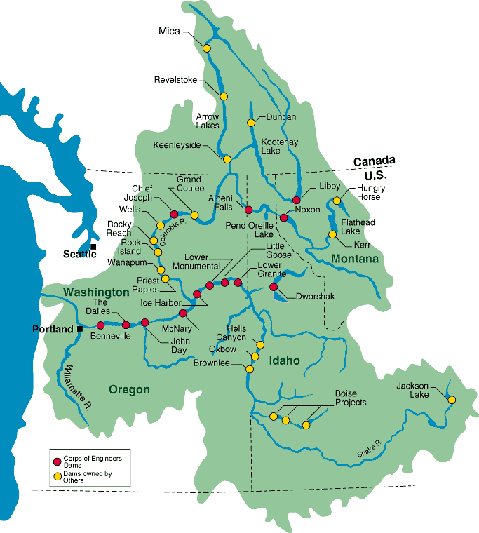
map_text=
map_width=200px
coordinates=
lat=
long=
extra=Revelstoke Dam, also known as Revelstoke Canyon Dam, is a hydroelectric
dam spanning theColumbia River , 5km north ofRevelstoke, British Columbia ,Canada . The powerhouse was completed in1984 and has a generating capacity of 1980 MW. Four generating units were installed initially, with room for two more, which would bring capacity to 2760 MW. The reservoir behind the dam is namedRevelstoke Lake . The dam is operated byBC Hydro .Areas inundated
Areas inundated by the dam include the
Dalles des Morts or "Death Rapids", which was the stretch of canyon just above the dam's location, and various small localities located along the pre-inundation route of theBig Bend Highway , which was the original route of theTrans-Canada Highway until the building of itsRogers Pass section. Just below the dam was the location of La Porte, one of the boomtowns of theBig Bend Gold Rush and the head of river navigation via theArrow Lakes andColumbia River fromMarcus, Washington . Just below the site of La Porte is the former town of Downie Creek, also a Big Bend Gold Rush boomtown but which survived into the days of the Big Bend Highway as a stopping-point .Expansion
BC Hydro is currently seeking regulatory approval to build a fifth generating unit at the Revelstoke Dam. This would add 500 MW of capacity to the dam. BC Hydro hopes to have the fifth unit online by
2010 . [http://www.bchydro.com/info/epi/epi31090.html]See also
*
Mica Dam
*Keenleyside Dam
*Hydroelectric dams on the Columbia River External links and references
* [http://www.bchydro.com/recreation/southern/southern1205.html BC Hydro Revelstoke Dam Visitor Centre page]
* [http://www.bchydro.com/info/system/system15276.html BC Hydro regional power generation info]
* [http://www.bchydro.com/info/epi/epi31090.html BC Hydro information on fifth generating unit]
Wikimedia Foundation. 2010.