- U.S. Route 197
-
U.S. Route 197
The Dalles-California Highway 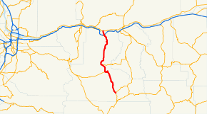
Route information Auxiliary route of US 97 Length: 63.90 mi[1][2] (102.84 km) Major junctions South end:  US 97 near Shaniko, OR
 OR 216 in Tygh Valley, OR
 I-84 in The Dalles, OR
North end:  SR 14 near Dallesport, WA
Highway system United States Numbered Highways
List • Bannered • Divided • Replaced←  OR 194
OR US 199  →
→←  US 195
WA SR 202  →
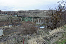
→U.S. Route 197 (US 197) is a north–south U.S. Route serving Central Oregon and the Columbia Gorge. The route was added in the 1950s. The southern terminus of US 197 is at an intersection with U.S. Route 97 west of Shaniko, Oregon.[3] From US 97, US 197 traverses Wasco County and the cities of Maupin, Tygh Valley, Dufur, and The Dalles before reaching the Oregon – Washington border.[4] From the border, US 197 goes over The Dalles Bridge and then continues north to end at SR 14 north of Dallesport, Washington.
Contents
Route description
Oregon
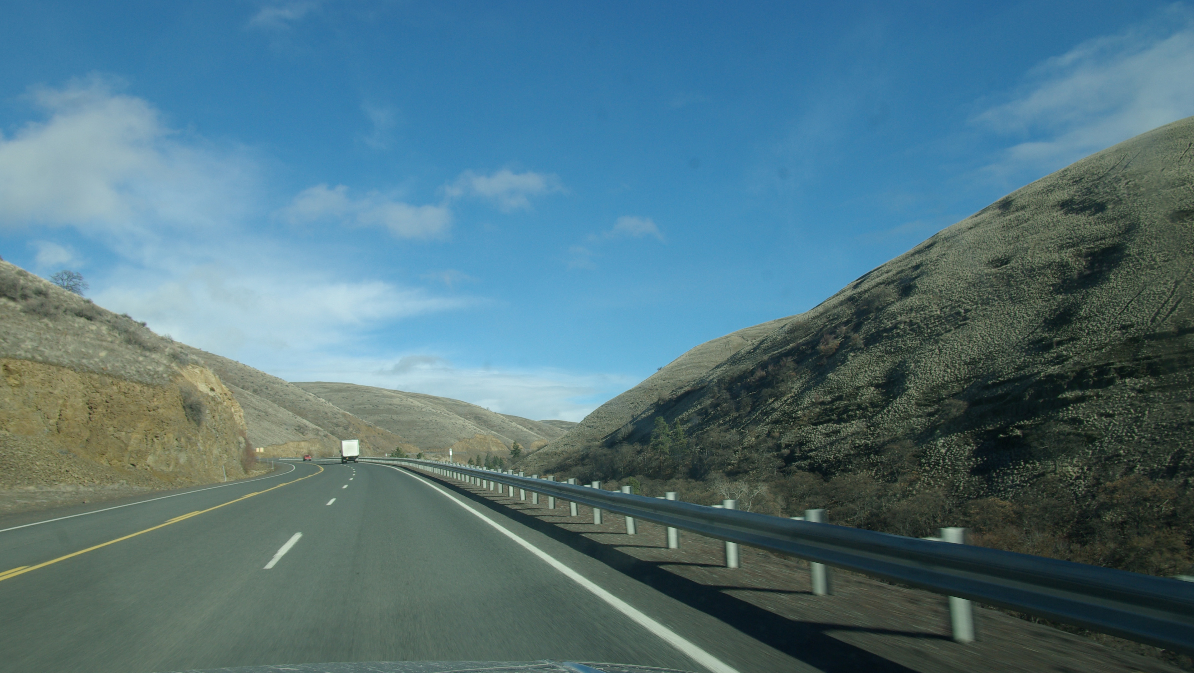
Lengths mi km OR 60.72 WA 3.18 Total 63.90 102.84  U.S. 197 northbound on Tygh grade
The Oregon section of US 197 is designated as part of The Dalles-California Highway No. 4 (see Oregon highways and routes).
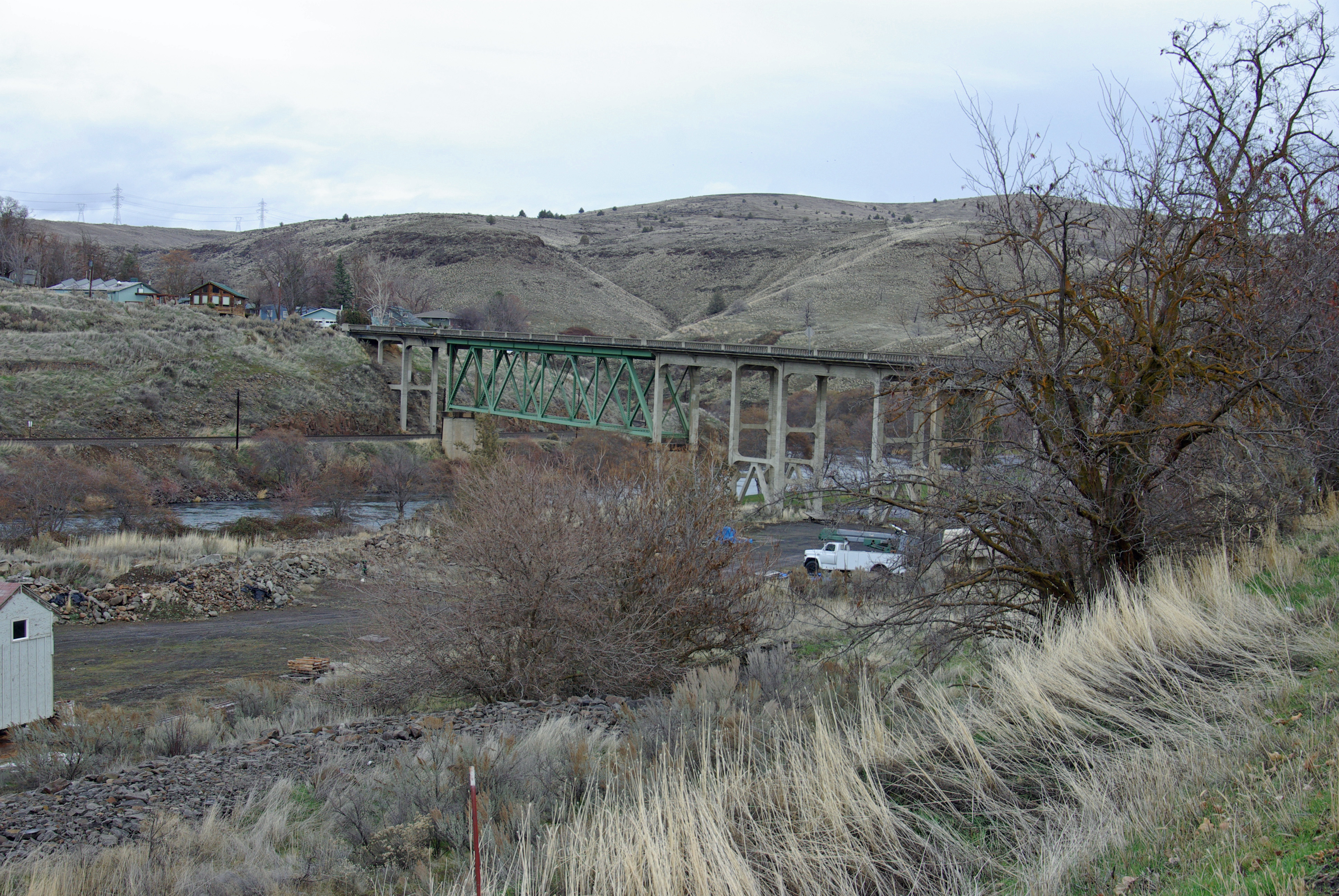
 Crossing the Deschutes River at Maupin
Branching from US 97 south of Shaniko, US 197 runs northwest, first climbing to the Criterion Summit at over 3,300 feet (1,000 m) and dropping to about 900 feet (270 m) to the Deschutes River at Maupin in a dramatic winding river crossing.[4] About two miles (3 km) west of Maupin, US 197 intersects Oregon Route 216 (Wapinitia Highway) and overlaps it north to Tygh Valley. At Tygh Valley, OR 216, now known as the Sherars Bridge Highway, turns east to Sherar's Bridge and Grass Valley.[4]
Remaining west of the Deschutes River, US 197 crests the Tygh Grade Summit 6.5 miles (10.5 km) north of Tygh Valley and then proceeds north down the slope of the Columbia River Gorge through Dufur to the city of The Dalles and thence to The Dalles Bridge and on to Washington.[4][5][6]
Washington
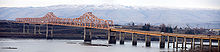
In Washington, US 197 extends for three miles (5 km) from The Dalles Bridge over the Columbia River to an intersection with SR 14 near Dallesport. Although most of the route within the state is little more than a local road, the southernmost portion of US 197 passes by The Dalles Municipal Airport and is the main connector between the airport and the city.[7] The entirety of U.S. 197 within Washington is defined at Washington Revised Code § 47.17.382.[8]
History
When US 197 was created in the 1950s, US 197 went from US 97, its current southern terminus, north to U.S. Route 830 and east to US 97 in Maryhill, Washington. The portion from US 830 to US 97 was co-signed with US 830 until 1968, when US 830 was removed from the system and US 197's northern terminus was moved to SR 14, which is the former route of US 830. Even though the section was removed in 1968, the portion of US 197 was not removed from most highway mileage logs until 2006.
Major intersections
County Location Mile[1][2] Destinations Notes Wasco Shaniko Junction 0.00 US 97 – Madras, Bend, Shaniko, Biggs24.71 OR 216 west – Government Camp, PortlandSouth end of OR 216 overlap Tygh Valley 31.69 OR 216 east – Tygh Valley, Wamic, Sherars Bridge, Grass ValleyNorth end of OR 216 overlap The Dalles 59.79  US 30 west – The Dalles
South end of US 30 overlap 60.07 I-84 / US 30 east – The Dalles, Portland, ArlingtonNorth end of US 30 overlap 60.72 The Dalles Bridge over the Columbia River (state line) Klickitat 63.90  SR 14 to I-82 – Vancouver, Kennewick
References
- ^ a b Oregon Department of Transportation, Public Road Inventory (primarily the Digital Video Log), accessed March 2008
- ^ a b Washington State Department of Transportation, State Highway Log, 2006
- ^ Oregon Transportation Map Wasco County 2006 Sheet 3
- ^ a b c d State of Oregon Highway System Route Map 2006
- ^ Google, Inc. Google Maps – U.S. Route 197 (US 97 to Tygh Valley) (Map). Cartography by Google, Inc. http://maps.google.com/maps?f=d&hl=en&geocode=7374505421856157214,44.921610,-120.945260&saddr=US-97+%4044.921610,+-120.945260&daddr=45.253018,-121.175251&mra=mi&mrsp=1,0&sz=13&doflg=ptm&sll=45.251809,-121.178856&sspn=0.034442,0.067291&ie=UTF8&ll=45.137493,-120.921021&spn=0.552167,1.07666&z=9. Retrieved 2008-07-24.
- ^ Google, Inc. Google Maps – U.S. Route 197 (Tygh Valley to The Dalles Bridge) (Map). Cartography by Google, Inc. http://maps.google.com/maps?f=d&hl=en&geocode=17646479602209830033,45.252500,-121.174560&saddr=OR-216%2FUS-197+%4045.252500,+-121.174560&daddr=45.611276,-121.14079&mra=mi&mrsp=1&sz=15&doflg=ptm&sll=45.610585,-121.140103&sspn=0.008556,0.016823&ie=UTF8&ll=45.44279,-120.907288&spn=0.549203,1.07666&z=9. Retrieved 2008-07-24.
- ^ Google, Inc. Google Maps – U.S. Route 197 (The Dalles Bridge to SR 14) (Map). Cartography by Google, Inc. http://maps.google.com/maps?f=d&hl=en&geocode=11490869291562453408,45.611260,-121.140740&saddr=US-197+%4045.611260,+-121.140740&daddr=45.649118,-121.156197&mra=mi&mrsp=1&sz=15&doflg=ptm&sll=45.648638,-121.153793&sspn=0.00855,0.016823&ie=UTF8&ll=45.636127,-121.131134&spn=0.068416,0.134583&z=12. Retrieved 2008-07-24.
- ^ Washington State Legislature (1979). "RCW 47.17.382: State route No. 197". http://apps.leg.wa.gov/RCW/default.aspx?cite=47.17.382. Retrieved 2008-07-24.
External links
 U.S. Routes in WashingtonCategories:
- Three-digit U.S. Highways
- U.S. Highways in Oregon
- U.S. Highways in Washington (state)
- Transportation in Klickitat County, Washington
- Transportation in Wasco County, Oregon


Wikimedia Foundation. 2010.