- Dallesport, Washington
-
Dallesport — CDP — Location of Dallesport in Klickitat County, Washington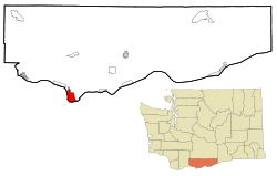
Coordinates: 45°37′42″N 121°10′49″W / 45.62833°N 121.18028°WCoordinates: 45°37′42″N 121°10′49″W / 45.62833°N 121.18028°W Country United States State Washington County Klickitat Area - Total 6.8 sq mi (17.5 km2) - Land 6.8 sq mi (17.5 km2) - Water 0.0 sq mi (0 km2) Elevation 213 ft (65 m) Population (2010) - Total 1,202 - Density 175.3/sq mi (67.7/km2) Time zone Pacific (PST) (UTC-8) - Summer (DST) PDT (UTC-7) ZIP code 98617 Area code(s) 509 FIPS code 53-16550[1] GNIS feature ID 1512134[2] Dallesport is a census-designated place (CDP) in Klickitat County, Washington, United States. The population was 1,202 at the 2010 census.
Contents
History
Traditionally a site of the Wishram tribe (Called Echeloots by Lewis and Clark), who lived on the north bank of the Columbia about 10 miles in both directions from The Dalles, Oregon. Although the Wishrams were included in the Treaty of Yakima, they resisted removal to the Yakama Reservation. Indian burials from Memaloose Island in the Columbia were removed to the Wish-ham Cemetery near Dallesport prior to the filling of Lake Celilo. The loss of their traditional fishing grounds at Celilo Falls during the construction of The Dalles Dam in March 1957 dealt both a spiritual and an economic blow to the tribe.[3]
Originally called Rockport or Rockland Flats, this was the site of the first Ferry crossing in the area, beginning in 1854. Rockland Flats was the original seat of Clickitat County (The name of the county was spelled with a 'C' until an official name change in 1869), and remained so until 1878. Riverboat traffic moved up and down the river, but could not pass the falls at the Dalles and Celilo Falls. Portage was originally via a 19-mile long wagon road circumventing the falls. The Oregon Portage Railroad allowed passage of goods and travelers by rail beginning in 1863, but shippers chafed at the monopoly. in 1905, Congress approved 8.5-mile canal with locks on the north shore to bypass the falls. The Dalles-Celilo Canal opened May 5, 1915. The canal incorporated 5 locks with a total 90-foot lift. The canal remained in use until it was flooded by the Dalles Dam in 1957.[4]
The idea of a bridge crossing at this location was talked about beginning in the late 19th century, but was not approved until 1947. The Dalles Bridge remained unbuilt until Congress approved the Dalles Dam in 1951. The bridge was opened December 18, 1953.[5]
Resources
The area is a flat peninsula created from the Columbia River during the big flood.
Geography
Dallesport is located at 45°37′42″N 121°10′49″W / 45.62833°N 121.18028°W (45.628331, -121.180400).[6]
According to the United States Census Bureau, the CDP has a total area of 6.8 square miles (17.5 km²), all of it land.
Demographics
As of the census[1] of 2000, there were 1,185 people, 473 households, and 335 families residing in the CDP. The population density was 175.3 people per square mile (67.7/km²). There were 525 housing units at an average density of 77.7/sq mi (30.0/km²). The racial makeup of the CDP was 89.03% White, 0.25% African American, 3.46% Native American, 1.69% Asian, 1.94% from other races, and 3.63% from two or more races. Hispanic or Latino of any race were 3.71% of the population.
There were 473 households out of which 30.2% had children under the age of 18 living with them, 57.9% were married couples living together, 9.7% had a female householder with no husband present, and 29.0% were non-families. 23.5% of all households were made up of individuals and 6.8% had someone living alone who was 65 years of age or older. The average household size was 2.51 and the average family size was 2.96.
In the CDP the population was spread out with 27.8% under the age of 18, 5.5% from 18 to 24, 23.5% from 25 to 44, 30.3% from 45 to 64, and 12.8% who were 65 years of age or older. The median age was 40 years. For every 100 females there were 92.1 males. For every 100 females age 18 and over, there were 98.4 males.
The median income for a household in the CDP was $36,250, and the median income for a family was $41,689. Males had a median income of $40,250 versus $21,853 for females. The per capita income for the CDP was $17,995. About 12.0% of families and 17.6% of the population were below the poverty line, including 22.3% of those under age 18 and 18.6% of those age 65 or over.
References
- ^ a b "American FactFinder". United States Census Bureau. http://factfinder.census.gov. Retrieved 2008-01-31.
- ^ "US Board on Geographic Names". United States Geological Survey. 2007-10-25. http://geonames.usgs.gov. Retrieved 2008-01-31.
- ^ http://historylink.org/index.cfm?DisplayPage=output.cfm&file_id=7800
- ^ http://historylink.org/index.cfm?DisplayPage=output.cfm&file_id=5195
- ^ http://historylink.org/index.cfm?DisplayPage=output.cfm&file_id=7804
- ^ "US Gazetteer files: 2010, 2000, and 1990". United States Census Bureau. 2011-02-12. http://www.census.gov/geo/www/gazetteer/gazette.html. Retrieved 2011-04-23.
Municipalities and communities of Klickitat County, Washington Cities 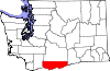
CDPs Bickleton | Centerville | Dallesport | Klickitat | Lyle | Maryhill | Roosevelt | Trout Lake | Wishram
Unincorporated
communitiesAppleton | Cleveland | Glenwood | Wahkiacus
Categories:- Populated places in Klickitat County, Washington
- Census-designated places in Washington (state)
- Columbia River Gorge


Wikimedia Foundation. 2010.