- Boardman, Oregon
Infobox Settlement
official_name = Boardman, Oregon
settlement_type =City
nickname =
motto = On the river, on the way
imagesize =
image_caption =
image_
imagesize =
image_caption =
image_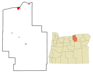
mapsize = 250px
map_caption = Location inOregon
mapsize1 =
map_caption1 =
subdivision_type = Country
subdivision_name =United States
subdivision_type1 = State
subdivision_name1 =Oregon
subdivision_type2 = County
subdivision_name2 = Morrow
government_type =
leader_title =Mayor
leader_name = F. E. Glenn
established_title = Incorporated
established_date = 1927
area_magnitude =
area_total_sq_mi = 3.9
area_total_km2 = 10.2
area_land_sq_mi = 3.6
area_land_km2 = 9.3
area_water_sq_mi = 0.4
area_water_km2 = 0.9
area_urban_sq_mi =
area_urban_km2 =
area_metro_sq_mi =
area_metro_km2 =
population_as_of = 2007
population_note =
population_total = 3310
population_metro =
population_urban =
population_density_km2 = 307.9
population_density_sq_mi = 798.2
timezone = Pacific
utc_offset = -8
timezone_DST = Pacific
utc_offset_DST = -7
latd = 45 |latm = 50 |lats = 8 |latNS = N
longd = 119 |longm = 41 |longs = 57 |longEW = W
elevation_m = 90.83
elevation_ft = 298
website = http://www.cityofboardman.com/
postal_code_type =ZIP code
postal_code = 97818
area_code = 541
blank_name = FIPS code
blank_info = 41-07200GR|2
blank1_name = GNIS feature ID
blank1_info = 1136082GR|3
footnotes =Boardman is a city in Morrow County,
Oregon ,United States on theColumbia River and Interstate 84. Boardman was homesteaded in 1903, by Samuel Herbert Boardman. Sam Boardman was the first Superintendent of the Oregon State Parks System. The town was incorporated in 1927. ThePort of Morrow , Oregon's second-largest port,cite web |last= Jacklet |first= Ben |date= April 2008 |url= http://www.oregonbusiness.com/.docs/action/detail/rid/32114/pg/10002 |title= Prisontown Myth: The Promise of Prosperity Hasn't Come True for Oregon's Rural Communities |publisher= "Oregon Business " |accessdate= 2008-06-17] is located just outside the city. The port property also includes twoPortland General Electric (PGE) gas-fired power plants. PGE also has a coal-fired power plant in the Boardman area. TheUmatilla Chemical Depot , which includes the Umatilla Chemical Agent Disposal Facility, is located 10 miles east of the city, northeast of the intersection of I-84 and Interstate 82. Seven miles east of Boardman is theIrrigon Hatchery . As of the 2000 census, the city population was 2,855. The 2007 estimate is 3,310 residents. [http://www.pdx.edu/media/p/r/prcCertifiedRelease_07_web_cities.pdf PSU:Population Research Center] ] It is part of the Pendleton–Hermiston Micropolitan Statistical Area.Geography
Boardman is located at coor dms|45|50|8|N|119|41|57|W|city (45.835505, -119.699036)GR|1.
According to the
United States Census Bureau , the town has a total area of 3.9square mile s (10.2km² ), of which, 3.6 square miles (9.3 km²) of it is land and 0.4 square miles (0.9 km²) of it (9.14%) is water.Distance to nearby cities and towns:
* Irrigon - 11 miles
* Hermiston - 25 miles
* Umatilla - 25 miles
* Arlington - 28 miles
* Pendleton - 45 miles
* Heppner - 46 miles
* Portland - 164 milesDemographics
As of the
census GR|2 of 2000, there were 2,855 people, 853 households, and 686 families residing in the town. Thepopulation density was 798.2 people per square mile (307.9/km²). There were 947 housing units at an average density of 264.8/sq mi (102.1/km²). The racial makeup of the town was 55.24% White, 0.39% African American, 1.93% Native American, 0.70% Asian, 0.11% Pacific Islander, 38.74% from other races, and 2.91% from two or more races. Hispanic or Latino of any race were 50.12% of the population.There were 853 households out of which 53.0% had children under the age of 18 living with them, 57.4% were married couples living together, 14.4% had a female householder with no husband present, and 19.5% were non-families. 14.7% of all households were made up of individuals and 4.0% had someone living alone who was 65 years of age or older. The average household size was 3.33 and the average family size was 3.66.
In the town the population was spread out with 38.1% under the age of 18, 11.0% from 18 to 24, 30.5% from 25 to 44, 15.0% from 45 to 64, and 5.3% who were 65 years of age or older. The median age was 25 years. For every 100 females there were 109.9 males. For every 100 females age 18 and over, there were 114.8 males.
The median income for a household in the town was $32,105, and the median income for a family was $32,543. Males had a median income of $30,000 versus $21,765 for females. The
per capita income for the town was $12,297. About 16.3% of families and 20.1% of the population were below thepoverty line , including 26.2% of those under age 18 and 6.7% of those age 65 or over.Transportation
*
Boardman Airport References
External links
* [http://www.cityofboardman.com/ City of Boardman] (official website)
* [http://www.visitboardman.com/ Official visitors information site] at Visit Boardman.com
* [http://info.econ.state.or.us:591/FMPro?-db=Community.fp4&-Format=forms.htm&-lay=webpage&-op=eq&sort%20name=Boardman&-script=hit%20count&-Find Boardman profile] from theOregon Economic and Community Development Department
* [http://www.dfw.state.or.us/hatchery/irrigon.html Irrigon Hatchery] from theOregon Department of Fish and Wildlife
Wikimedia Foundation. 2010.