- Dayville Historic District
-
Dayville Historic District

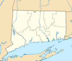

Location: Main and Pleasant Sts., Killingly, Connecticut Coordinates: 41°50′45″N 71°53′8″W / 41.84583°N 71.88556°WCoordinates: 41°50′45″N 71°53′8″W / 41.84583°N 71.88556°W Architect: Blanchard,Alexander; Et al. Architectural style: Greek Revival, Italianate, Queen Anne Governing body: Private NRHP Reference#: 88001422[1] Added to NRHP: August 25, 1988 Dayville Historic District is a historic district in the town of Killingly, Connecticut, in the unincorporated community of Dayville.
The district was added to the National Register of Historic Places in 1988.[1]
The community or village of Dayville was named after Capt. John Day, who owned the water privileges on the Five Mile River. With the opening of the Norwich and Worcester Railroad in 1830, Dayville also became a hub for freight transport for other manufacturing villages along the river. By 1849, the village had grown sufficiently in population to have its own church, the Dayville Congregational Church, a Greek revival building built by Alexander Blanchard. The church was heavily damaged in a hurricane in 1938.
References
- ^ a b "National Register Information System". National Register of Historic Places. National Park Service. 2009-03-13. http://nrhp.focus.nps.gov/natreg/docs/All_Data.html.
U.S. National Register of Historic Places Topics Lists by states Alabama • Alaska • Arizona • Arkansas • California • Colorado • Connecticut • Delaware • Florida • Georgia • Hawaii • Idaho • Illinois • Indiana • Iowa • Kansas • Kentucky • Louisiana • Maine • Maryland • Massachusetts • Michigan • Minnesota • Mississippi • Missouri • Montana • Nebraska • Nevada • New Hampshire • New Jersey • New Mexico • New York • North Carolina • North Dakota • Ohio • Oklahoma • Oregon • Pennsylvania • Rhode Island • South Carolina • South Dakota • Tennessee • Texas • Utah • Vermont • Virginia • Washington • West Virginia • Wisconsin • WyomingLists by territories Lists by associated states Other Municipalities and communities of Windham County, Connecticut Towns 
Borough Unincorporated
communitiesCentral Village | Dayville | East Brooklyn | Moosup | North Grosvenor Dale | Plainfield Village | Putnam District | Quebec | Quinebaug | South Windham | South Woodstock | Wauregan | Willimantic | Windham Center
Categories:- Historic districts in Connecticut
- Killingly, Connecticut
- Historic districts in Windham County, Connecticut
- Connecticut Registered Historic Place stubs


Wikimedia Foundation. 2010.