- Artvin
-
- This article is about the city of Artvin. See Artvin Province for more information about the surrounding area.
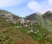
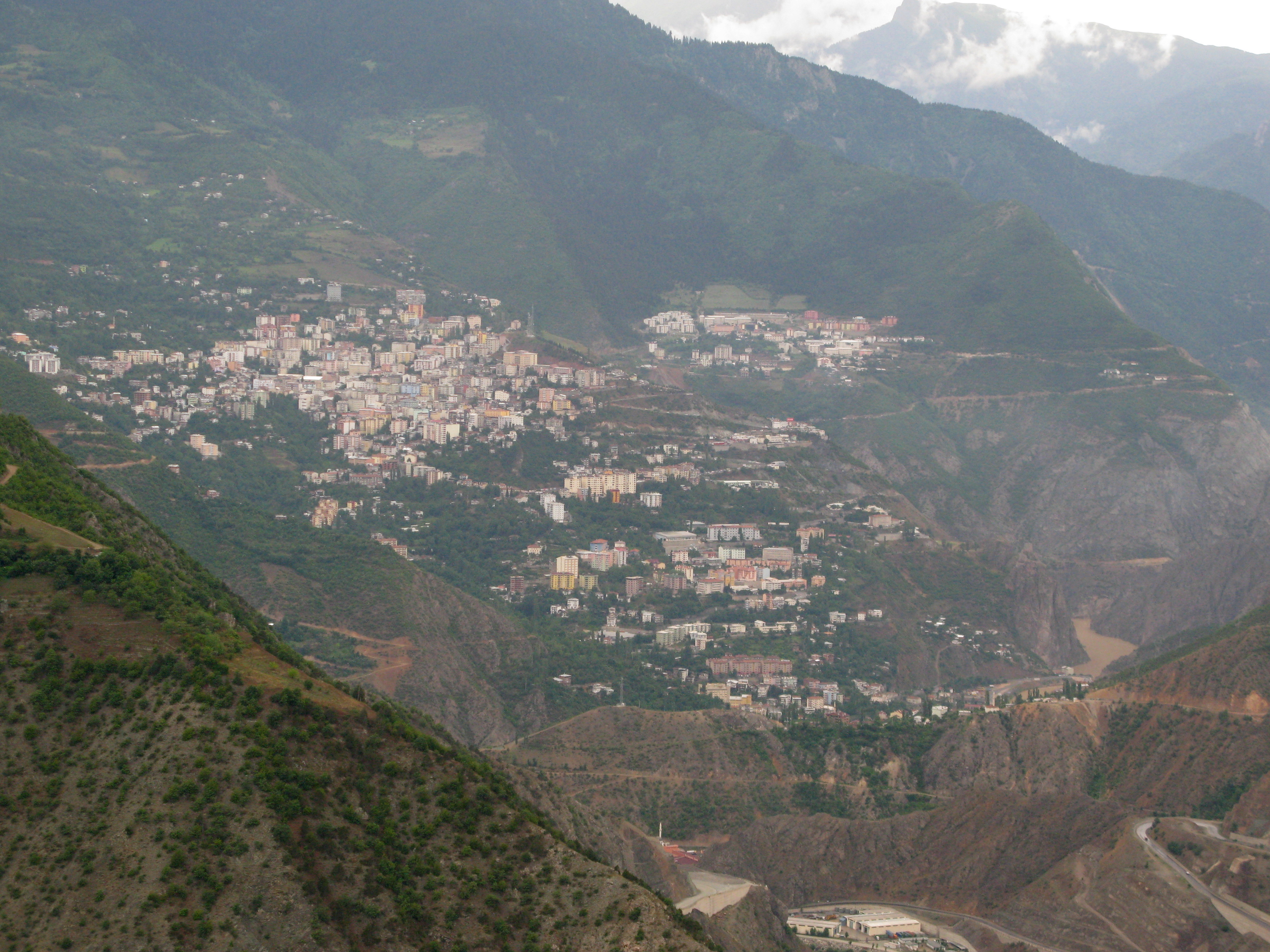
Artvin Artvin from above Location of Artvin within Turkey.
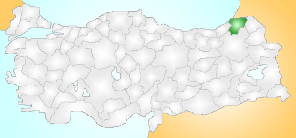
Coordinates: 41°11′N 41°49′E / 41.183°N 41.817°ECoordinates: 41°11′N 41°49′E / 41.183°N 41.817°E Country  Turkey
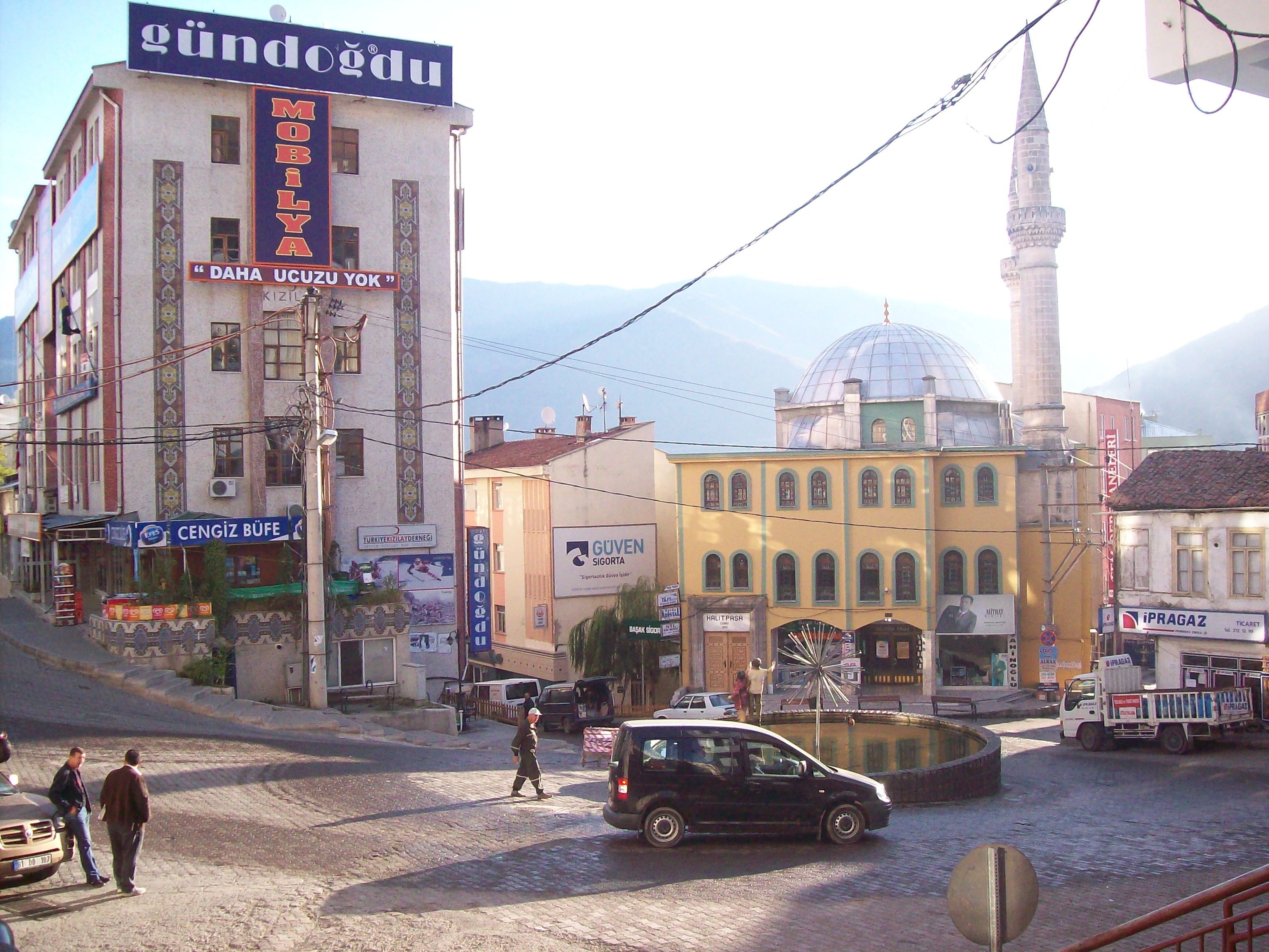
Region Black Sea Government - Mayor Emin Özgün (CHP) Elevation 345 m (1,132 ft) Time zone EET (UTC+2) - Summer (DST) EEST (UTC+3) Postal code 08 Area code(s) 466 Licence plate 08 Website www.artvin.bel.tr 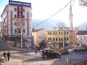 Artvin city center
Artvin is a city in northeastern Turkey on the Çoruh River near the Georgian border.
Contents
Etymology
The area of Artvin had been called Coroksi and Corok; Kollhis (Kolchis - Κολχίς in Ancient Greek) or Livane (Livani - Λιβάνι in Greek) in the Byzantine Period and was once part of the larger Ottoman Empire district of Livane. Names in other languages are Armenian: Արդվին, Georgian: ართვინი (artvini), in Russian: Ардвин (Ardvin), in Laz: Art'vini.[1]
Geography and Climate
Artvin is located on the terrace hills by the Çoruh River with most of it on the western bank. The climate is wet all year round, and the summers are pleasantly cool, being strongly affected by the nearby Black Sea. The population of Artvin, the capital town is 24354[2]
Climate data for Artvin Month Jan Feb Mar Apr May Jun Jul Aug Sep Oct Nov Dec Year Record high °C (°F) 16.7
(62.1)21.0
(69.8)27.1
(80.8)31.5
(88.7)36.0
(96.8)37.0
(98.6)41.6
(106.9)39.5
(103.1)39.5
(103.1)33.0
(91.4)23.5
(74.3)20.9
(69.6)41.6
(106.9)Average high °C (°F) 5.9
(42.6)7.7
(45.9)12.2
(54.0)17.6
(63.7)21.3
(70.3)23.8
(74.8)25.4
(77.7)25.9
(78.6)23.6
(74.5)19.2
(66.6)12.7
(54.9)7.3
(45.1)16.88
(62.39)Average low °C (°F) −0.7
(30.7)−0.2
(31.6)2.4
(36.3)6.8
(44.2)10.6
(51.1)13.8
(56.8)16.5
(61.7)16.9
(62.4)13.8
(56.8)9.9
(49.8)5.1
(41.2)1.2
(34.2)8.01
(46.41)Record low °C (°F) −11.9
(10.6)−11.2
(11.8)−9.8
(14.4)−7.1
(19.2)−0.6
(30.9)5.2
(41.4)9.5
(49.1)9.5
(49.1)5.5
(41.9)−1.6
(29.1)−4
(24.8)−10.8
(12.6)−11.9
(10.6)Precipitation mm (inches) 96.3
(3.791)72.6
(2.858)60.1
(2.366)57.1
(2.248)53.4
(2.102)49.4
(1.945)32.7
(1.287)29.4
(1.157)34.2
(1.346)63.1
(2.484)79.4
(3.126)91.7
(3.61)719.4
(28.323)Avg. rainy days 12.6 12.8 12.6 12.9 13.8 12.3 8.4 7.9 8.3 11.3 11.0 11.8 135.7 Sunshine hours 77.5 92.4 136.4 159 204.6 216 207.7 213.9 195 148.8 93 65.1 1,809.4 Source: Devlet Meteoroloji İşleri Genel Müdürlüğü [3] History
See Artvin Province for the history of the region.
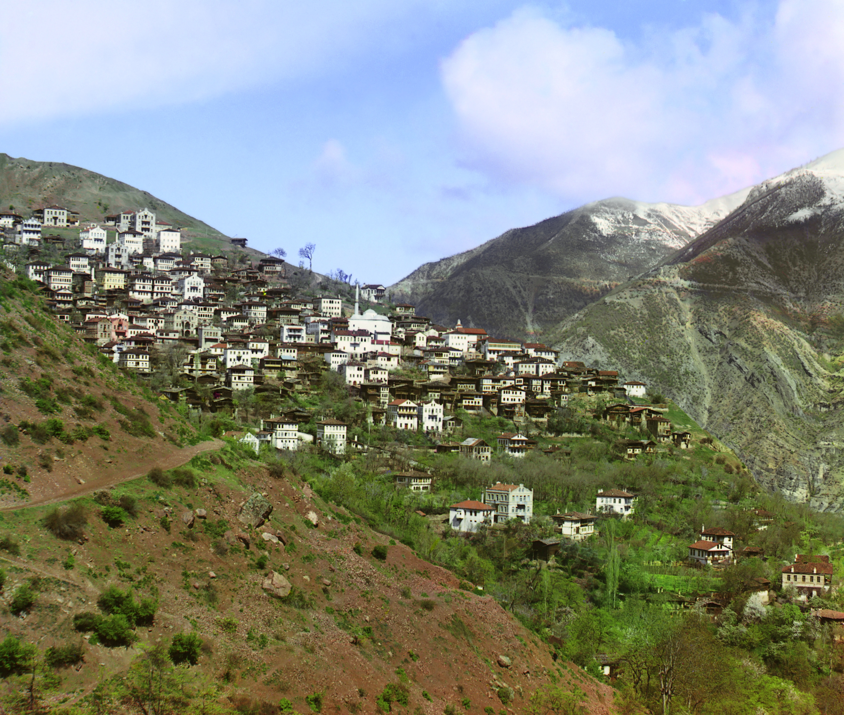
 General view of Artvin from the small town of Svet, Prokudin-Gorsky
Places of interest
- Artvin or Livana (Livane) castle, built in 937
There are a number of Ottoman Empire houses and public buildings including:
- Salih Bey mosque, built in 1792
- The fountain of Çelebi Efendi, built in 1783.
The surrounding countryside offers many places for climbing, trekking and rafting.
Events
Artvin is known for the Kafkasör Festival that takes place every year which involves bullfighting.[4]
Sister cities
Notes and references
- ^ Özhan Öztürk claims that Livane related with Latin and Artvin comes from Armenian/Georgian Arta + vani means "arable field city" Özhan Öztürk. Pontus: Antik Çağ’dan Günümüze Karadeniz’in Etnik ve Siyasi Tarihi Genesis Yayınları. Ankara, 2011. p.788-789 ISBN 978-605-5410-17-9
- ^ Statistical Institute
- ^ http://www.dmi.gov.tr/veridegerlendirme/il-ve-ilceler-istatistik.aspx?m=ARTVIN
- ^ Bullwrestling in Artvin, Turkey
- The Catholic Encyclopedia
- Karadeniz Ansiklopedik Sözlük.İstanbul. 2005. ISBN 975-6121-00-9.
See also
External links
- Governor's Office
- the Municipality
- Artvin Village (Turkish)
- local information (Turkish)
- Artvin Weather Forecast Information
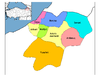
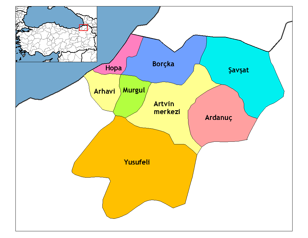
 Artvin in Artvin Province (in the Black Sea region) of Turkey
Urban districts Artvin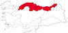
Rural districts RegionsAegean Black Sea Central Anatolia Eastern Anatolia Marmara Mediterranean Southeastern Anatolia Categories:- Artvin Province
- Cities in Turkey
- Black Sea Region
- Populated places in Artvin Province
- Black Sea Region geography stubs
Wikimedia Foundation. 2010.