- Orbost, Victoria
-
Orbost
Victoria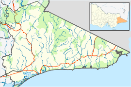
 Orbost
Population: 2452 (2006)[1] Postcode: 3888 Coordinates: 37°42′S 148°27′E / 37.7°S 148.45°ECoordinates: 37°42′S 148°27′E / 37.7°S 148.45°E Elevation: 41 m (135 ft) Location: - 375 km (233 mi) E of Melbourne
- 235 km (146 mi) S of Canberra
- 93 km (58 mi) E of Bairnsdale
- 60 km (37 mi) NE of Lakes Entrance
LGA: Shire of East Gippsland State District: Gippsland East Federal Division: Gippsland Mean max temp Mean min temp Annual rainfall 20.4 °C
69 °F10.0 °C
50 °F735.7 mm
29 inOrbost is a town in the Shire of East Gippsland, Victoria, Australia, located 375 kilometres (233 mi) east of Melbourne and 235 kilometres (146 mi) south of Canberra where the Princes Highway crosses the Snowy River. It is about 16 kilometres (10 mi) from the town of Marlo on the coast of Bass Strait. At the 2006 census, Orbost had a population of 2452. Orbost is the service centre for the primary industries of beef, dairy cattle, and sawmilling. More recently, tourism has become an important industry, being the major town close to several national parks, including the Snowy River National Park, Alpine National Park, Errinundra National Park, Croajingolong National Park and Cape Conran Coastal Park.
Contents
History
Peter Imlay established the Snowy River Station for grazing in 1842, and his brother the Newmerella run nearby. In 1845 the land was sold to Norman McLeod, who named the area after Orbost farm in the northwest of Isle of Skye, in Scotland.
Gold was discovered in the mid 1850s in the Bendoc area, in the mountains north of Orbost, which brought an influx of people to the district. By 1868 it was estimated that there was a population of 500 miners and squatters in the vicinity of Bendoc.
The Cameron family settled on the rich alluvial river flats in 1876, followed by many other selectors, many of them Scottish migrants. The Post Office opened on 1 December 1880 named Neumerella (sic) and was renamed Orbost in 1883. A Newmerella office opened in 1889 and closed in 1897, then reopened in 1921. [2] The township was proclaimed in 1890 and a bridge constructed across the Snowy River and a telegraph office established. Sawmills were established in the area and the first batch of sawn timber was cut at Orbost in 1882. By the late 1890s produce was regularly being exported to Melbourne via coastal trading vessels sailing up the Snowy River to Orbost. The railway from Melbourne arrived in 1916, allowing further agricultural settlement up the valley, and exploitation of native hardwood forests for timber and railway sleepers.
For most of the 20th century, Orbost was a fairly prosperous local centre for the forestry and agricultural industries and a supply point for smaller towns in the area. In the 1950s and 1960s several new sawmills were opened to exploit the native forests north and east of Orbost. By the 1980s logging of East Gippsland native forests had become an environmental issue. This resulted in the creation or extension of National Parks in the area, and a steady decline in forestry and sawmilling jobs. The general rural decline of the area and its economy saw the railway close in the mid-1980s and the population drop from around 4000 to around 2000 by the start of the 21st century. Logging and forestry continues to be a contentious issue in 2004 and 2005 in the Goolengook Valley, near the Errinundra National Park.
The Snowy Mountains Scheme resulted in the waters of the Snowy River being diverted to the Murray and Murrumbidgee Rivers and associated irrigation schemes. During the 1990s the low level of water in the Snowy River was a major concern, with a political campaign to increase the flow of water from the dam at Jindabyne. Independent candidate from the Orbost district, Craig Ingram, was elected in 1999, and re-elected in 2002, to the Victorian Legislative Assembly on a platform to increase the flow of water in the Snowy River.
The small rural communities of Bendoc, Bonang and Tubbut lie North East of Orbost. Delegate in NSW is the next major town geographically across the NSW/Vic Border from Orbost.
Climate
Climate data for Orbost Month Jan Feb Mar Apr May Jun Jul Aug Sep Oct Nov Dec Year Average high °C (°F) 26.5
(79.7)25.1
(77.2)23.9
(75.0)20.9
(69.6)17.7
(63.9)15.5
(59.9)15.0
(59.0)16.2
(61.2)18.2
(64.8)19.7
(67.5)22.4
(72.3)23.8
(74.8)20.4 Average low °C (°F) 14.7
(58.5)14.5
(58.1)12.7
(54.9)10.6
(51.1)8.4
(47.1)6.6
(43.9)5.6
(42.1)6.0
(42.8)7.5
(45.5)9.0
(48.2)11.5
(52.7)12.6
(54.7)10.0 Precipitation mm (inches) 39.5
(1.555)71.6
(2.819)47.6
(1.874)75.7
(2.98)51.8
(2.039)74.5
(2.933)58.9
(2.319)56.3
(2.217)56.4
(2.22)59.6
(2.346)76.7
(3.02)66.1
(2.602)735.7
(28.965)Source: [3] Sports teams
The town is represented in the sport of Australian rules football by the Orbost-Snowy Rovers in the East Gippsland Football League.[4]
The town also boasts a field hockey club which fields junior, women's and men's sides in the East Gippsland Hockey Association.
Golfers play at the course of the Orbost Golf Club on the Bonang Highway.[5]
Current Profile
The national parks are showcased in events such as The Wilderness Bike Ride, a community event managed out of Orbost, which won the Best Event 2004 Regional Tourism Award for East Gippsland. The Orbost region has four State primary schools, one Catholic primary school, and Orbost Secondary College (Government). Orbost has a regional airport, Orbost Airport YORB (RBS).
Notable people from Orbost
- Percival Bazeley, scientist
- Richard Dalla-Riva, politician
- Jennifer Hansen, TV presenter
- Sarah Hanson-Young, politician[6]
- Nick Heyne, Current Australian rules footballer with the St.Kilda Football Club
- Craig Ingram, politician[6]
- Charlie Lynn, politician
- Molly Meldrum, music critic, journalist, TV presenter
- Peter Nixon, politician
- Lindsay Tanner, politician[6]
- Michael Voss, former Australian rules footballer and current coach of the Brisbane Lions in the AFL
References
- ^ Australian Bureau of Statistics (25 October 2007). "Orbost (State Suburb)". 2006 Census QuickStats. http://www.censusdata.abs.gov.au/ABSNavigation/prenav/LocationSearch?collection=Census&period=2006&areacode=SSC26399&producttype=QuickStats&breadcrumb=PL&action=401. Retrieved 2007-10-01.
- ^ Premier Postal History, Post Office List, https://www.premierpostal.com/cgi-bin/wsProd.sh/Viewpocdwrapper.p?SortBy=VIC&country=, retrieved 2008-04-11
- ^ "Climate Statistics For Orbost". Australian Bureau of Meteorology. http://www.bom.gov.au/climate/averages/tables/cw_084145.shtml.
- ^ Full Points Footy, Orbost Snowy Rovers, http://www.fullpointsfooty.net/Orbost_Snowy_Rovers.htm, retrieved 2008-07-25[dead link]
- ^ Golf Select, Orbost, http://www.golfselect.com.au/armchair/courseView.aspx?course_id=1059, retrieved 2009-05-11
- ^ a b c Spicer, Victoria (9 July 2009). "Solo Man: A Natural Politician". CraigIngram.com. Craig Ingram. http://www.craigingram.com/index.php?option=com_content&view=article&id=46&Itemid=79. Retrieved 24 February 2011.
Peter Knight Musician
External links
Towns in East Gippsland Shire Anglers Rest · Bairnsdale · Bellbird Creek · Bemm River · Benambra · Bendoc · Buchan · Bruthen · Cabbage Tree Creek · Cann River · Cape Conran · Cassilis · Club Terrace · Deddick · Eagle Point · Ensay · Gelantipy · Genoa · Gipsy Point · Goongerah · Johnsonville · Lakes Entrance · Lake Tyers Beach · Lindenow · Mallacoota · Marlo · Metung · Mossiface · Nicholson · Nowa Nowa · Nungurner · Omeo · Orbost · Paynesville · Raymond Island · Swan Reach · Swifts Creek · Tambo Crossing · Tambo Upper · Twin Rivers · W Tree · Woodglen · Wulgulmerang
Categories:- Towns in Victoria (Australia)
- East Gippsland

Wikimedia Foundation. 2010.