Bemm River, Victoria

Bemm River, Victoria

Infobox Australian Place | type = town
name = Bemm River
state = vic
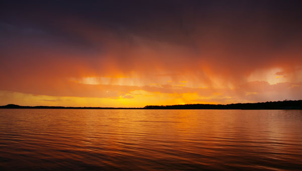


caption = A sunset over the Sydenham Inlet.
lga = Shire of East Gippsland
postcode = 3889
est =
pop = 151
elevation=
maxtemp =
mintemp =
rainfall =
stategov = Gippsland East
fedgov = Gippsland
dist1 = 431
dir1 = E
location1= Melbourne
dist2 = 145
dir2 = E
location2= Bairnsdale
dist3 = 59
dir3 = E
location3= Orbost
dist4 = 38
dir4 = SW
location4= Cann River

Bemm River is a town in Far East Gippsland, Victoria, Australia. At the 2006 census, Bemm River and the surrounding area had a population of 151.Census 2006 AUS
id=SSC25123
name=Bemm River (State Suburb)
accessdate=2007-07-21
quick=on
]

History

The Post Office opened on 1 July 1911 closing in 1920, reopening in 1993, then closing again in 1982. Citation
last = Premier Postal History | title = Post Office List | url = https://www.premierpostal.com/cgi-bin/wsProd.sh/Viewpocdwrapper.p?SortBy=VIC&country= | accessdate = 2008-04-11
]

Today

It is renowned for its Bream fishing, which gives it its second name, 'The Bream Capital'. It is situated on the north-western shore of Sydenham Inlet, a lake that stretches over to the sand hills of the Bass Strait shoreline. The lake is fed by the Bemm River. It is 4km from the beach, and 10km from Py-yoot Bay (pronounced Pie-Ute Bay).

There are several tourist accommodation places in the town. There is a general store and a pub which is also a licensed restaurant.

References


Wikimedia Foundation. 2010.

Игры ⚽ Поможем решить контрольную работу

Look at other dictionaries:

  • Bemm River — Bemm RiverVorlage:Infobox Fluss/GKZ fehlt Lage Victoria (Australien) Flusssystem Bemm River Abfluss über Bemm River → Sydenham Inlet → Bass Straße …   Deutsch Wikipedia

  • McKenzie River (Victoria) — McKenzie RiverVorlage:Infobox Fluss/GKZ fehlt Lage Victoria (Australien) Flusssystem Bemm River Abfluss über Bemm River → Sydenham Inlet → …   Deutsch Wikipedia

  • Nicholson River (Victoria) — Nicholson River Looking south along the river from the East Gippsland Rail Trail trestle bridge at Nicholson Origin Angora Range (A …   Wikipedia

  • Mitchell River (Victoria) — Panorama of the Mitchell River as it carves a valley through the Mitchell River National Park The Mitchell River is the largest unregulated river in Victoria, Australia and provides a unique example of riparian ecology. Tributaries include the… …   Wikipedia

  • Cumberland River (Victoria) — Cumberland River Basin countries Victoria, Australia The Cumberland River is a river in southwestern Victoria, Australia. It arises in the Otway Ranges and it enters Bass Strait to the east of Cape Otway and to the south of the town of Lorne. The …   Wikipedia

  • Mueller River (Victoria) — Mueller River Basin countries Victoria, Australia The Mueller River is a river of Gippsland in southeastern Victoria, Australia. References …   Wikipedia

  • Errinundra River — Errinundra RiverVorlage:Infobox Fluss/GKZ fehlt Lage Victoria (Australien) Flusssystem Bemm River Abfluss über Bemm River → Sydenham Inlet → …   Deutsch Wikipedia

  • Goolengook River — Goolengook RiverVorlage:Infobox Fluss/GKZ fehlt Lage Victoria (Australien) Flusssystem Bemm River Abfluss über Bemm River → Sydenham Inlet → …   Deutsch Wikipedia

  • Combienbar River — Combienbar RiverVorlage:Infobox Fluss/GKZ fehlt Lage Victoria (Australien) Flusssystem Bemm River Abfluss über Bemm River → Sydenham Inlet → …   Deutsch Wikipedia

  • Arte River — Arte RiverVorlage:Infobox Fluss/GKZ fehlt Lage Victoria (Australien) Flusssystem Bemm River Abfluss über Goolengook River → Bemm …   Deutsch Wikipedia

Share the article and excerpts

Direct link
Do a right-click on the link above
and select “Copy Link”