- Nicholson, Victoria
-
Nicholson
Victoria
Eastern entry to town looking across the Nicholson River to the boat ramp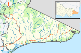
 Nicholson
Population: 1,504[1] Postcode: 3882 Location: - 295 km (183 mi) E of Melbourne
- 13 km (8 mi) E of Bairnsdale
- 24 km (15 mi) W of Lakes Entrance[2]
LGA: Shire of East Gippsland State District: Gippsland East Federal Division: Gippsland Nicholson is a small town in East Gippsland, Victoria, Australia, 295 km east of the state capital Melbourne. It is situated between the larger towns of Bairnsdale and Lakes Entrance.[2] At the 2006 census, Nicholson and surrounds had a population of 1,504.[1]
Nicholson is located on the Princes Highway[2] and lies on the banks of the Nicholson River.
Nicholson Post Office opened on 1 August 1885.[3]
The town has a substantial boat ramp on the west bank of the river, to the south of the highway, where picnic, toilet, and barbecue facilities are also available.
The East Gippsland Rail Trail passes across the north section of the town, with the site of the former Nicholson Railway Station identified by a sign.
 Looking south along the Nicholson River, with the boat ramp and Princes Highway to the right
References
 Looking north to the East Gippsland Rail Trail trestle bridge across the river
- ^ a b Australian Bureau of Statistics (25 October 2007). "Nicholson (State Suburb)". 2006 Census QuickStats. http://www.censusdata.abs.gov.au/ABSNavigation/prenav/LocationSearch?collection=Census&period=2006&areacode=SSC26347&producttype=QuickStats&breadcrumb=PL&action=401. Retrieved 2008-09-15.
- ^ a b c RACV: "Experience Victoria (Second Edition)", page 211. RACV Sales and Marketing, 1998.
- ^ Premier Postal History, Post Office List, https://www.premierpostal.com/cgi-bin/wsProd.sh/Viewpocdwrapper.p?SortBy=VIC&country=, retrieved 2008-04-11
Towns in East Gippsland Shire Anglers Rest · Bairnsdale · Bellbird Creek · Bemm River · Benambra · Bendoc · Buchan · Bruthen · Cabbage Tree Creek · Cann River · Cape Conran · Cassilis · Club Terrace · Deddick · Eagle Point · Ensay · Gelantipy · Genoa · Gipsy Point · Goongerah · Johnsonville · Lakes Entrance · Lake Tyers Beach · Lindenow · Mallacoota · Marlo · Metung · Mossiface · Nicholson · Nowa Nowa · Nungurner · Omeo · Orbost · Paynesville · Raymond Island · Swan Reach · Swifts Creek · Tambo Crossing · Tambo Upper · Twin Rivers · W Tree · Woodglen · Wulgulmerang
Coordinates: 37°49′S 147°44′E / 37.817°S 147.733°E

This article about a location in Gippsland is a stub. You can help Wikipedia by expanding it.


