- Metung, Victoria
-
Metung
Victoria
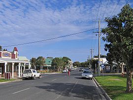
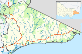
Town centre on Metung RdPopulation: 1207(2006)[1] Postcode: 3904 Coordinates: 37°53′S 147°51′E / 37.883°S 147.85°ECoordinates: 37°53′S 147°51′E / 37.883°S 147.85°E Location: - 314 km (195 mi) E of Melbourne
- 31 km (19 mi) SE of Bairnsdale
- 20 km (12 mi) W of Lakes Entrance[2]
LGA: Shire of East Gippsland State District: Gippsland East Federal Division: Gippsland Mean max temp Mean min temp Annual rainfall 19.2 °C
67 °F10.3 °C
51 °F731.7 mm
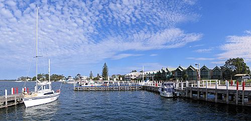
28.8 inMetung is a small town in East Gippsland, Victoria, Australia, 314 km east of the state capital Melbourne. It is situated between the larger towns of Bairnsdale and Lakes Entrance. It is on a small peninsula 31 km south-east of Bairnsdale, separating Lake King and Bancroft Bay on the Gippsland Lakes. At the 2006 census, Metung had a population of 1207.
Metung Post Office opened on 2 June 1879.[3]
Metung is a popular holiday spot, near to larger towns, but off any main routes itself. Many of the permanent inhabitants commute to work at Bairnsdale or Lakes Entrance.
Golfers play at the course of the Kings Cove Metung Golf Club on Kings Cove Boulevard.[4]
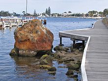
Legend Rock
The original inhabitants of the area, people of the Aboriginal Gunai or Kurnai tribe, told a story about an unusual group of rocks now found alongside the boardwalk in the Metung Marina on Bancroft Bay. This legend or fable indicates how greed will be punished.
The legend goes that some fishermen made a good catch and ate the fish around their campfire. The fishermen, however, did not share their catch with their dogs, despite having more than enough to eat. As a punishment, the women, who were guardians of social law, turned the greedy men to stone.[5]
Originally there were three rocks found at this location that related to the legend, but two of them were destroyed during road works. The remaining Legend Rock is now protected.[5]
References
- ^ Australian Bureau of Statistics (25 October 2007). "Metung (State Suburb)". 2006 Census QuickStats. http://www.censusdata.abs.gov.au/ABSNavigation/prenav/LocationSearch?collection=Census&period=2006&areacode=SSC26157&producttype=QuickStats&breadcrumb=PL&action=401. Retrieved 2007-10-01.
- ^ RACV: "Experience Victoria (Second Edition)", page 211. RACV Sales and Marketing, 1998.
- ^ Premier Postal History, Post Office List, https://www.premierpostal.com/cgi-bin/wsProd.sh/Viewpocdwrapper.p?SortBy=VIC&country=, retrieved 2008-04-11
- ^ Golf Select, Kings Cove, http://www.golfselect.com.au/armchair/courseView.aspx?course_id=2228, retrieved 2009-05-11
- ^ a b Bataluk Cultural Trail Site Signage, Site 7 - Legend Rock, East Gippsland, Victoria
Towns in East Gippsland Shire Anglers Rest · Bairnsdale · Bellbird Creek · Bemm River · Benambra · Bendoc · Buchan · Bruthen · Cabbage Tree Creek · Cann River · Cape Conran · Cassilis · Club Terrace · Deddick · Eagle Point · Ensay · Gelantipy · Genoa · Gipsy Point · Goongerah · Johnsonville · Lakes Entrance · Lake Tyers Beach · Lindenow · Mallacoota · Marlo · Metung · Mossiface · Nicholson · Nowa Nowa · Nungurner · Omeo · Orbost · Paynesville · Raymond Island · Swan Reach · Swifts Creek · Tambo Crossing · Tambo Upper · Twin Rivers · W Tree · Woodglen · Wulgulmerang

This article about a location in Gippsland is a stub. You can help Wikipedia by expanding it.


