- Norwood, New York
-
Norwood, New York — Village — Location within the state of New York
 Norwood, New York
Coordinates: 44°44′54″N 74°59′50″W / 44.74833°N 74.99722°WCoordinates: 44°44′54″N 74°59′50″W / 44.74833°N 74.99722°W Country United States State New York County St. Lawrence Government – Mayor James McFadden Area – Total 2.3 sq mi (5.9 km2) – Land 2.1 sq mi (5.4 km2) – Water 0.2 sq mi (0.5 km2) Elevation 331 ft (101 m) Population (2000) – Total 1,685 – Density 814.1/sq mi (314.3/km2) Time zone Eastern (EST) (UTC-5) – Summer (DST) EDT (UTC-4) FIPS code 36-54012 GNIS feature ID 0976744 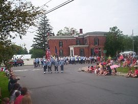 2006 July 4th parade in Norwood, New York
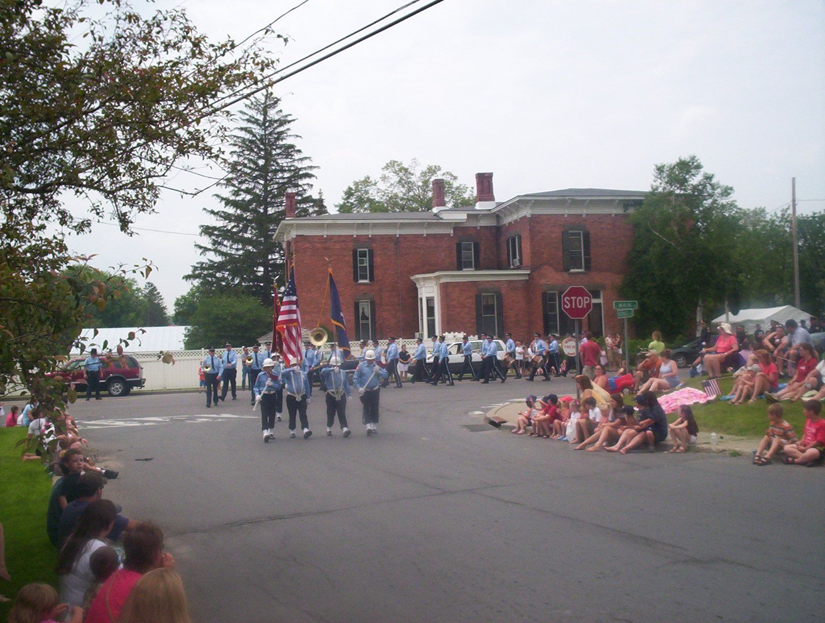
Norwood is a village located in St. Lawrence County, New York. As of the 2000 census, the village had a total population of 1,685.
The Village of Norwood is on the town line of two towns so that it is partly in the Town of Potsdam and partly in the Town of Norfolk. The village is north of Potsdam.
Contents
History
The community was known early in its history as "Raquetteville." Norwood as it is known today, grew out of the shadows of Potsdam, New York in the 1870s. In 1871 the growing Potsdam hamlet became a village entered into existence as the "Village of Potsdam Junction."
Villagers later wanted to further distinguish the town by disassociating its name with Potsdam and submitted proposal to the federal government to become the Village of Baldwin but it was discovered that there was already a post office named Baldwin. A short time later on April 15, 1875 a new name was voted on and Norwood was selected. The mayor of Norwood is currently Jim McFadden.
The Benjamin Gordon Baldwin House was listed on the National Register of Historic Places in 2004.[1]
Geography
Norwood is located at 44°44'54" North, 74°59'50" West (44.748416, -74.997269)[2].
According to the United States Census Bureau, the village has a total area of 2.3 square miles (6.0 km2), of which, 2.1 square miles (5.4 km2) of it is land and 0.2 square miles (0.52 km2) of it is water. The total area is 8.41% water.
The village straddles the Raquette River.
North-south highway, New York State Route 56 (North/South Main Street) passes through the center of the village. County Road 35 enters the village from the west, and County Road 48 joins NY-56 just south of the village.
Demographics
As of the census[3] of 2000, there are 1,685 people, 685 households, and 446 families residing in the village. The population density is 814.1 inhabitants per square mile (314.3/km²). There are 750 housing units at an average density of 362.4 per square mile (139.9/km²), of which 685 are occupied. The racial makeup of the village is 98.46% White, 0.36% African American, 0.42% Native American, 0.53% Asian, 0.00% Pacific Islander, 0.12% from other races, and 0.12% from two or more races. 0.65% of the population are Hispanic or Latino of any race.
There are 685 households out of which 30.4% have children under the age of 18 living with them, 49.6% are married couples living together, 11.2% have a female householder with no husband present, and 34.9% are non-families. 28.3% of all households are made up of individuals and 11.1% have someone living alone who is 65 years of age or older. The average household size is 2.39 and the average family size is 2.93.
In the village the population is spread out with 23.4% under the age of 18, 8.8% from 18 to 24, 28.4% from 25 to 44, 25.6% from 45 to 64, and 13.7% who are 65 years of age or older. The median age is 38 years. Males make up 49.4% of the population while females make up the other 50.6%.
The median income for a household in the village is $37,150, and the median income for a family is $43,068. Male full-time, year-round workers have a median income of $36,187 versus $24,167 for females. The per capita income for the village is $18,063. 11.6% of the population and 62.1% of families are below the poverty line. Out of the total population, 9.8% of those under the age of 18 and 8.8% of those 65 and older are living below the poverty line.
The Brass Firemen
The Norwood Brass Firemen are the pride of Norwood. An all volunteer brass band composed primarily of volunteer firemen was founded by Fred Morgan in 1945. The band has played in front of numerous audiences ever since.
In 1979 the band was invited to play in Albany, New York and was telecast across the state.
In 1980, the band was invited by former Congressman David O’Brien Martin to play in Washington, DC on the Capitol steps and also at the Lincoln Memorial. In 1982 the band was invited back to Washington DC to play for then First Lady Nancy Reagan.
The band played on and performed at the International Luge event held in Lake Placid, New York in 1983. The band as usual drew notice while performing, this time from the US Olympic Committee (USOC), and was invited to play at the 1984 Winter Olympics held in Sarajevo, Yugoslavia. The Brass Firemen would be the Official USA Band in the Opening Ceremonies for the 1984 Winter Olympic Games.
See also
- WNPI-TVThe Brass Firemen play a mix of New Orleans style jazz, military, and traditional marching band standards, affectionally referred to by the band members as, "Dixieland jazz, North Country style."
References
- ^ "National Register Information System". National Register of Historic Places. National Park Service. 2009-03-13. http://nrhp.focus.nps.gov/natreg/docs/All_Data.html.
- ^ "US Gazetteer files: 2010, 2000, and 1990". United States Census Bureau. 2011-02-12. http://www.census.gov/geo/www/gazetteer/gazette.html. Retrieved 2011-04-23.
- ^ "American FactFinder". United States Census Bureau. http://factfinder.census.gov. Retrieved 2008-01-31.
External links
- Norwood NY page by Jack and Chuck Morgan
- Norwood Village Green Concert Series
- Alumni Listing of former Norwood-Norfolk Central School Students
- Norwood history
- The Story Of Norwood, N.Y.
- RW&O railroad, Norwood, NY
Municipalities and communities of St. Lawrence County, New York City 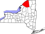
Towns Brasher | Canton | Clare | Clifton | Colton | De Kalb | De Peyster | Edwards | Fine | Fowler | Gouverneur | Hammond | Hermon | Hopkinton | Lawrence | Lisbon | Louisville | Macomb | Madrid | Massena | Morristown | Norfolk | Oswegatchie | Parishville | Piercefield | Pierrepont | Pitcairn | Potsdam | Rossie | Russell | Stockholm | Waddington
Villages Canton | Edwards | Gouverneur | Hammond | Hermon | Heuvelton | Massena | Morristown | Norwood | Potsdam | Rensselaer Falls | Richville | Waddington
CDPs Other
hamletsCranberry Lake | Crary Mills | Helena | Massena Center | Morley | Newton Falls | Rooseveltown | Wanakena
Categories:- Villages in New York
- Populated places in St. Lawrence County, New York


Wikimedia Foundation. 2010.