- De Kalb, New York
-
De Kalb, New York — Town — Location within the state of New York
 De Kalb, New York
Coordinates: 44°28′18″N 75°21′10″W / 44.47167°N 75.35278°W Country United States State New York County St. Lawrence Area - Total 83.2 sq mi (215.5 km2) - Land 82.5 sq mi (213.7 km2) - Water 0.7 sq mi (1.8 km2) Elevation 302 ft (92 m) Population (2000) - Total 2,213 - Density 26.8/sq mi (10.4/km2) Time zone Eastern (EST) (UTC-5) - Summer (DST) EDT (UTC-4) FIPS code 36-20038 GNIS feature ID 0978893 De Kalb is a town in St. Lawrence County, New York, USA. The population was 2,213 at the 2000 census. The town is named after American general Baron de Kalb, a German officer serving under George Washington.
The Town of De Kalb is in the southwest part of the county and is southwest of the Village of Canton.
Contents
History
Settlement began in June 1803 when the first settlement party arrived, led by Judge William Cooper of Cooperstown, NY.
The town was organized in 1806. De Kalb was one of the original ten towns of the county. In 1825, the part of De Kalb North West of Beaver Creek was taken to be part of the Town of De Peyster. In 1830, the Southeastern corner of De Kalb was made part of the Town of Hermon.
Geography
According to the United States Census Bureau, the town has a total area of 83.2 square miles (215 km2), of which, 82.5 square miles (214 km2) of it is land and 0.7 square miles (1.8 km2) of it (0.82%) is water.
The Oswegatchie River flows through the western part of the town. Beaver Creek defines the northwest town line.
US Route 11 is a northeast-southwest highway in the south part of the town. New York State Route 812 intersects US-11 south of De Kalb village.
Demographics
As of the census[1] of 2000, there were 2,213 people, 792 households, and 582 families residing in the town. The population density was 26.8 people per square mile (10.4/km²). There were 889 housing units at an average density of 10.8 per square mile (4.2/km²). The racial makeup of the town was 98.19% White, 0.27% African American, 0.27% Native American, 0.09% Asian, 0.32% from other races, and 0.86% from two or more races. Hispanic or Latino of any race were 0.27% of the population.
There were 792 households out of which 37.4% had children under the age of 18 living with them, 57.4% were married couples living together, 9.6% had a female householder with no husband present, and 26.4% were non-families. 21.1% of all households were made up of individuals and 8.2% had someone living alone who was 65 years of age or older. The average household size was 2.79 and the average family size was 3.23.
In the town the population was spread out with 30.2% under the age of 18, 8.5% from 18 to 24, 27.5% from 25 to 44, 23.4% from 45 to 64, and 10.3% who were 65 years of age or older. The median age was 34 years. For every 100 females there were 101.0 males. For every 100 females age 18 and over, there were 102.1 males.
The median income for a household in the town was $33,173, and the median income for a family was $37,463. Males had a median income of $29,000 versus $23,050 for females. The per capita income for the town was $13,742. About 11.4% of families and 15.7% of the population were below the poverty line, including 23.2% of those under age 18 and 9.8% of those age 65 or over.
Communities and locations in De Kalb
- Bigelow – A hamlet east of Richville on County Road 20.
- Cooper Falls – A hamlet north of De Kalb village on NY-812.
- De Kalb – The hamlet of De Kalb in the north part of the town on NY-812. The original name was Coopers Village or Williamstown, after Judge William Cooper the father of James Fenimore Cooper, who organized the settlement of the town. The community was founded in 1803.
- De Kalb Junction – A former railroad center in the town, located northeast of East De Kalb on US-11 at the intersection of County Road 17. Community growth began in 1862 with the establishment of a spur rail line to Ogdensburg.
- East De Kalb – A hamlet southeast of De Kalb village, located on US-11. Was the economic center of this portion of the town before the establishment of De Kalb Junction.
- Huckleberry Mountain – An elevation by the west town line.
- Kendrew Corners – A location north of Cooper Falls on NY-812 on the west side of the Oswegatchie River. Named for Thomas Kendrew.
- Osbornville – A hamlet in the North west corner of the township on County Route 11.
- Richville – The Village of Richville is in the southwest part of the town, located on US-11.
- Snowshoe Island – A location in the Oswegatchie River north of Richville.
- Spooner Flat – A location in the southwest part of De Kalb, northwest of Richville.
- Stellaville – A hamlet at the eastern corner of De Kalb on County Road 17.
References
- ^ "American FactFinder". United States Census Bureau. http://factfinder.census.gov. Retrieved 2008-01-31.
External links
Coordinates: 44°29′56″N 75°20′34″W / 44.49889°N 75.34278°W
Municipalities and communities of St. Lawrence County, New York County seat: Canton City 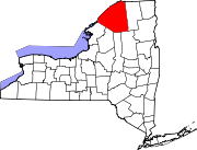
Towns Brasher | Canton | Clare | Clifton | Colton | De Kalb | De Peyster | Edwards | Fine | Fowler | Gouverneur | Hammond | Hermon | Hopkinton | Lawrence | Lisbon | Louisville | Macomb | Madrid | Massena | Morristown | Norfolk | Oswegatchie | Parishville | Piercefield | Pierrepont | Pitcairn | Potsdam | Rossie | Russell | Stockholm | Waddington
Villages Canton | Edwards | Gouverneur | Hammond | Hermon | Heuvelton | Massena | Morristown | Norwood | Potsdam | Rensselaer Falls | Richville | Waddington
CDPs Other
hamletsCranberry Lake | Crary Mills | Helena | Massena Center | Morley | Newton Falls | Rooseveltown | Wanakena
Categories:- Towns in New York
- Populated places in St. Lawrence County, New York


Wikimedia Foundation. 2010.