- De Peyster, New York
-
De Peyster, New York — Town — Location within the state of New York
 De Peyster, New York
Coordinates: 44°32′32″N 75°27′39″W / 44.54222°N 75.46083°W Country United States State New York County St. Lawrence Area – Total 45.1 sq mi (116.8 km2) – Land 43.1 sq mi (111.5 km2) – Water 2.0 sq mi (5.3 km2) Elevation 308 ft (94 m) Population (2000) – Total 936 – Density 21.7/sq mi (8.4/km2) Time zone Eastern (EST) (UTC-5) – Summer (DST) EDT (UTC-4) FIPS code 36-20335 GNIS feature ID 0978898 De Peyster is a town in St. Lawrence County, New York, USA. The population was 936 at the 2000 census. The name is that of one of the land owners of the region, Frederic De Peyster, grandfather of John Watts de Peyster.
Contents
History
The town was first settled around 1802.
The town was established in 1825 from parts of the Towns of De Kalb and Oswegatchie. The town name was proposed to be "Stilwell" after a prominent resident, but the town was given its current name in the hope of obtaining some benefit from De Peyster.
Residents of note
Newton Martin Curtis, born in the town was a postmaster, brigadier general, and customs inspector.
Geography
According to the United States Census Bureau, the town has a total area of 45.1 square miles (117 km2), of which, 43.1 square miles (112 km2) of it is land and 2.0 square miles (5.2 km2) of it (4.54%) is water.
The northeast town line is defined by the Oswegatchie River and the northwest town line is defined by Black Lake. Mud Lake is a smaller lake in the southwest of the town. The southeast town line is marked by Beaver Creek.
New York State Route 812 crosses the northern part of the town. New York State Route 184 is a northeast-southwest highway.
Demographics
As of the census[1] of 2000, there were 936 people, 272 households, and 217 families residing in the town. The population density was 21.7 people per square mile (8.4/km²). There were 307 housing units at an average density of 7.1 per square mile (2.8/km²). The racial makeup of the town was 98.61% White, 1.07% African American, 0.11% Pacific Islander, and 0.21% from two or more races. Hispanic or Latino of any race were 0.43% of the population.
There were 272 households out of which 42.6% had children under the age of 18 living with them, 69.9% were married couples living together, 7.7% had a female householder with no husband present, and 19.9% were non-families. 16.2% of all households were made up of individuals and 7.4% had someone living alone who was 65 years of age or older. The average household size was 3.44 and the average family size was 3.89.
In the town the population was spread out with 37.3% under the age of 18, 8.8% from 18 to 24, 24.9% from 25 to 44, 20.2% from 45 to 64, and 8.9% who were 65 years of age or older. The median age was 29 years. For every 100 females there were 104.4 males. For every 100 females age 18 and over, there were 107.4 males.
The median income for a household in the town was $28,750, and the median income for a family was $31,500. Males had a median income of $25,000 versus $21,458 for females. The per capita income for the town was $10,667. About 24.5% of families and 27.2% of the population were below the poverty line, including 36.0% of those under age 18 and 11.8% of those age 65 or over.
Communities and locations in De Peyster
- De Peyster – The hamlet of De Peyster is in the northern part of the town on County Road 10.
- Kokomo Corners – A locations west of De Peyster village on NY-184.
- Lower Big Bay – A location on Black Lake.
References
- ^ "American FactFinder". United States Census Bureau. http://factfinder.census.gov. Retrieved 2008-01-31.
External links
Coordinates: 44°33′09″N 75°26′08″W / 44.5525°N 75.43556°W
Municipalities and communities of St. Lawrence County, New York City 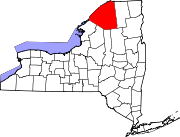
Towns Brasher | Canton | Clare | Clifton | Colton | De Kalb | De Peyster | Edwards | Fine | Fowler | Gouverneur | Hammond | Hermon | Hopkinton | Lawrence | Lisbon | Louisville | Macomb | Madrid | Massena | Morristown | Norfolk | Oswegatchie | Parishville | Piercefield | Pierrepont | Pitcairn | Potsdam | Rossie | Russell | Stockholm | Waddington
Villages Canton | Edwards | Gouverneur | Hammond | Hermon | Heuvelton | Massena | Morristown | Norwood | Potsdam | Rensselaer Falls | Richville | Waddington
CDPs Other
hamletsCranberry Lake | Crary Mills | Helena | Massena Center | Morley | Newton Falls | Rooseveltown | Wanakena
Categories:- Towns in New York
- Populated places in St. Lawrence County, New York


Wikimedia Foundation. 2010.