- Arutua
-
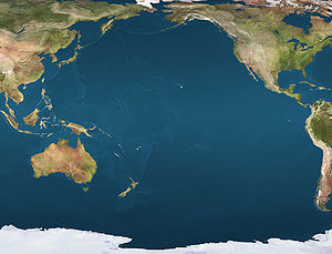
 ArutuaLocation of Arutua Atoll in the Pacific Ocean
Arutua

Location of Arutua in the Tuamotu Archipelago Administration Country France Overseas collectivity French Polynesia Administrative subdivision Îles Tuamotu-Gambier Statistics Land area 45 km2 (17 sq mi) Population1 1,759 (2007[1]) - Density 39 /km2 (100 /sq mi) 1 Population without double counting: residents of multiple communes (e.g., students and military personnel) only counted once. Coordinates: 15°14′43″S 146°36′44″W / 15.245236°S 146.612086°W
Arutua, or Ngaru-atua is an atoll in the Tuamotu group in French Polynesia. It is located 40 km SW of Rangiroa. The closest land is Apataki Atoll, only 16 km to the East.
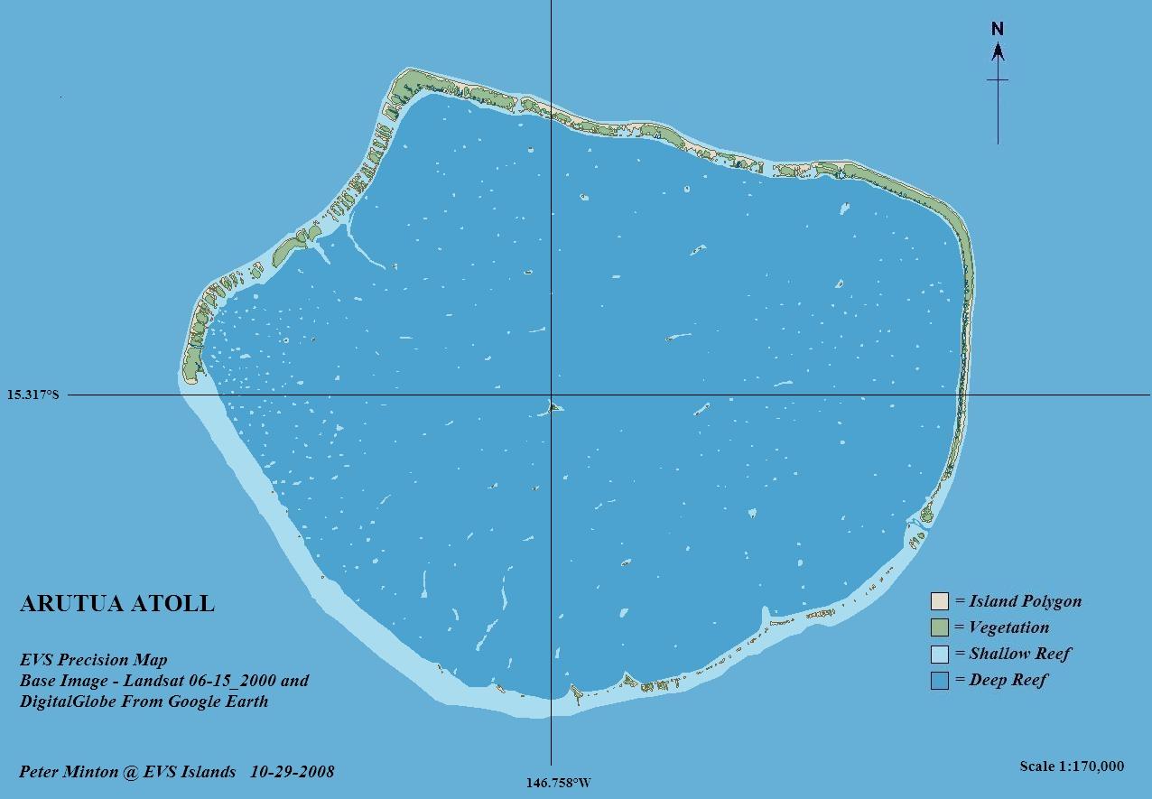
Arutua Atoll has a roughly pentagonal shape. Length 31 km, width 24 km. Its lagoon is wide and deep with one navigable passage. Arutua has a population of 554 inhabitants. The main village is Rautini. There is a small airport at Arutua which was opened in 1984.
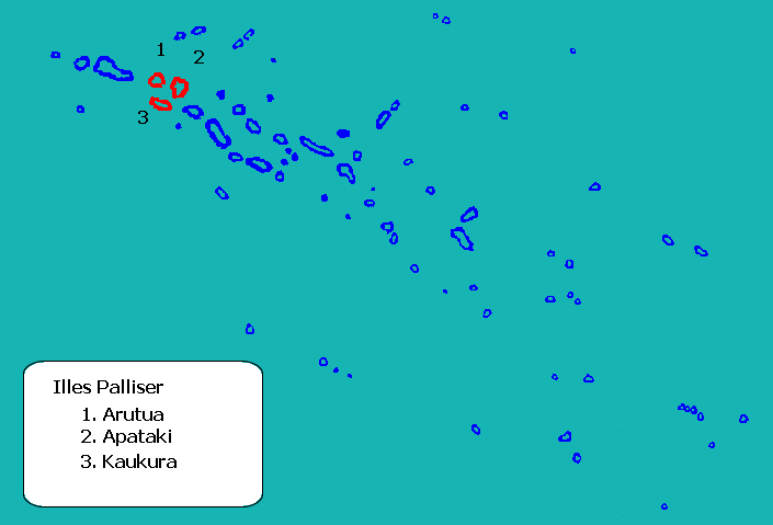
Geographically Arutua belongs to the Palliser Islands (Îles Palliser) subgroup of the Tuamotus.
Contents
History
The first recorded European to visit Arutua Atoll was Jakob Roggeveen (who also first sighted Easter Island) in 1722. British mariner Frederick Beechey touched at Arutua in 1826. He named this atoll "Cockburn Island".
Administration
This atoll is the capital of the commune of Arutua, which consists of Arutua, as well as the atolls of Apataki and Kaukura.
Images and maps
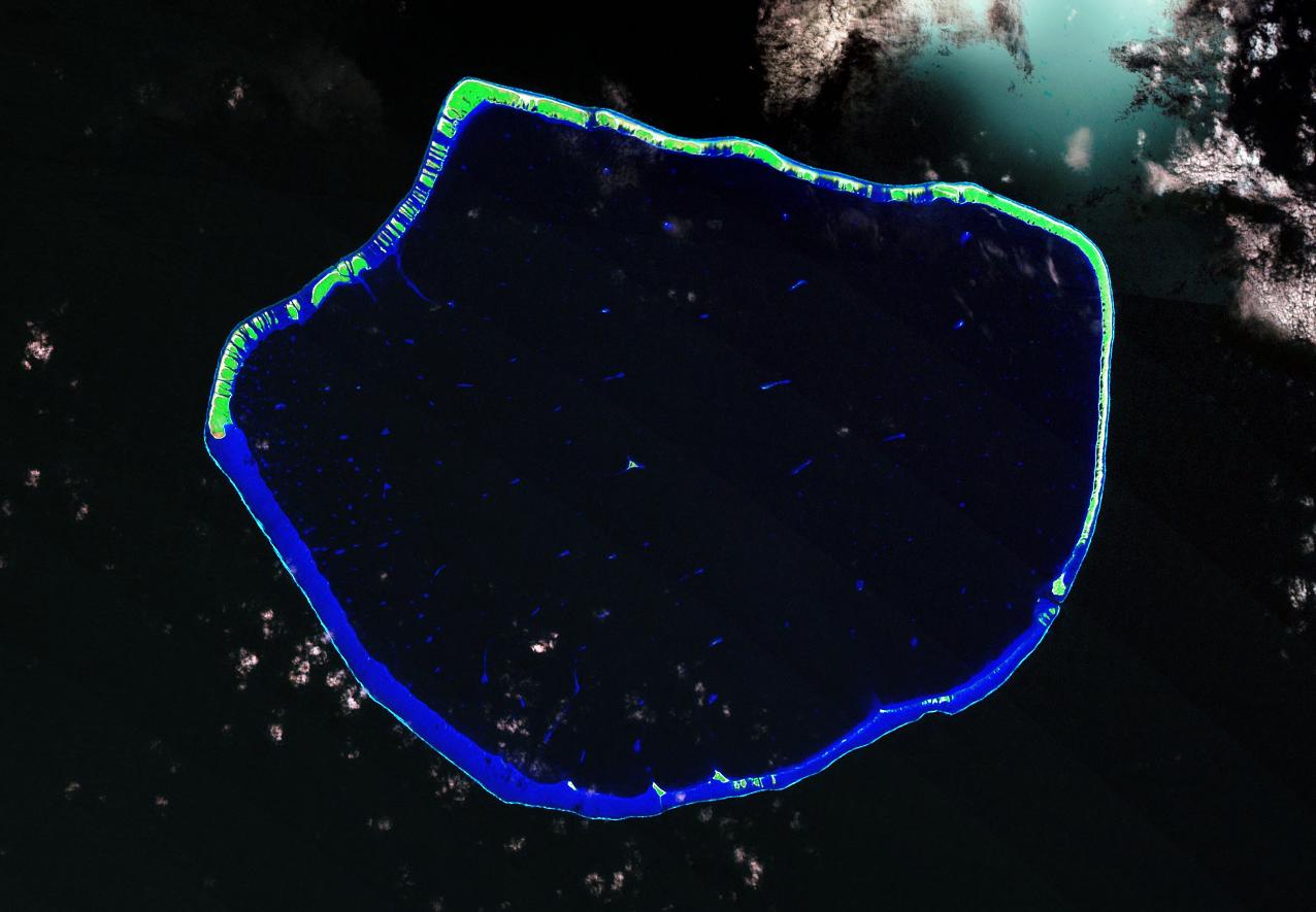
 Image Source: Landsat S-06-15_2008
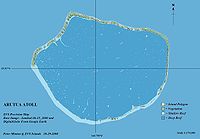 Map Source: EVS Precision Map (1:170,000)
References
- ^ Population des communes de Polynésie française en 2007 sur le site de l'INSEE
External links
- Arutua Atoll FP (EVS Islands)
- Shuttle Image ISS014-E-5393 (Astronaut Photography)
- Arutua Atoll FP (Oceandots.com)
- Tuamotu Atolls List (Pacific Image)

Tuamotus

GambiersIslands/Atolls: Ahe • Ahunui • Akiaki • Amanu • Anaa* • Anuanuraro • Anuanurunga • Apataki • Aratika • Arutua* • Faaite • Fakahina • Fakarava* • Fangatau* • Fangataufa • Hao* • Haraiki • Hereheretue • Hikueru* • Hiti • Katiu • Kauehi • Kaukura • Makatea • Makemo* • Manihi* • Manuhangi • Maria Est • Marokau • Marutea (North) • Marutea (South) • Mataiva • Matureivavao • Morane • Moruroa • Motutunga • Napuka* • Nengonengo • Niau • Nihiru • Nukutavake* • Nukutepipi • Paraoa • Pinaki • Puka Puka* • Pukaruha • Rangiroa* • Raraka • Raroia • Ravahere • Reao* • Reitoru • Rekareka • Taenga • Tahanea • Taiaro • Takapoto • Takaroa* • Takume • Tatakoto* • Tauere • Tekokota • Tematangi • Temoe • Tenararo • Tenarunga • Tepoto (North) • Tepoto (South) • Tikehau • Tikei • Toau • Tuanake • Tureia* • Vahanga • Vahitahi • Vairaatea • Vanavana * commune administration centerIsland groups: Acteon • Disappointment • Duke of Gloucester • King George • Two Groups • Palliser • RaeffksyCategories:
- Communes of French Polynesia
- Atolls of the Tuamotus

Wikimedia Foundation. 2010.