- Matureivavao
-
Coordinates: 21°29′S 136°25′W / 21.483°S 136.417°W
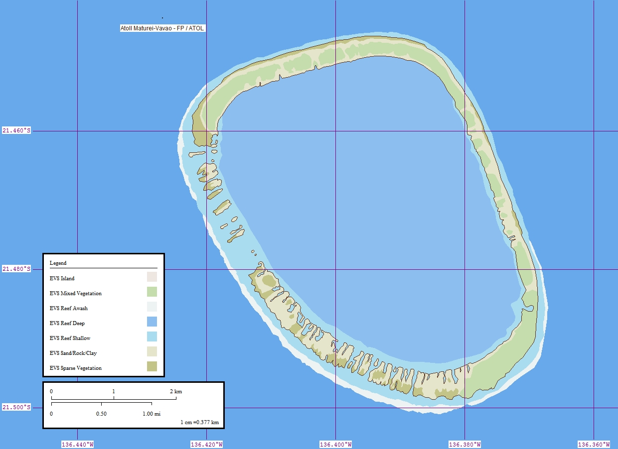
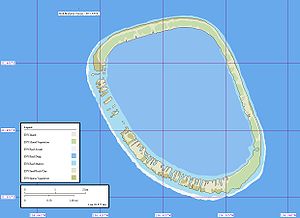 Map of Matureivavao Atoll.
Matureivavao, or Mature-vavao is an atoll in the Acteon Group in the southeastern part of the Tuamotu Islands. It is the largest atoll within the Acteon Group.
Matureivavao is about 4 miles (6.4 km) long in a NNW-SSE direction and is high enough to be visible from a considerable distance. It appears as a sandy beach, backed by a line of dark green. Some buildings lie on the northwest side of the atoll. In bad weather, the seas sometimes sweep over the reef. There is no entrance to the lagoon.
Contents
History
The first recorded European to sight Matureivavao was Pedro Fernández de Quirós on February 5th 1605. He described the group as "four islands crowned by coconut palms". On the different texts describing his voyage, the islands are named "Las Cuatro Coronadas", "Las Cuatro Hermanas" or "Las Anegadas".
In some maps this atoll also appears as "Melbourne".
Administration
Administratively Matureivavao Atoll, like the rest of the Acteon group, belongs to the commune of the Gambier Islands.
References
- Sailing Directions, Pub 126, "Pacific Islands" NIMA 2002; page-12
- Atoll names
External links

Tuamotus

GambiersIslands/Atolls: Ahe • Ahunui • Akiaki • Amanu • Anaa* • Anuanuraro • Anuanurunga • Apataki • Aratika • Arutua* • Faaite • Fakahina • Fakarava* • Fangatau* • Fangataufa • Hao* • Haraiki • Hereheretue • Hikueru* • Hiti • Katiu • Kauehi • Kaukura • Makatea • Makemo* • Manihi* • Manuhangi • Maria Est • Marokau • Marutea (North) • Marutea (South) • Mataiva • Matureivavao • Morane • Moruroa • Motutunga • Napuka* • Nengonengo • Niau • Nihiru • Nukutavake* • Nukutepipi • Paraoa • Pinaki • Puka Puka* • Pukaruha • Rangiroa* • Raraka • Raroia • Ravahere • Reao* • Reitoru • Rekareka • Taenga • Tahanea • Taiaro • Takapoto • Takaroa* • Takume • Tatakoto* • Tauere • Tekokota • Tematangi • Temoe • Tenararo • Tenarunga • Tepoto (North) • Tepoto (South) • Tikehau • Tikei • Toau • Tuanake • Tureia* • Vahanga • Vahitahi • Vairaatea • Vanavana Island groups: Acteon • Disappointment • Duke of Gloucester • King George • Two Groups • Palliser • RaeffksyCategories:
- Atolls of the Tuamotus
- French Polynesia geography stubs
Wikimedia Foundation. 2010.