- Nengonengo
-
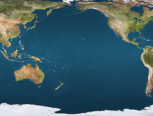
Coordinates: 18°46′S 141°48′W / 18.767°S 141.8°W
NASA picture of Nengonengo Atoll.
Nengonengo is a small atoll of the Tuamotu Archipelago in French Polynesia. It is located 53 km southeast of Ravahere, its closest neighbor, and 100 km southwest of Hao Atoll.
Nengonengo Atoll is roughly bell-shaped. It measures 13 km in length with a maximum width of 8 km. It has a wide lagoon with a surface 67 km², but there is no pass to enter it.
Nengonengo has 54 inhabitants.
Contents
History
The first recorded European who arrived to Nengonengo was Englishman Samuel Wallis in 1767. He named it "Prince William Henry".
The small private airport on Nengonengo was inaugurated in 1993. It is owned by the Wan pearl company.
Administration
Nengonengo Atoll belongs to the commune of Hao, which includes Ahunui (uninhabited), Nengonengo, Manuhangi (uninhabited) and Paraoa (uninhabited).
References
- [1]
- Nengonengo Seamount
- History (German)
- Atoll names
External links
- Atoll list (French)

Tuamotus

GambiersIslands/Atolls: Ahe • Ahunui • Akiaki • Amanu • Anaa* • Anuanuraro • Anuanurunga • Apataki • Aratika • Arutua* • Faaite • Fakahina • Fakarava* • Fangatau* • Fangataufa • Hao* • Haraiki • Hereheretue • Hikueru* • Hiti • Katiu • Kauehi • Kaukura • Makatea • Makemo* • Manihi* • Manuhangi • Maria Est • Marokau • Marutea (North) • Marutea (South) • Mataiva • Matureivavao • Morane • Moruroa • Motutunga • Napuka* • Nengonengo • Niau • Nihiru • Nukutavake* • Nukutepipi • Paraoa • Pinaki • Puka Puka* • Pukaruha • Rangiroa* • Raraka • Raroia • Ravahere • Reao* • Reitoru • Rekareka • Taenga • Tahanea • Taiaro • Takapoto • Takaroa* • Takume • Tatakoto* • Tauere • Tekokota • Tematangi • Temoe • Tenararo • Tenarunga • Tepoto (North) • Tepoto (South) • Tikehau • Tikei • Toau • Tuanake • Tureia* • Vahanga • Vahitahi • Vairaatea • Vanavana * commune administration centerIsland groups: Acteon • Disappointment • Duke of Gloucester • King George • Two Groups • Palliser • RaeffksyCategories:
- Atolls of the Tuamotus
- French Polynesia geography stubs
Wikimedia Foundation. 2010.


