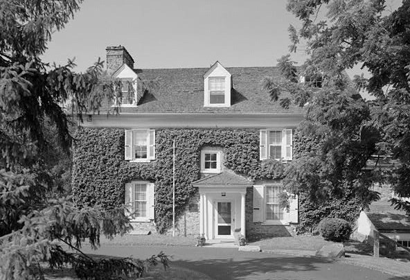
- Mill Grove
-
Mill Grove
 Mill Grove
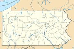

Location: Audubon, Pennsylvania Coordinates: 40°7′23″N 75°26′39″W / 40.12306°N 75.44417°WCoordinates: 40°7′23″N 75°26′39″W / 40.12306°N 75.44417°W Built: 1804 Architect: Morgan,James Architectural style: No Style Listed Governing body: Local NRHP Reference#: 72001138[1] Significant dates Added to NRHP: March 16, 1972 Designated NHL: May 5, 1989[2] Mill Grove is a historic stone house in Audubon, Pennsylvania on the National Register of Historic Places. It is the first home in America of painter John James Audubon for which the community is named. It is maintained as a museum and wildlife sanctuary by Montgomery County.
Mill Grove was owned for 17 years by Audubon's father, Jean, a French sea captain. In 1803, Captain Audubon sent his youthful son John James to Mill Grove to supervise the estate that included a working lead mine.
The house serves as the educational center of the Pennsylvania chapter of the National Audubon Society. The estate comprises 175 acres (71 ha) with more than five miles (8 km) of trails. The house features a museum displaying original Audubon prints, all of his major oil paintings and memorabilia.
References
- ^ "National Register Information System". National Register of Historic Places. National Park Service. 2007-01-23. http://nrhp.focus.nps.gov/natreg/docs/All_Data.html.
- ^ "Mill Grove (John James Audubon House)". National Historic Landmark summary listing. National Park Service. http://tps.cr.nps.gov/nhl/detail.cfm?ResourceId=1264&ResourceType=Building. Retrieved 2008-07-02.
External links
U.S. National Register of Historic Places Topics Lists by states Alabama • Alaska • Arizona • Arkansas • California • Colorado • Connecticut • Delaware • Florida • Georgia • Hawaii • Idaho • Illinois • Indiana • Iowa • Kansas • Kentucky • Louisiana • Maine • Maryland • Massachusetts • Michigan • Minnesota • Mississippi • Missouri • Montana • Nebraska • Nevada • New Hampshire • New Jersey • New Mexico • New York • North Carolina • North Dakota • Ohio • Oklahoma • Oregon • Pennsylvania • Rhode Island • South Carolina • South Dakota • Tennessee • Texas • Utah • Vermont • Virginia • Washington • West Virginia • Wisconsin • WyomingLists by territories Lists by associated states Other  Category:National Register of Historic Places •
  Portal:National Register of Historic PlacesCategories:
- National Historic Landmarks in Pennsylvania
- Museums in Montgomery County, Pennsylvania
- Houses on the National Register of Historic Places in Pennsylvania
- Buildings and structures completed in 1804
- Art museums in Pennsylvania
- Historic house museums in Pennsylvania
- Biographical museums in Pennsylvania
- Houses in Montgomery County, Pennsylvania
- Pennsylvania Registered Historic Place stubs

Wikimedia Foundation. 2010.