- M1 highway (Russia)
-
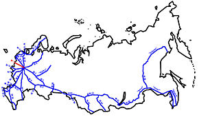
The Russian route M1 (also known as the Belarus Highway, road to Minsk) is a major trunk road that runs from Moscow through Smolensk before reaching the border with Belarus. The length is 440 kilometers (270 mi). The highway runs south of Odintsovo, Kubinka, Mozhaysk, Gagarin, north of Vyazma, through Safonovo and Yartsevo. After crossing the border with Belarus, the highway continues (as olimpijka) to Minsk, Brest, and Warsaw. It is part of the European route E30.
During the 1980 Summer Olympics, a 50 km (31 mi) stretch between the 23 km (14 mi) mark and the 73 km (45 mi) mark was used for the road team time trial cycling event.
Reference
- 1980 Summer Olympics official report. Volume 2. Part 1, p. 103.
Russian federal highways M1 "Belarus" · M2 "Crimea" · M3 "Ukraine" · M4 "Don" · M5 "Ural" · M6 "Caspian" · M7 "Volga" · M8 "Kholmogory" · M9 "Baltia" · M10 "Scandinavia / Russia" · M11 "Narva" · M18 "Kola" · M20 "Pskov" · M29 "Caucasus" · M52 "Chuisky Trakt"
Baikal (M51 · M53 · M55) · M56 "Lena" · M56 "Kolyma" · M58 "Amur" · M60 "Ussuri" · A119 "Vyatka" · "Vostok"
Venues of the 1980 Summer Olympics Central Lenin Stadium Area Druzhba Multipurpose Arena · Grand Arena · Minor Arena · Sports Palace · Swimming Pool · Streets of MoscowOlympiysky Sports Complex Indoor Stadium · Swimming PoolNorthwestern Planning Zone CSKA Athletics Fieldhouse · CSKA Football Fieldhouse · CSKA Palace of Sports · Dynamo Central Stadium, Grand Arena · Dynamo Central Stadium, Minor Arena · Dynamo Palace of Sports · Krylatskoye Sports Complex Archery Field · Krylatskoye Sports Complex Canoeing and Rowing Basin · Krylatskoye Sports Complex Cycling Circuit · Krylatskoye Sports Complex Velodrome · Trade Unions' Equestrian Complex · Young Pioneers StadiumEastern Planning Zone Football venues Other venues Moscow-Minsk Highway · Olympic Regatta in TallinnCategories:- 1980 Summer Olympic venues
- Olympic cycling venues
- Roads in Russia
- Constituent roads of European route E30
Wikimedia Foundation. 2010.


