M11 highway (Russia)

M11 highway (Russia)


M11


Federal Highway M11
Федеральная автомобильная дорога M11
Narva Highway
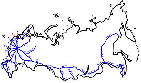
Major junctions
East end: St. Peterburg
West end: Estonian border
Highway system

Russian Federal Highways

Russian Route M11, also known as Narva Highway (Russian: Федера́льная автомоби́льная доро́га М11 «На́рва», Federal highway M11 "Narva") is a Russian federal highway from St.Petersburg to Ivangorod up to the border with Estonia by the Narva River, with the Estonian city of Narva on the opposite bank, which explains the name of the highway. It is part of the European route E20.
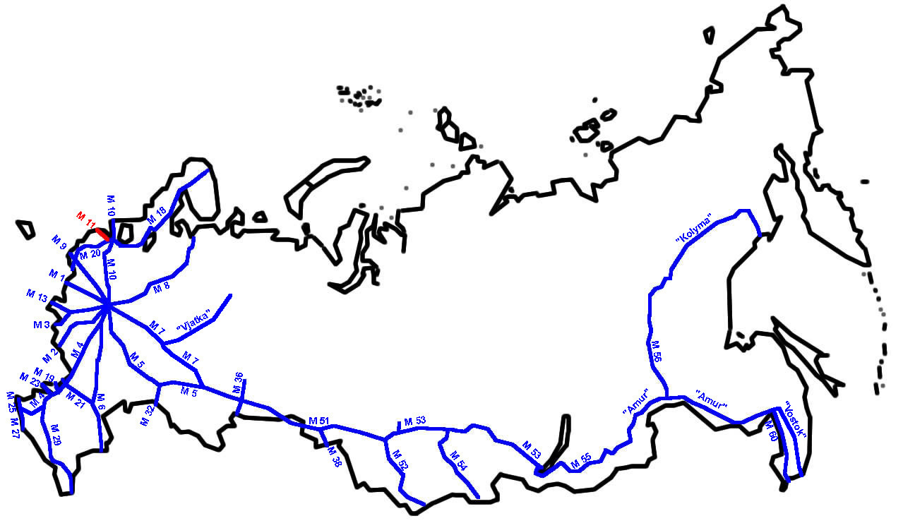


Wikimedia Foundation. 2010.

Игры ⚽ Нужно сделать НИР?

Look at other dictionaries:

  • M10 highway (Russia) — M10 Federal Highway M10 Федеральная автомобильная дорога M10 Russia–Scandinavia Highway …   Wikipedia

  • M4 highway (Russia) — M4 Federal Highway M4 Федеральная автомобильная дорога M4 Don Highway …   Wikipedia

  • M1 highway (Russia) — M1 Federal Highway M1 Федеральная автомобильная дорога M1 Belarus Highway …   Wikipedia

  • M52 highway (Russia) — M52 Federal Highway M52 Федеральная автомобильная дорога M52 Chuya Highway Чуйский тракт …   Wikipedia

  • Controlled-access highway — Freeway redirects here. For other meanings, see Freeway (disambiguation). A freeway with a wide grass median (Highway 402 in Canada) A controlled access highway is a highway designed exclusively for high speed vehicular traffic, with all traffic… …   Wikipedia

  • List of firearms — This is an extensive list of small arms pistol, machine gun, grenade launcher, anti tank rifle that includes variants. 0 9*977 Bowing rifle ( Russian Rifle) *90 1000 Assault Rifle ( American Rifle) *9A 91 (Russia Carbine Assault Rifle 9 x 39… …   Wikipedia

  • Chery A3 — Manufacturer Chery Automobile Also called Chery J3 Chery M11 Chery Chance/Niche Chery Cielo Chery Tengo Chery Skin/Skin Sport Cher …   Wikipedia

  • List of autopistas and autovías in Spain — The Spanish motorway network is the fourth largest in the world by length, after the United States, China and Canada. As of 2008, there are 15,152 km (9,415 mi) of High Capacity Roads[1] (Sp. Vías de Gran Capacidad) in the country.… …   Wikipedia

  • Roads in the United Kingdom — The A2 at Leyton Cross, Dartford. Roads in the United Kingdom form a network of varied quality and capacity. Road distances are shown in miles or yards and UK speed limits are in miles per hour (mph) or use of the national speed limit (NSL)… …   Wikipedia

  • Daylight saving time — This article is about daylight saving time in general. For DST in a specific location, see Daylight saving time by country. Summer time and DST redirect here. For other uses, see Summer time (disambiguation) and DST (disambiguation) …   Wikipedia

Share the article and excerpts

Direct link
Do a right-click on the link above
and select “Copy Link”