- Melbourne tram route 57
-
City - West Maribyrnong 

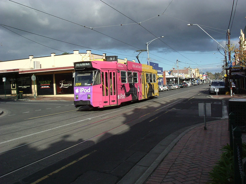
Route Information Route Number 57 Number of stops 49 Timetables Link Route Map Link Zone Location Zone 1 Entire route Tram route 57 is a public transport service in Melbourne, Victoria, Australia. It runs from the corner of Flinders Street and Elizabeth Street in the city centre to West Maribyrnong in the inner Western suburbs.
Like most Melbourne tram routes, route 57 operates entirely in Metcard ticketing Zone 1. The route is operated by Z3 class trams from Essendon tram depot.
The route runs along Elizabeth Street in the city, Victoria Street in West Melbourne, Errol Street, Queensberry Street and Abbotsford Street in North Melbourne, Flemington Road in Parkville, Racecourse Road through North Melbourne, Kensington, Newmarket and Flemington, Epsom Road through Flemington and Ascot Vale, Union Road and Maribyrnong Road in Ascot Vale, and Raleigh Road and Cordite Avenue in Maribyrnong where it terminates at the corner of Cordite Avenue and Central Park Avenue.
Route 57 shares track with route 82 between the intersection of Maribyrnong Road and Union Road, Ascot Vale; and Raleigh Road and Wests Road, Maribyrnong. A loop siding exists at the south end of Union Road in Ascot Vale,[1] and is used during special events at the Royal Melbourne Showgrounds and Flemington Racecourse to handle the additional trams used to move the crowds of passengers.
There have been proposal, supported by the Public Transport Users Association and local politicians, to extend route 57 north-west along Milleara Road to Avondale Heights and East Keilor.[2] Variations of this proposal including building a park and ride facility near the terminus, or establishing a high frequency bus service between the terminus and East Keilor down Milleara Road.
Route
There are 49 stops on route 57. Commencing at the Sir Robert Risson tram terminus at the intersection of Flinders and Elizabeth Streets, opposite Flinders Street Station (stop 1), route 57 then runs via:
- Elizabeth Street (stops 1 - 9)
- Collins Street, tram routes 11, 12, 42, 48, 109, and 112 (stop 2)
- Bourke Street, GPO, tram routes 86, 95, and 96 (stop 3)
- Lonsdale Street, St Francis' Church (stop 4)
- La Trobe Street, Melbourne Central shopping centre and railway station, tram routes 24, 30, 34, and City Circle (stop 5)
- Victoria Street, Queen Victoria Market, tram routes 19 and 59 (stop 7)
- Victoria Street
- Errol Street/Queensberry Street/Abbotsford Street
- Flemington Road
- Abbotsford Street, Royal Park, tram route 55 (stop 19)
- Racecourse Road/Epsom Road/Union Road
- Boundary Road, Flemington Bridge station, tram route 59 (stop 22)
- Newmarket Plaza, Newmarket station (stop 26)
- Flemington Racecourse (stop 29)
- Royal Melbourne Showgrounds (stop 33)
- Maribyrnong Road, tram route 82 (stop 37)
- Maribyrnong Road
- Maribyrnong River Trail (stop 41)
- Raleigh Road/Cordite Avenue
- Highpoint Shopping Centre (stop 46)
- Wests Road, tram route 82 (stop 47)
Ends at Cordite Avenue, West Maribyrnong (stop 49).
References
- ^ "Showgrounds Loop". Vicsig Forums. http://forums.vicsig.net/viewtopic.php?f=13&t=3034. Retrieved 6 October 2011.
- ^ Public Transport Users Association. "Policies: Extending Melbourne’s network". ptua.org.au. http://www.ptua.org.au/policy/network/. Retrieved 6 October 2011.
Maps and timetables
- Official timetables
- Official route map
- Official tram network map
- Melbourne tram and train network map from railmaps.com.au
Trams in Melbourne - Yarra Trams Routes Current Tram Fleet W • Z • A • B • C • C2 • DOperator KDR Melbourne (Yarra Trams)Former operators Prahran and Malvern • Hawthorn • Melbourne, Brunswick and Coburg • Fitzroy, Northcote and Preston • Footscray • Northcote Municipality • North Melbourne Electric Tramway and Lighting Company • Melbourne and Metropolitan Tramways Board • Victorian Railways • M>Tram • Transdev TSLTourist services Tram depots Brunswick • Camberwell • East Preston • Essendon • Glenhuntly • Hawthorn • Kew • Malvern • North Fitzroy • Preston Workshops • Newport Workshops • Southbank • South MelbourneMiscellaneous Categories:- Tram routes in Melbourne
- Elizabeth Street (stops 1 - 9)
Wikimedia Foundation. 2010.