- Deerfield (Metra)
-
Deerfield

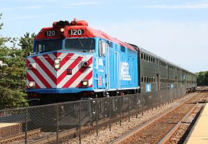
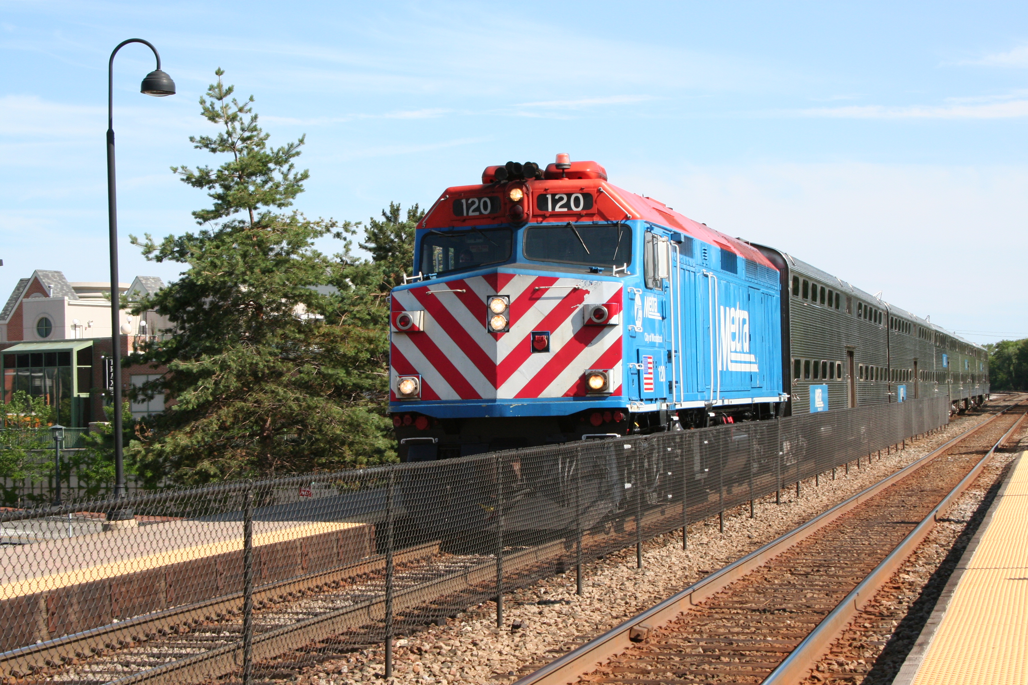
Metra F40PH-2 120 "City Of Woodstock" approaching the Deerfield station, June 23, 2006.Station statistics Address 860 Deerfield Road
Deerfield, IllinoisCoordinates 42°10′4.8″N 87°50′59.64″W / 42.168°N 87.8499°WCoordinates: 42°10′4.8″N 87°50′59.64″W / 42.168°N 87.8499°W Lines Connections Pace Buses Platforms 2 side platforms Tracks 2 Parking On street Other information Opened 1872 Rebuilt 1900, 1917 Accessible 
Fare zone E Services Preceding station Metra Following station toward Fox LakeMilwaukee District/North toward Union StationChicago, Milwaukee and St. Paul Railway Passenger Depot

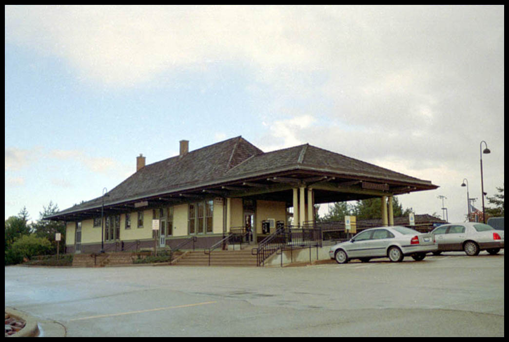
Location: Deerfield, Illinois, USA Coordinates: 42°10′4.8″N 87°50′59.64″W / 42.168°N 87.8499°WCoordinates: 42°10′4.8″N 87°50′59.64″W / 42.168°N 87.8499°W Built: 1917 Governing body: Village of Deerfield NRHP Reference#: 98000066 Added to NRHP: February 5, 1998 Deerfield Station is one of two Metra commuter railroad stations in Deerfield, Illinois, along the Milwaukee District/North Line. It is located at 860 Deerfield Road, 2 blocks west of Illinois State Route 43, is 24.2 miles (38.9 km) away from Union Station, the southern terminus of the line,[1] and serves commuters between Union Station and Fox Lake, Illinois. The current station originally served the Chicago, Milwaukee, St. Paul & Pacific Railroad.
Deerfield station was originally built as the Chicago, Milwaukee and St. Paul Railway Passenger Depot in 1872 on what is currently the site of 35 Central Avenue.[citation needed] A boxcar was used as a temporary station while the permanent one was being built. It was rebuilt at its present location in 1900. A pedestrian underpass was built at the station in 1913 and it was rebuilt again after a fire in 1917.[2]
Deerfield station became nationally famous in 1979, when Deerfield village officials created a "No-Kissing Zone" at the station in response to complaints about traffic jams caused by couples taking too long to kiss their goodbyes at the drop-off point. The "No-Kissing" signs (patterned after international traffic signs) attracted national attention and were featured in Time Magazine and ABC's AM America (precursor to Good Morning America). A Deerfield family appearing on the game show Family Feud presented Richard Dawson with replica pins of the signs. Despite this restriction, the station is shown in the 1983 Paul Brickman film Risky Business. The station was added to the National Register of Historic Places on February 5, 1998.[3]
Bus connections
- #471 Highland Park-Deerfield
- #576 Deerfield Metra to Buffalo Grove/Lincolnshire
- #622 Shuttle Bug 12
- #632 Lake Cook Shuttle Bug 2
References
External links
U.S. National Register of Historic Places Topics Lists by states Alabama • Alaska • Arizona • Arkansas • California • Colorado • Connecticut • Delaware • Florida • Georgia • Hawaii • Idaho • Illinois • Indiana • Iowa • Kansas • Kentucky • Louisiana • Maine • Maryland • Massachusetts • Michigan • Minnesota • Mississippi • Missouri • Montana • Nebraska • Nevada • New Hampshire • New Jersey • New Mexico • New York • North Carolina • North Dakota • Ohio • Oklahoma • Oregon • Pennsylvania • Rhode Island • South Carolina • South Dakota • Tennessee • Texas • Utah • Vermont • Virginia • Washington • West Virginia • Wisconsin • WyomingLists by territories Lists by associated states Other Categories:- Metra stations
- National Register of Historic Places in Lake County, Illinois
- Railway stations opened in 1872
- Railway stations on the National Register of Historic Places in Illinois
- Stations along Milwaukee Road lines
- Deerfield, Illinois
- Railway stations in Lake County, Illinois
- Illinois railway station stubs

Wikimedia Foundation. 2010.