- Daburiyya
-
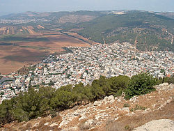
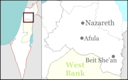
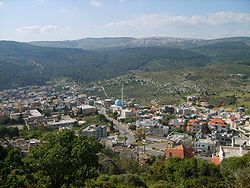
Daburiyya Hebrew transcription(s) – Hebrew דַבּוּרִיָּה, דבורייה – ISO 259 Dabburiya – Also spelled Deburieh (unofficial) Arabic transcription(s) – Arabic دبورية Coordinates: 32°41′31″N 35°22′18″E / 32.69194°N 35.37167°ECoordinates: 32°41′31″N 35°22′18″E / 32.69194°N 35.37167°E District North Government – Type Local council (from 1961) – Head of Municipality Dr. Faisal Azayzah Area – Total 7,200 dunams (7.2 km2 / 2.8 sq mi) Population (2005) – Total 8,500 Daburiyya (Arabic: دبورية; Hebrew: דַבּוּרִיָּה) is an Arab village east of Nazareth that gained local council status in Israel's North District in 1961. Its jurisdiction extends over 7,200 dunams. According to the Israeli Central Bureau of Statistics, Daburiyya is home to approximately 8,500 residents.[1] The town's population is homogeneously fallahen. A fallah is an Arab who lives or descended from the village, as opposed to city dwellers or medinniyin.
Daburiyya is located off of Highway 65 at the foot of Mount Tabor in the Lower Galilee, near the area where the prophetess Deborah judged.
According to the Information on Equality and Social Justice in Israel (ADVA), in 1999 10.5% of Daburiyya's job-ready population are unemployed and 40.4% of the town's university applicants are rejected.[2]
Contents
History
Daburiyya is associated with the Biblical city of Dabrath, which in Joshua 21:28 and in the Book of Chronicles is allotted to the tribe of Issachar who gave it to the Levites.[3]
Its Hebrew name was Dav(a)rita or Dveyra.[4][5]
In the Roman-Byzantine period, it was named Helenopolis in Palestina Secunda.[6] The Christian episcopal see of Helenopolis was a suffragan of Scythopolis (Beit She'an).[7]
Remains of a Crusader Church can still be seen in Daburiyya.[8] A mosque, possibly constructed above an old Crusader tower,[9] has an inscription above the entrance informing us that it was built in 610 H (1213 CE) by al-Al-Mu'azzam 'Isa.[10]
Archaeology
During July 2004, a salvage excavation was conducted in the center of Dabburiya village, south of the local council building, subsequent to the discovery of antiquities in a lot slated for construction. The excavation revealed building remains from the Late Roman or Byzantine periods.[11]
Another salavage excavation, in 2006, revealed two winepresses and cupmarks were exposed and potsherds from the Iron Age and the Hellenistic period were collected.[12]See also
References
- ^ Populations of Localities Numbering Above 1,000 Residents - Israel Central Bureau of Statistics
- ^ Israel: A Social Report
- ^ Keil, 1857, p. 424.
- ^ Rivka Shpak Lissak, "Dabburiya, An Arabic Village was formerly the Israeli/Jewish Davarita" [1]
- ^ Bellarmino Bagatti, The Church from the gentiles in Palestine: history and archaeology, 1971 snippet
- ^ Günter Stemberger, Jews and Christians in the Holy Land: Palestine in the fourth century, 2000, p. 9 full text.
- ^ Sophrone Pétridès, "Helenopolis", The Catholic Encyclopedia, 1910. Retrieved February 21, 2010 New Advent
- ^ Pringle, 1993, p. p.192, 193
- ^ Pringle, 1997, p.46
- ^ Petersen, 2002, p.131
- ^ Abu Raya, Rafeh (April, 2009). "Dabburiya, Final Report". http://www.hadashot-esi.org.il/report_detail_eng.asp?id=1078&mag_id=115&previewit=TrUe. Retrieved 2010-08-28.
- ^ Daniel, Zohar (February, 2010). "Dabburiya, Final Report". http://www.hadashot-esi.org.il/report_detail_eng.asp?id=1344&mag_id=117. Retrieved 2010-08-28.
Bibliography
- Conder, Claude Reignier and H.H. Kitchener (1881): The Survey of Western Palestine: memoirs of the topography, orography, hydrography, and archaeology. London:Committee of the Palestine Exploration Fund. vol 1 p 363p 366
- Guérin, M. V. (1880): Description Géographique, Historique et Archéologique de la Palestine. Galilee 1 part. p 140-1 ff)
- Keil, Carl Friedrich (1857). Commentary on the Book of Joshua. T. & T. Clark
- Palmer, E. H. (1881): The survey of Western Palestine: Arabic and English name lists collected during the survey by Lieutenants Conder and Kitchener, R. E. Transliterated and explained by E.H. Palmer. ( p.125 )
- Pringle, Denys (1993), The Churches of the Crusader Kingdom of Jerusalem: A-K (excluding Acre and Jerusalem), Cambridge University Press, http://books.google.ca/books?id=BgQ6AAAAIAAJ
- Pringle, Denys (1997), Secular buildings in the Crusader Kingdom of Jerusalem: an archaeological Gazetter, Cambridge University Press, http://books.google.ca/books?id=-_NbE5obqRMC
- Petersen, Andrew (2002): A Gazetteer of Buildings in Muslim Palestine: Volume I (British Academy Monographs in Archaeology) p.131
- Robinson, Edward, Eli Smith (1841): Biblical Researches in Palestine, Mount Sinai and Arabia Petraea: A Journal of Travels in the Year 1838a, Published by Crocker & Brewster, 1841 Item notes: v. 3 p, 210 179
- le Strange, Guy (1890), Palestine Under the Moslems: A Description of Syria and the Holy Land from A.D. 650 to 1500, Committee of the Palestine Exploration Fund, http://www.archive.org/details/palestineundermo00lestuoft p. 427
- TIR: Tsafrir, Y., L Di Segni and J. Green (1994): Tabula Imperium Romani: Iudaea-Paleastina; Eretz Israel in the Hellenistic, Roman and Byzantine Periods, Jerusalem. 106
- Wilson, Charles Williams, ed. (1881, 1884): Picturesque Palestine, Sinai and Egypt. vol 2 of 4 p. 44
External links
- Unofficial website (Arabic)
Categories:- North District (Israel)
- Local councils in Israel
- Arab localities in Israel
- Palestine
Wikimedia Foundation. 2010.


