- Kaukab Abu al-Hija
Infobox Israel municipality
name=Kaukab Abu al-Hija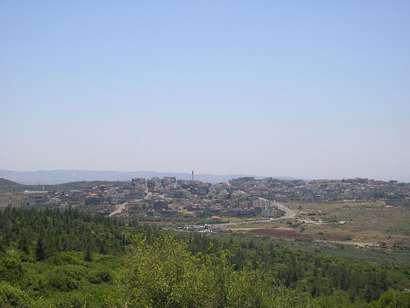
imgsize=250px
hebname=Hebrew|כַּוּכַּבּ/כאוכב אַבּוּ אל-הִיגַ'א
arname=كوكب أبو الهيجا
meaning=Abu al-Hija's Star
founded=
type=lc
typefrom=1984
stdHeb=
altOffSp=Kaokab Abu Al-Hija
altUnoSp=Kawkab Abu al-Heija
district=north
population=2,800
popyear=2006
area_dunam=2567
mayor=Kaukab Abu al-Hija ( _ar. كوكب أبو الهيجا; _he. כַּוּכַּבּ אַבּוּ אל-הִיגַ'א), often simply Kaukab, is an Arab
Muslim village and local council in the North District ofIsrael , in theLower Galilee . It is located on Road 784, betweenShefa-'Amr andKarmiel , and next toKafr Manda . Kaukab was historically under the control of the Abu al-Hija family of theGalilee . [http://www.crwflags.com/FOTW/FLAGS/il-lckeh.html Kaokab Abu Al-Hija (Israel)] Gutterman, Dov. Flags of the World.]According to the
Israel Central Bureau of Statistics , Kaukab had a population of 2,800 in 2005,cite web|url=http://www.cbs.gov.il/population/new_2009/table3.pdf|publisher=Israel Central Bureau of Statistics |title=Table 3 - Population of Localities Numbering Above 1,000 Residents and Other Rural Population|date=2007-12-31|accessdate=2008-05-26] and is ranked low (3/10) on the Israeli socio-economic scale. Its jurisdiction is 2,567dunam s.cite web|url=http://www.cbs.gov.il/publications/local_authorities2005/pdf/467_0505.pdf|title=Local Authorities in Israel 2005, Publication #1295 - Municipality Profiles - Kaukab Abu al-Hija|publisher=Israel Central Bureau of Statistics|accessdate=2008-05-27 he icon]History
Kaukab was founded next to the grave of Hussam ad-Din Abu al-Hija, one of
Saladin 's lieutenants, which is holy toIslam . It is thus named Kaukab Abu al-Hija to differentiate it from several otherArab villages with the same name.cite encyclopedia|author=Vilnai, Ze'ev|title=Kaukab|encyclopedia=Ariel Encyclopedia|volume=Volume 4|pages=p. 3524|publisher=Am Oved|location=Israel|year=1976 he icon] cite book|title=Lexicon of the Land of Israel|publisher=Miskal - Yedioth Ahronoth Books and Chemed Books|year=1999|first=Immanuel|last=HaReuveni|pages=p. 476|isbn=965-448-413-7 he icon] It is possible to discern the ruins of Byzantine, Roman and Greek settlements on Kaukab's location, and it is also thought to be the location of the town Kokhva, mentioned in theTalmud .In the British Mandate census of 1931, Kaukab had a population of 285 and according to a land and population survey by
Sami Hadawi , its population was 490 in 1945. [ [http://www.palestineremembered.com/download/VillageStatistics/Table%20I/Nazareth/Page-062.jpgVillage Statistics 1945: A Classification of Land and Area Ownership in Palestine] (1970).Sami Hadawi . Palestine Liberation Organization Research Center.] In 1973, this grew to 1,340. Kaukab was declared a local council in 1984.References
ee also
*
Ein Hawd , another Abu al-Hija village
*List of Arab localities in Israel
Wikimedia Foundation. 2010.