- Osann-Monzel
-
Osann-Monzel 

 Osann-MonzelLocation of Osann-Monzel within Bernkastel-Wittlich district
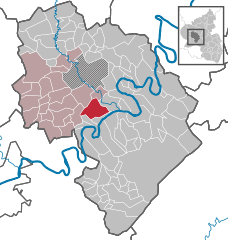
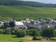
Coordinates 49°55′18″N 6°57′19″E / 49.92167°N 6.95528°ECoordinates: 49°55′18″N 6°57′19″E / 49.92167°N 6.95528°E Administration Country Germany State Rhineland-Palatinate District Bernkastel-Wittlich Municipal assoc. Wittlich-Land Mayor Matthias Stoffel Basic statistics Area 16.58 km2 (6.40 sq mi) Elevation 190 m (623 ft) Population 1,611 (31 December 2010)[1] - Density 97 /km2 (252 /sq mi) Other information Time zone CET/CEST (UTC+1/+2) Licence plate WIL Postal code 54518 Area code 06535 Website www.osann-monzel.de  Monzel at the Hüttenkopf
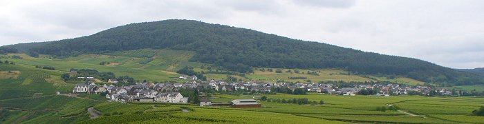
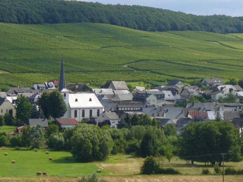
 Osann at the Rosenberg
Osann-Monzel is an Ortsgemeinde – a municipality belonging to a Verbandsgemeinde, a kind of collective municipality – and a winegrowing centre in the Bernkastel-Wittlich district in Rhineland-Palatinate, Germany.
Contents
Geography
Location
The municipality lies on the Middle Moselle on a slope set two kilometres back from the river, between the two mountains of the Hüttenkopf and the Rosenberg in a side valley through which a bend in the Moselle flowed in the Tertiary. Osann-Monzel’s elevation is some 180 m above sea level. Osann-Monzel belongs to the Verbandsgemeinde of Wittlich-Land, whose seat is in Wittlich, although that town is itself not in the Verbandsgemeinde.
Constituent communities
Osann-Monzel’s Ortsteile are, as the name suggests, Osann and Monzel. They were merged to form today’s municipality in 1969.
History
The Osann-Monzel area is believed to have first been settled in Roman times after Julius Caesar (100 BC – 44 BC) had absorbed the Eifel and the Moselle into the Roman Empire. Within Monzel’s limits, rubble was found that was interpreted as having been a Roman villa rustica, that is, an agricultural homestead. After the end of Roman hegemony, the municipality belonged, beginning in 510, to Francia, and after that kingdom’s division in the mid 9th century to Lotharingia. Lotharingia, for its part, switched allegiances between the East Frankish and West Frankish kingdoms. In the end, the municipal area belonged, beginning in 925, albeit with interruptions, to Germany’s western border area.
No direct documentary mention from this time is known. Nevertheless, it is assumed that both Osann and Monzel were founded as early as the 7th or 8th century. What is certain is that these places arose no later than 950. This is known from an inventory of holdings made at that time by Saint Martin’s Abbey in Trier in which osanna and muncele villam are named. This first documentary mention has been dated to 1008[2][3].
Archbishop Balduin von Trier enfeoffed the Count of Saarbrücken-Nassau with Monzel and Osann in 1323; however, another important landholder in Monzel remained Himmerod Abbey. In 1412, the fiefholder at the time, Philipp von Nassau-Saarbrücken, further enfeoffed the Count of Daun and at Bruch with Osann and Monzel as a “subfief”, leading to Osann’s and Monzel’s becoming, through a dowry, part of the possessions held by the Counts of Manderscheid.
Beginning in 1794, both Osann and Monzel lay under French rule. In 1815 they were assigned to the Kingdom of Prussia at the Congress of Vienna. From 1946, they were part of the then newly founded state of Rhineland-Palatinate. In 1969, the two municipalities were dissolved, and out of them was formed the new municipality of Osann-Monzel on 7 June 1969.
Politics
Municipal council
The council is made up of 16 council members, who were elected by proportional representation at the municipal election held on 7 June 2009, and the honorary mayor as chairman.
The municipal election held on 7 June 2009 yielded the following results[4]:
WG Stoffel WG Kohnz Total 2009 10 6 16 seats Mayor
The Mayor is Matthias Stoffel.
Coat of arms
The municipality’s arms might be described thus: Per pale argent a cross gules and per fess Or a fess dancetty of the second and vert a bunch of grapes between two ears of wheat, the dexter in bend and the sinister in bend sinister and conjoined on one stem slipped in bend sinister, all of the third.
The cross on the dexter (armsbearer’s right, viewer’s left) side refers to Osann-Monzel’s centuries-long allegiance to the Electorate of Trier. The zigzag stripe (“fess dancetty”) is the arms formerly borne by another of the municipality’s old feudal lords, the Counts of Manderscheid-Blankenhein. Also on the sinister (armsbearer’s left, viewer’s right) side, the stylized bunch of grapes and the ears of wheat stand for the municipality’s traditional winegrowing and agriculture respectively.
Osann-Monzel was granted the right to bear its own arms on 13 March 1972[5].
Economy and infrastructure
Vineyards in Osann-Monzel
- Osanner Kirchlay
- Osanner Rosenberg
- Monzeler Kätzchen
- Monzeler Paulinslay
As everywhere in the Mosel-Saar-Ruwer wine region, it is mainly Riesling, Müller-Thurgau and Dornfelder that are raised.
Established businesses
- CTR Fahrzeugtechnik GmbH, 100 employees
References
- ^ "Bevölkerung der Gemeinden am 31.12.2010" (in German). Statistisches Landesamt Rheinland-Pfalz. 31 December 2010. http://www.statistik.rlp.de/fileadmin/dokumente/berichte/A1033_201022_hj_G.pdf.
- ^ Gerten, Erich; Kirch, Fritz; Kohnz, Armin, Osann – Geschichte eines Weindorfes im Moselland, Verein „1000 Jahre Osann e.V." (published 2008)
- ^ The oldest known documentary mention of the places Osann and Monzel is found in the appendix of “Vita Magnerici”, a biography of Saint Magneric, Bishop of Trier (570-596). This document, which contains no date, is reckoned to be from 1008, while the appendix might well have been attached sometime between 1020 and 1040. The appendix is a listing of the holdings that still belonged to Saint Martin’s Abbey in Trier about 950 before it was stripped of them by the Archbishop of Trier. Also mentioned here besides Osann and Monzel are Wehlen (today an outlying centre of Bernkastel-Kues), Longkamp, Kommen, Salmrohr (today an outlying centre of Salmtal), Fastrau (today an outlying centre of Fell), Mertloch, Bitburg, Reinig (today an outlying centre of Wasserliesch) and a place named Eweson which is nowadays unknown.
- ^ Kommunalwahl Rheinland-Pfalz 2009, Gemeinderat
- ^ Description and explanation of Osann-Monzel’s arms
External links
- Municipality’s official webpage (German)
- This article incorporates information from the German Wikipedia.
Categories:- Municipalities in Rhineland-Palatinate
- Bernkastel-Wittlich geography stubs


Wikimedia Foundation. 2010.