- Oberscheidweiler
-
Oberscheidweiler 

 OberscheidweilerLocation of Oberscheidweiler within Bernkastel-Wittlich district
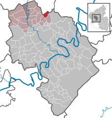
Coordinates 50°4′26″N 6°56′3″E / 50.07389°N 6.93417°ECoordinates: 50°4′26″N 6°56′3″E / 50.07389°N 6.93417°E Administration Country Germany State Rhineland-Palatinate District Bernkastel-Wittlich Municipal assoc. Manderscheid Mayor Erhard Rosenbaum Basic statistics Area 4.50 km2 (1.74 sq mi) Elevation 370 m (1214 ft) Population 187 (31 December 2010)[1] - Density 42 /km2 (108 /sq mi) Other information Time zone CET/CEST (UTC+1/+2) Licence plate WIL Postal code 54533 Area code 06574 Oberscheidweiler is an Ortsgemeinde – a municipality belonging to a Verbandsgemeinde, a kind of collective municipality – in the Bernkastel-Wittlich district in Rhineland-Palatinate, Germany.
Contents
Geography
Location
The municipality lies in the Eifel, indeed on the edge of the Vulkaneifel, on a high plateau between the Alf and Sammetbach valleys. Oberscheidweiler belongs to the Verbandsgemeinde of Manderscheid, whose seat is in the like-named municipality.
Neighbouring municipalities
Oberscheidweiler borders in the south on Niederscheidweiler, in the west on Hasborn and in the north on Mückeln.
History
In 1144, Oberscheidweiler had its first documentary mention as Scheida. Since the 17th century, the name Oberscheidweiler has been customary. Beginning in 1794, Oberscheidweiler lay under French rule. In 1814 it was assigned to the Kingdom of Prussia at the Congress of Vienna. Since 1947, it has been part of the then newly founded state of Rhineland-Palatinate.
Politics
Municipal council
The council is made up of 6 council members, who were elected by majority vote at the municipal election held on 7 June 2009, and the honorary mayor as chairman[2].
Coat of arms
The municipality’s arms might be described thus: Tierced in mantle, dexter argent a cross gules, sinister argent a fleur-de-lis of the second, and in base azure a post horn Or, the bell to sinister.
The cross on the dexter (armsbearer’s right, viewer’s left) side refers to Oberscheidweiler’s centuries-long allegiance to the Electorate of Trier. The lily on the sinister (armsbearer’s left, viewer’s right) side stands for Springiersbach Abbey, for which Emperor Henry IV issued a certificate of confirmation. This led to, among many other things, Oberscheidweiler’s mention in 1193 as Scheitwilre. The post horn appears as a charge for a more straightforward reason: Oberscheidweiler lay on the old postal route from Trier to Koblenz, known to have been run by the Princely house of Thurn und Taxis in 1840.
Oberscheidweiler was granted the right to bear its own arms on 7 January 1993[3].
Economy and infrastructure
To the west runs the Autobahn A 1. In Wittlich is a railway station on the Koblenz-Trier railway line.
References
- ^ "Bevölkerung der Gemeinden am 31.12.2010" (in German). Statistisches Landesamt Rheinland-Pfalz. 31 December 2010. http://www.statistik.rlp.de/fileadmin/dokumente/berichte/A1033_201022_hj_G.pdf.
- ^ Kommunalwahl Rheinland-Pfalz 2009, Gemeinderat
- ^ Description and explanation of Oberscheidweiler’s arms Go to Das Wappen.
External links
- Municipality’s official webpage (German)
- This article incorporates information from the German Wikipedia.
Categories:- Municipalities in Rhineland-Palatinate
- Bernkastel-Wittlich geography stubs


Wikimedia Foundation. 2010.