- Musweiler
-
Musweiler 

 MusweilerLocation of Musweiler within Bernkastel-Wittlich district
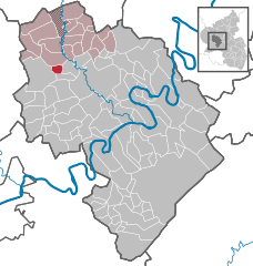
Coordinates 50°00′36″N 6°48′8″E / 50.01°N 6.80222°ECoordinates: 50°00′36″N 6°48′8″E / 50.01°N 6.80222°E Administration Country Germany State Rhineland-Palatinate District Bernkastel-Wittlich Municipal assoc. Manderscheid Ortsbürgermeister Lothar Zens Basic statistics Area 3.05 km2 (1.18 sq mi) Elevation 330 m (1083 ft) Population 55 (31 December 2010)[1] - Density 18 /km2 (47 /sq mi) Other information Time zone CET/CEST (UTC+1/+2) Licence plate WIL Postal code 54534 Area code 06575 Musweiler is an Ortsgemeinde – a municipality belonging to a Verbandsgemeinde, a kind of collective municipality – in the Bernkastel-Wittlich district in Rhineland-Palatinate, Germany.
Contents
Geography
Location
The municipality lies in the Eifel. The nearest large town is the district seat, Wittlich, some 6 km to the east. Musweiler belongs to the Verbandsgemeinde of Manderscheid, whose seat is in the like-named municipality.
Neighbouring municipalities
Musweiler borders in the north on Großlittgen, in the east on Minderlittgen and Hupperath and in the south on Landscheid.
History
Musweiler’s moated castle was an Electoral-Trier fief held by the Lords of Manderscheid, who for a time further enfeoffed the Lords of Esch with their holding. Beginning in 1794, Musweiler lay under French rule. In 1814 it was assigned to the Kingdom of Prussia at the Congress of Vienna. Since 1947, it has been part of the then newly founded state of Rhineland-Palatinate.
Politics
Municipal council
The council is made up of 6 council members, who were elected by majority vote at the municipal election held on 7 June 2009, and the honorary mayor as chairman[2].
Coat of arms
The municipality’s arms might be described thus: Argent on a mount in base vert a tower embattled on each of two floors gules between a spade and tongs, both palewise and azure[3].
Economy and infrastructure
To the south runs Bundesstraße 60. In Wittlich is a railway station on the Koblenz-Trier railway line.
References
- ^ "Bevölkerung der Gemeinden am 31.12.2010" (in German). Statistisches Landesamt Rheinland-Pfalz. 31 December 2010. http://www.statistik.rlp.de/fileadmin/dokumente/berichte/A1033_201022_hj_G.pdf.
- ^ Kommunalwahl Rheinland-Pfalz 2009, Gemeinderat
- ^ Musweiler’s arms Go to Ortsgemeinden> Musweiler.
External links
- Verbandsgemeinde of Manderscheid (German)
- This article incorporates information from the German Wikipedia.
Categories:- Municipalities in Rhineland-Palatinate
- Bernkastel-Wittlich geography stubs


Wikimedia Foundation. 2010.