- Meerfeld
-
Meerfeld 

 MeerfeldLocation of Meerfeld within Bernkastel-Wittlich district
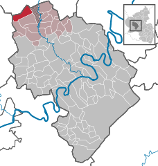
Coordinates 50°5′39″N 6°45′20″E / 50.09417°N 6.75556°ECoordinates: 50°5′39″N 6°45′20″E / 50.09417°N 6.75556°E Administration Country Germany State Rhineland-Palatinate District Bernkastel-Wittlich Municipal assoc. Manderscheid Mayor Karl Weiler (CDU) Basic statistics Area 13.22 km2 (5.10 sq mi) Elevation 350-500 m Population 345 (31 December 2010)[1] - Density 26 /km2 (68 /sq mi) Other information Time zone CET/CEST (UTC+1/+2) Licence plate WIL Postal code 54531 Area code 06572 Website www.meerfeld.info Meerfeld is an Ortsgemeinde – a municipality belonging to a Verbandsgemeinde, a kind of collective municipality – in the Bernkastel-Wittlich district in Rhineland-Palatinate, Germany.
Contents
Geography
Location
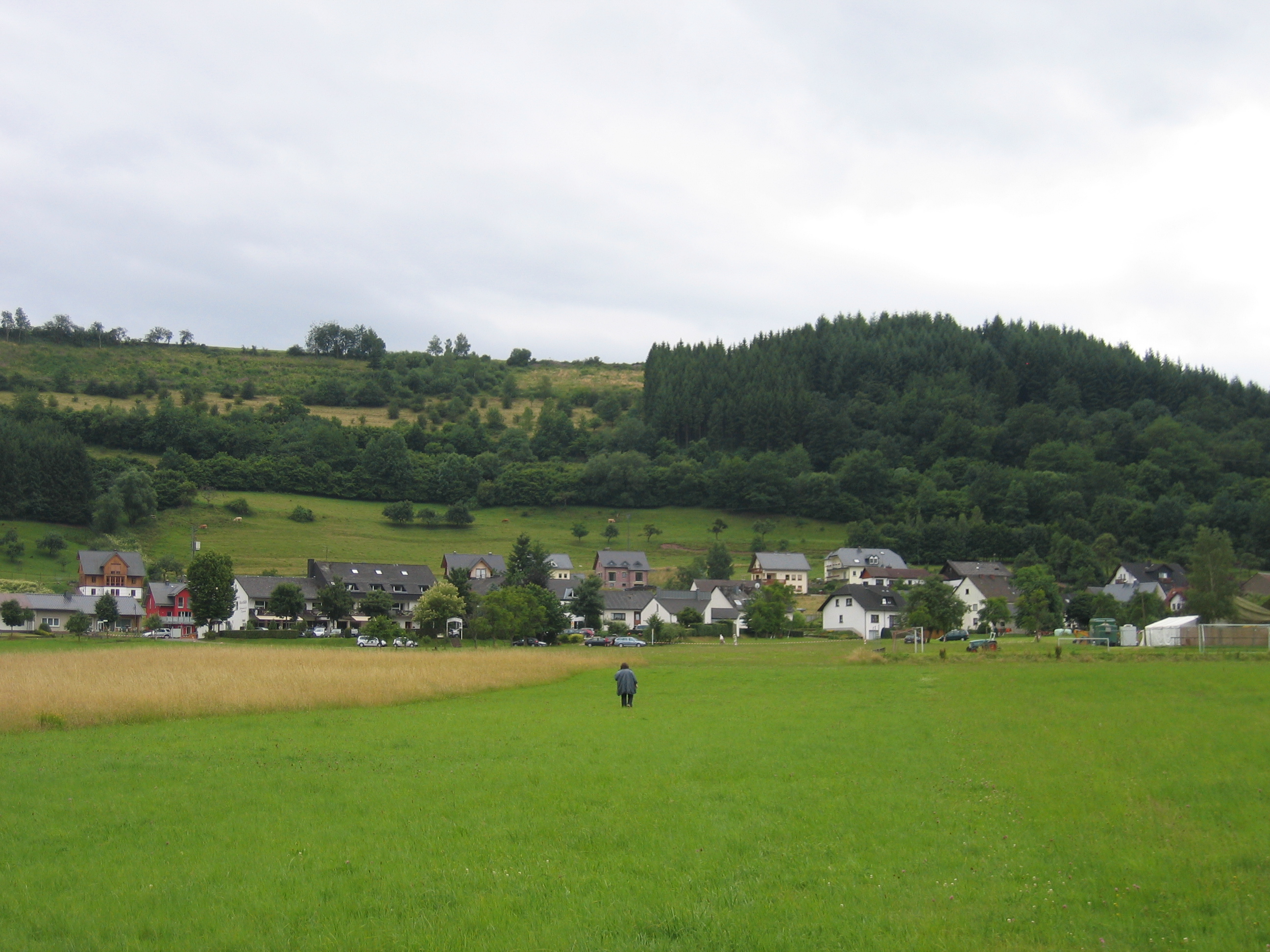
The municipality lies in the middle of a volcanic crater, part of which is filled with water and known as the Meerfelder Maar. The municipal area is 64.5% wooded. Meerfeld belongs to the Verbandsgemeinde of Manderscheid, whose seat is in the like-named municipality.
History
About 1152, Meerfeld had its first documentary mention as part of the parish of Bettenfeld. The landholders were for centuries the Lords of Malberg. Beginning in 1794, Meerfeld lay under French rule. In 1814 it was assigned to the Kingdom of Prussia at the Congress of Vienna. Since 1947, it has been part of the then newly founded state of Rhineland-Palatinate.
Politics
Municipal council
The council is made up of 8 council members, who were elected by majority vote at the municipal election held on 7 June 2009, and the honorary mayor as chairman[2].
Mayor
The mayor is Karl Weiler (CDU). He was confirmed in office at the 2009 election with 60.4% of the vote.
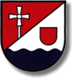
Coat of arms
The German blazon reads: Über blauen, durch Wellenschnitt geteilten Schildfuß schräglinks geteilt, rechts in Rot ein aufsteigendes silbernes Vortragskreuz, links in Silber ein rotes Schildchen.
The municipality’s arms might in English heraldic language be described thus: Over a base wavy azure, party per bend sinister gules issuant palewise from the line of partition John the Baptist’s cross argent and argent an inescutcheon of the second.
The maar gave the municipality the first syllable in its name, Meer—, from an Old High German word meaning “swamp” or “moor”. The wavy base stands for this body of water. Until 1800, the village belonged, within the Duchy of Luxembourg, to the Lords of Malberg whose heraldic bearing was the red shield on a silver field. The church’s and the village’s longtime patron saint is John the Baptist, who is represented by the cross, his attribute. The tinctures gules, argent and azure (red, silver and blue) also recall the old Luxembourgish landholders, as these were the ones that they bore[3].
Economy and infrastructure
The state-recognized recreational resort (Erholungsort) logged a good 30,000 overnight stays in 2003.
Gallery
-

View of Meerfeld from the side of the maar
-
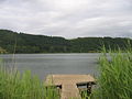
Meerfelder Maar
-

View of the maar from the village
References
- ^ "Bevölkerung der Gemeinden am 31.12.2010" (in German). Statistisches Landesamt Rheinland-Pfalz. 31 December 2010. http://www.statistik.rlp.de/fileadmin/dokumente/berichte/A1033_201022_hj_G.pdf.
- ^ Kommunalwahl Rheinland-Pfalz 2009, Gemeinderat
- ^ Description and explanation of Meerfeld’s arms
External links
- Municipality’s official webpage (German)
- This article incorporates information from the German Wikipedia.
Categories:- Municipalities in Rhineland-Palatinate
- Bernkastel-Wittlich geography stubs
-


Wikimedia Foundation. 2010.