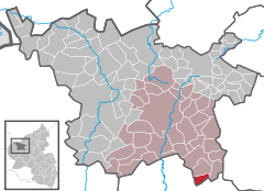
- Mückeln
-
Mückeln Coordinates 50.087°N 6.9239°E / 50.087°N 6.9239°ECoordinates: 50.087°N 6.9239°E / 50.087°N 6.9239°E Administration Country Germany State Rhineland-Palatinate District Vulkaneifel Municipal assoc. Daun Mayor Steffes Erwin Basic statistics Area 4.73 km2 (1.83 sq mi) Elevation 400 m (1312 ft) Population 215 (31 December 2010)[1] - Density 45 /km2 (118 /sq mi) Other information Time zone CET/CEST (UTC+1/+2) Licence plate DAU Postal code 54558 Area code 06574 Website www.mueckeln.de Mückeln is an Ortsgemeinde – a municipality belonging to a Verbandsgemeinde, a kind of collective municipality – in the Vulkaneifel district in Rhineland-Palatinate, Germany. It belongs to the Verbandsgemeinde of Daun, whose seat is in the like-named town.
Contents
Geography
Location
Mückeln lies in the south of the Vulkaneifel, a part of the Eifel known for its volcanic history, geographical and geological features, and even ongoing activity today, including gases that sometimes well up from the earth. The municipality borders on the Bernkastel-Wittlich district.
History
In 1336, Mückeln had its first documentary mention in connection with the sale of a piece of land. The village was utterly destroyed in 1678 by French troops. It was once again occupied by the French beginning in 1794, and in 1815 it passed to the Kingdom of Prussia. In 1944, Father Michael Demuth managed to forestall a further destruction of the village by persuading soldiers from a German anti-aircraft gun emplacement to surrender. Since 1947, Mückeln has been part of the then newly founded state of Rhineland-Palatinate. In 1974, Mückeln placed fourth nationally in the contest Unser Dorf soll schöner werden (“Our village should become lovelier”).
Politics
Municipal council
The council is made up of 6 council members, who were elected at the municipal election held on 7 June 2009, and the honorary mayor as chairman.
Mayor
Mückeln’s mayor is Steffes Erwin, and his deputy is Peter Sartoris.
Culture and sightseeing
Clubs
- Men’s singing club
- Music club
- Historische Bühne (“Historical Stage”)
Sightseeing
- Church from 1954
- Voit organ
References
- ^ "Bevölkerung der Gemeinden am 31.12.2010" (in German). Statistisches Landesamt Rheinland-Pfalz. 31 December 2010. http://www.statistik.rlp.de/fileadmin/dokumente/berichte/A1033_201022_hj_G.pdf.
External links
- Municipality’s official webpage (German)
- This article incorporates information from the German Wikipedia.
Categories:- Municipalities in Rhineland-Palatinate
- Vulkaneifel geography stubs
Wikimedia Foundation. 2010.


