- Chitradurga Fort
-
Chitradurga Fort Part of Chitradurga Karnataka, India 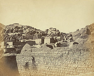
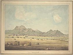
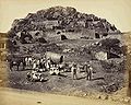
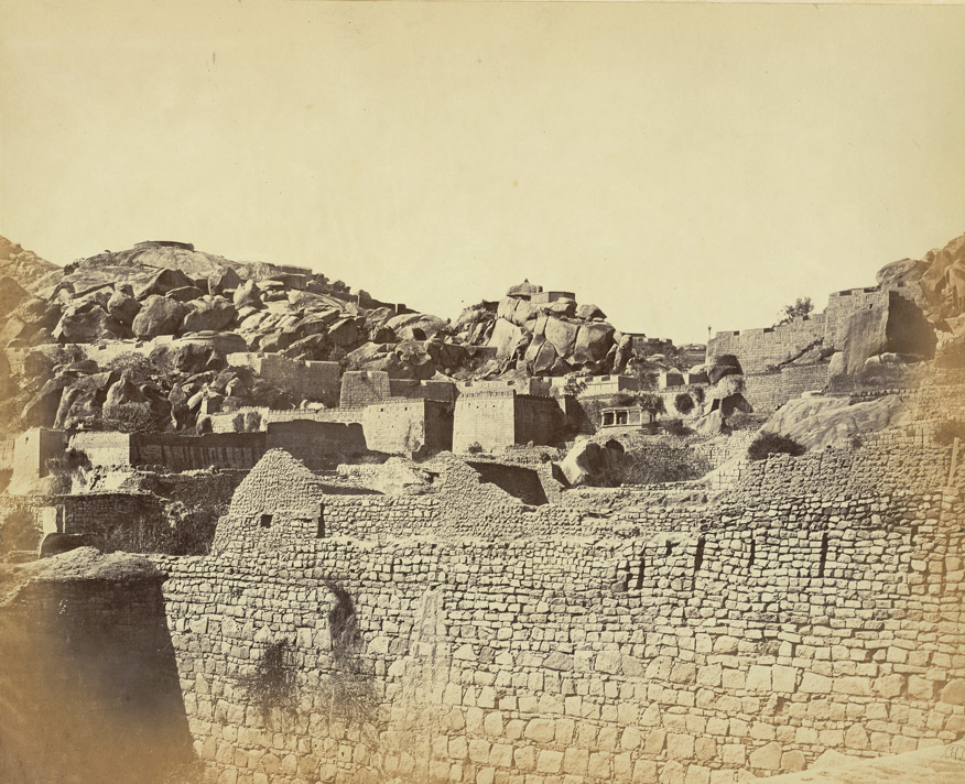
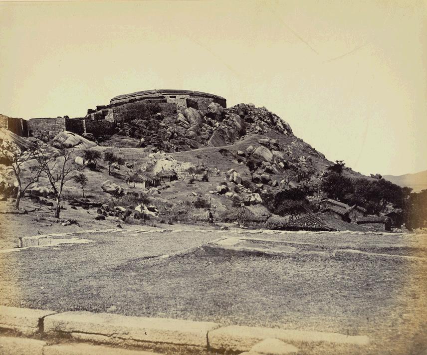
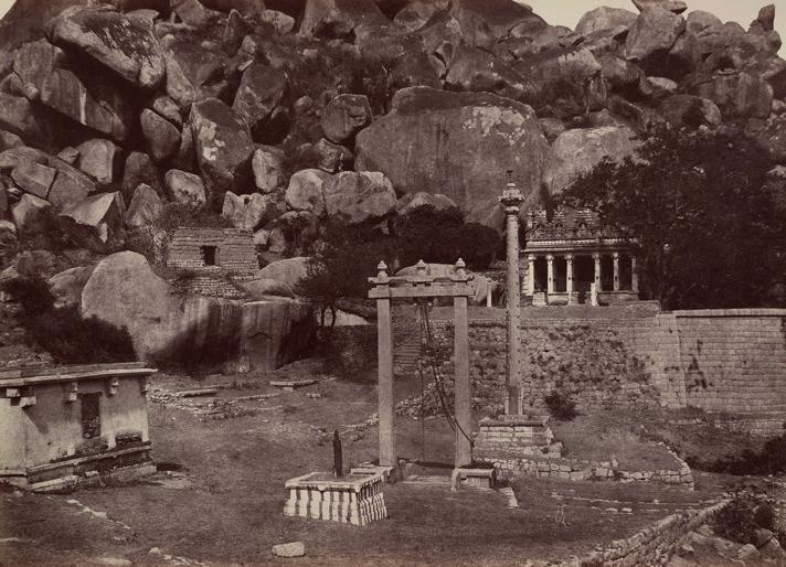
Ramparts of the Fort, Chitradurga, 1868

Type Fort Coordinates 14°12′55″N 76°23′43″E / 14.2152°N 76.3953°ECoordinates: 14°12′55″N 76°23′43″E / 14.2152°N 76.3953°E Built 18th century Built by Nayakas of Chitradurga Construction
materialsGranite Stones Current
conditionRuins Open to
the publicYes Controlled by Government of Karnataka Battles/wars Nayakas against Hyder Ali in 1760s, 1770s & 1799 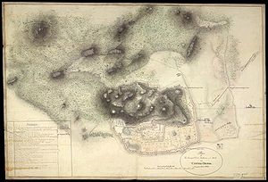
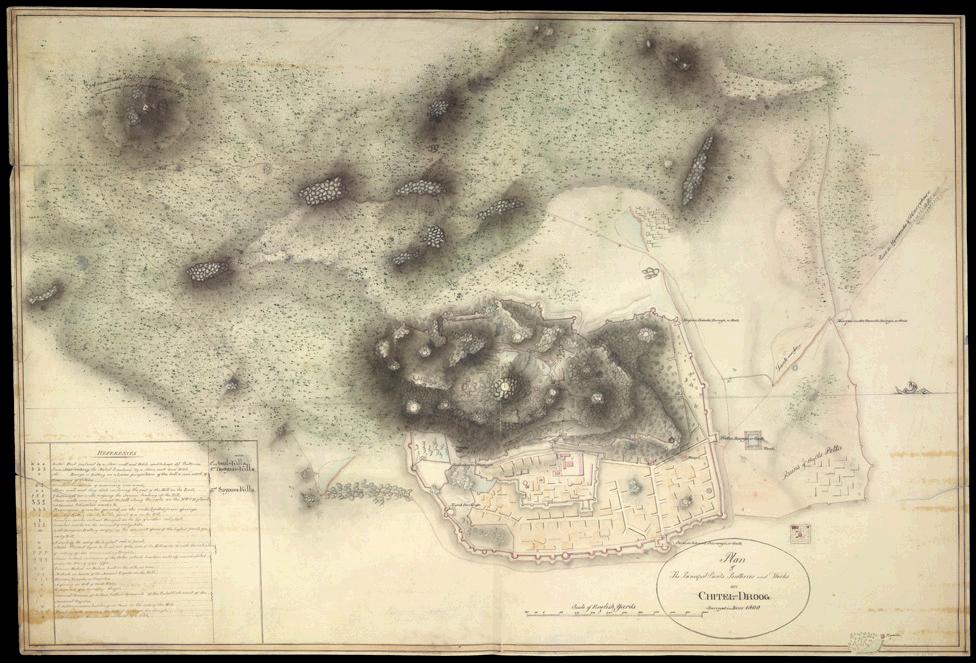
Plan of the Chitradurg Fort (1800 AD) also called 'Kallina Kote' / ' Ukinna kote ' / ' Elu Suttina kote 'Chitradurga Fort (Kannada: ಚಿತ್ರದುರ್ಗದ ಕೋಟೆ), or as the British called it Chitaldoorg, straddles several hills and a peak overlooking a flat valley in the Chitradurga District, Karnataka, India. The fort's name Chitrakaldurga, which means 'picturesque fort' in Kannada, is the namesake of the town Chitradurga and its administrative district.[1][2][3][4]
The Fort was built in stages between the 10th and 18th centuries by the dynastic rulers of the region, including the Rashtrakutas, Chalukyas and Hoysalas as well as the Nayakas of Chitradurga, feudal lords in the Vijayanagar Empire. The Nayakas of Chitradurga, or Palegar Nayakas, were most responsible for the expansion of the fort between the 15th and 18th centuries. They were defeated by Hyder Ali at Chitradurga in 1779. Later the fort was expanded and strengthened by Hyder Ali and his son Tippu Sultan,who succeeded Madakari Nayaka V, the last ruler of the Nayaka clan. The fort is built in a series of seven concentric fortification walls with various passages, a citadel, masjid, warehouses for grains and oil, water reservoirs and ancient temples. There are 18 temples in the upper fort and one huge temple in the lower fort. Among these temples the oldest and most interesting is the Hidimbeshwara temple. The masjid was an addition during Hyder Ali’s rule.[1][2][3][4] The fort's many interconnecting tanks were used to harvest rain water, and the fort was said to never suffer from a water shortage.[3]
Contents
Etymology
Chitradurga is formed of two words in the Kannada language: ‘chitra’ means “picture” and ‘durga’ means “fort” and is tagged with the English word ‘Fort’ to form the name “Chitradurga Fort”. It is also locally known as “Kallina Kote” or Stone Fortress, which is also formed of two Kannada words ‘Kallina’: “Stone” and Kote:“Fort”. Other names used in Kannada are ‘Ukkina Kote”: “Steel Fort” (euphemistically used to mean an impregnable fort) and ‘Yelusuttina Kote’: “Seven circles fort”.[3]
Geography
Chitradurga Fort lies in the midst of a valley formed by the Vedavati River. The Tungabhadra River flows to the northwest of the Fort. Seven hills constitute the Chinmuladri range. The seven circles of the fort enclose these hills. Features of massive rock hills and scenic valleys, huge towering boulders are seen in the fort precincts. The hills on which major part of the fort and the city rest, belong to the oldest rock of granitic formation in the country. The highest hill peak of the area is located at Jogi Matti, 5 kilometres (3.1 mi) to the south of Chitradurga.[2][3] The highest elevation of the hills at the fort is 976 metres (3,202 ft).[5] The area covered by the fort is reported to be 1,500 acres (607.0 ha).
The fort is located 120 km (74.6 mi) from Hampi, the UNESCO World Heritage Site and 200 km (124.3 mi) from Bangalore. The nearest railhead is Davanagere on the Bangalore/Mysore – Arasikere broad gauge railway line.[6]
History
Further information: Nayakas of ChitradurgaA number of inscriptions of the Chalukyas, the Hoysalas and the Vijayanagar kings have been found in and around the fort. These inscriptions trace the history of the fort to the 3rd Millennium B.C. Ashokan period rock edicts found near Brahmagiri also link Chitradurga to the Mauryan Empire during the reign of the royal dynasties of Rashtrakutas, Chalukyas and Hoysalas. However, the area where the fort now exists achieved prominence only under the dynastic rule of the Nayakas of Chitradurga or "Paleygars" (called "little Kings") as a feudatory of the Vijayanagar Empire.[1]
Between 1500 AD and 1800 AD, Chitradurga Fort witnessed a turbulent history starting with the Vijayanagar Empire; Vijayanagar Empire had got control of this region from the Hoysalas. Vijaynagar rulers brought the Nayakas, the traditional local chieftains of the area under their control as their feudatory, till their dynastic reign ended in 1565 A.D. Thereafter, the Nayakas of Chitradurga took independent control of the region and their clan ruled for more than 200 years until the last of their rulers Madakari Nayaka V was defeated by Hyder Ali of Mysore Kingdom, in 1779. During all these years, Chitradurga Fort was central to the reign, particularly of the Nayakas.[4]
Timmana Nayaka or Thimmappa Nayaka, a chieftain from Matti in Davangere taluk, during the rule of Saluva Narasimha, was the first ruler in the hierarchy of the Nayakas of Chitradurga. Initially, he was a chieftain under the Vijayanagar Empire but was soon elevated to the rank of Governor of Chitradurga by the Vijayanagar ruler in recognition of his excellent provence in military service to the empire. His rule covered areas of the Davangere district and Chitradurga district. His rule lasted for a brief period and ended with his incarceration and death in the jail of the Vijaynagar Empire. After him, his son Obana Nayaka or Madakari Nayaka (1588–1602) succeeded him. Madakari Nayaka was followed by a series of hierarchical or other adopted forms of successions of the same clan; Madakari Nayaka V was the final ruler of the clan from 1758 to 1779. Bharamappa Nayaka who ruled from 1689 till 1722 is regarded as the greatest of the Nayaka rulers famed for building forts, palaces, tanks and temples, including several gateways and bastions. He fought several battles against the Mughals.[4][7]
However, it was during the reign of Madakari Nayaka V (1758 to 1779) that the city of Chitradurga and the Fort were besieged by the troops of Hyder Ali. Madakari Nayaka used the fort effectively for defense during three battles that were fought against Hyder Ali.[1] At times he had allied himself with Hyder Ali of Mysore Kingdom and at other times with the Marathas. Hyder Ali attacked the Chitradurga Fort first time in 1760, the second time in 1770 and the third time successfully in 1779 when he defeated Madakari Nayaka. Madakari Nayaka was taken a prisoner and killed. Nayaka's gamble of playing with both Hyder Ali and the Marathas did not work out. He was betrayed by the Marathas and some local Muhammadan officers in his service. Subsequent to his death the treasury at the fort is said to have yielded a rich bounty. It was during one such war that the heroics of Onake Obavva, the wife of a soldier guarding the fort became a legendary event.[4][7]
The dynastic reign of the Nayakas lasted for over 200 years and the Chitradurga fort was their stronghold and the very heart of their province.[1][4]
In the Fourth Mysore War, Tippu Sultan was killed by the British in 1799, and the Mysore Kingdom was reordered under the Wodeyars. Chitradurga became a part of Mysore province. The British considered Chitradurga Fort a potentially useful base for providing a strong line of defense to Mysore's northern border. Between 1799 and 1809, the British garrisoned their troops in the fort. Later, the control of the fort was restored to the Government of Mysore.[4]
- Brave woman
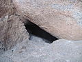
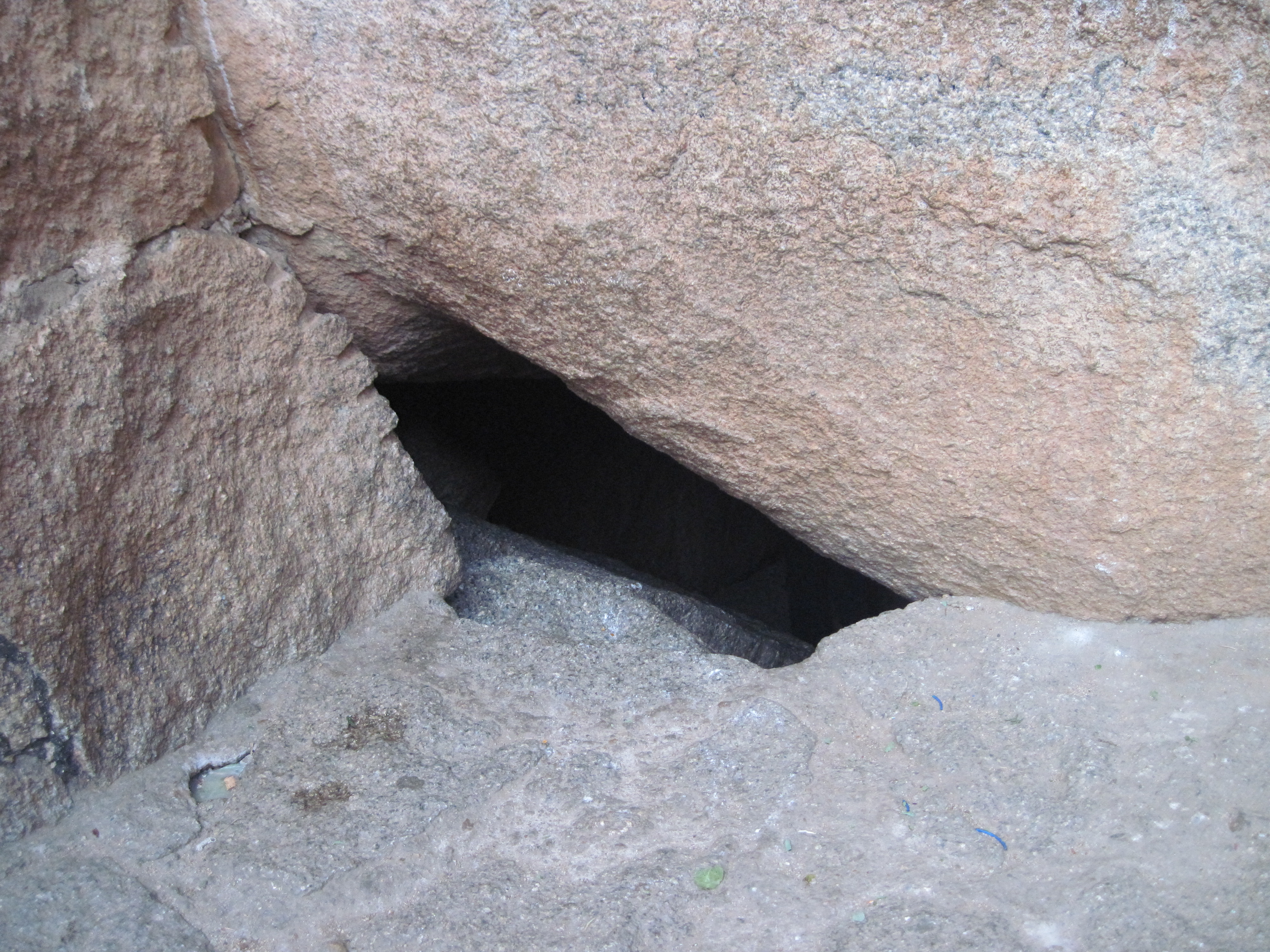
Heroic deeds of a woman named Obavva, wife of a soldier called Kalanayak was guarding a fort tower, substituting for her husband during a lunch break. She was guarding the Chitradurga Fort at a crack opening, a secret opening (where only one person could barely squeeze through). Her heroics at this location have entered the annals of legendary folklore of the Karnataka State. While fetching water, she heard the muted sounds of enemy soldiers attempting to enter the fort through the crevice. With great presence of mind she immediately hid behind the crevice in the fort and hit at each soldier trying to squeeze through the crevice with Onake, the name given in Kannada to a masse or pestle, a wooden rod used for pounding paddy. In this process, she bravely killed several enemy soldiers. By the time her husband appeared on the scene, she had already dragged several bodies of dead soldiers into the fort wall and was standing around the dead bodies with the blood stained Onake in her hand. Kalanayak blew the bugle when other soldiers also joined him and killed all the enemy soldiers. This brave act saved the fort on that day from further attacks by Hyder Ali’s soldiers. Her heroic act has been commemorated with her impressive statue (sculpted by Ashok Gudigar) erected in front of the District Commissioner’s office in Chittradurga town. The stadium in the town has also been named after her. This act also earned her the epithet Onake Obavva and the crevice in the fort where she showed her bravery is called Onake Kindi. However, in the battle for the fort, Madakari Nayaka V lost and Chitradurga fort eventually fell to Hyder Ali, in 1779.[4][8]
Legend
Further information: HidimbiFolk legend links the hills surrounding the fort to the epic Mahabharata. It is said that a man-eating giant named Hidimbasura lived on the Chitradurga hill and had terrorized everyone around. When the Pandavas came with their mother Kunti in the course of their exile, Bhima had a duel with Hidimba. Hidimba was slain by Bhima and peace returned to the area. Legend further states that the boulders were part of the arsenal used during that duel.
Fort precincts
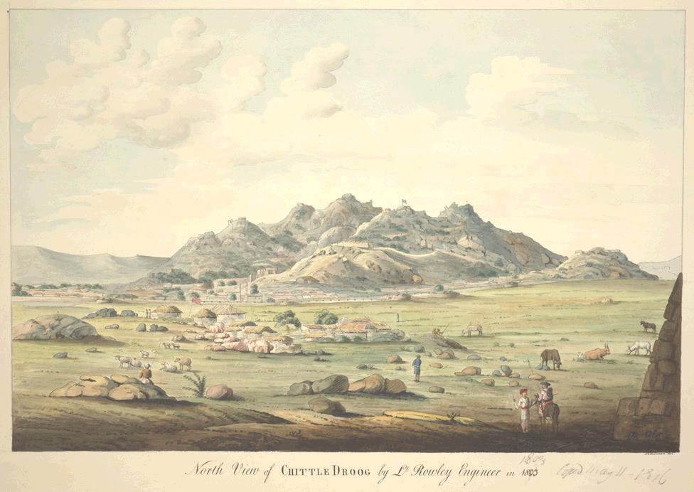
Formidable Chitradurg Fort – Views from the North and the East 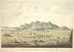
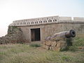
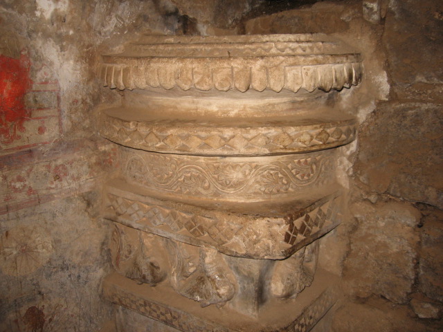
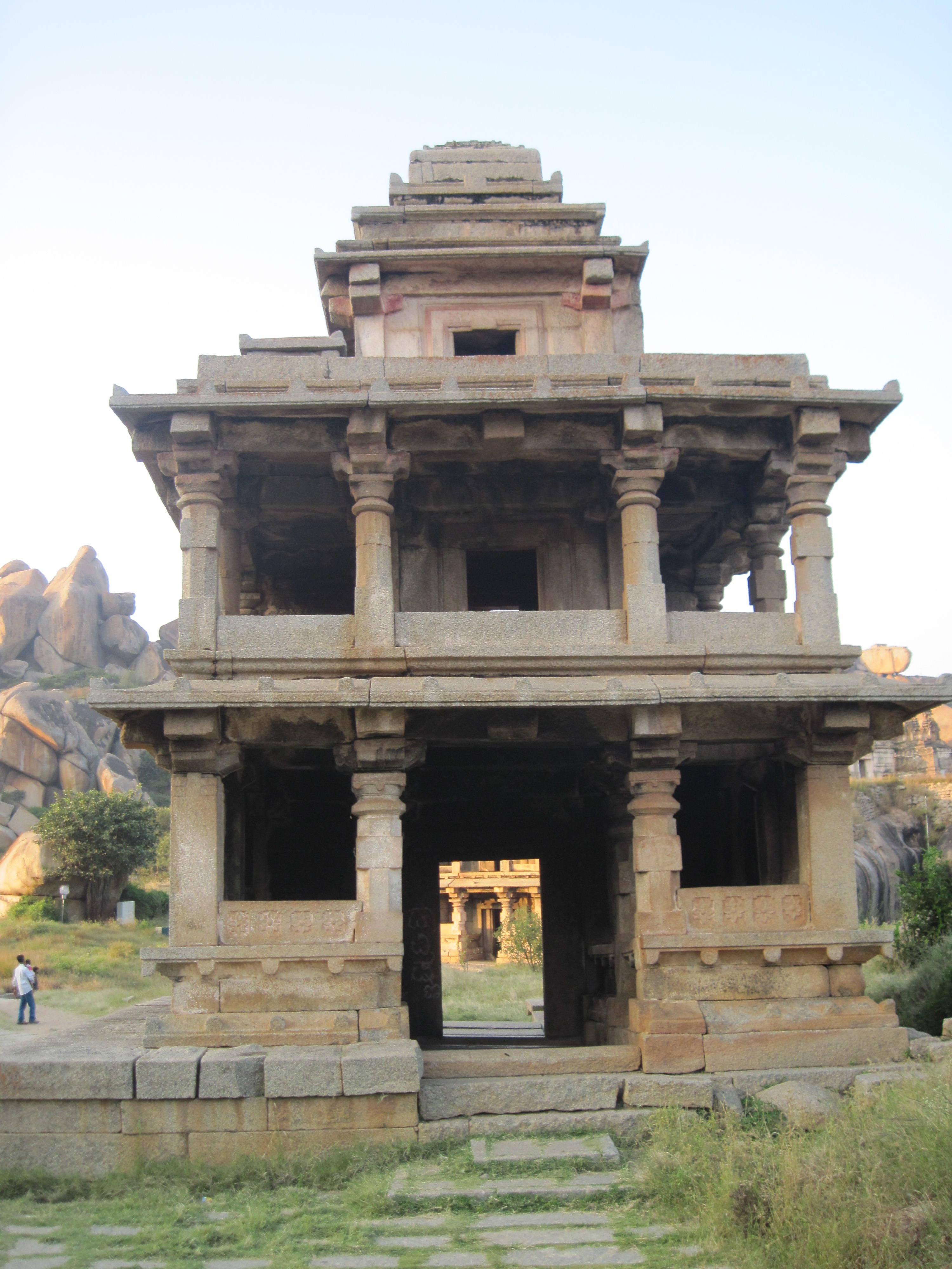
North view of the hill fort of Chitradurg East view of the hill fort of Chitradurg The Nayak Palegars built the fort as an impregnable fortification for defense purposes with 19 gateways, 38 posterior entrances, 35 secret entrances, four invisible passages, water tanks and 2000 watch towers to guard and keep vigil on the enemy incursions. The storage ware-houses, pits and reservoirs were primarily designed to ensure food, water and military supplies required to endure a long siege. Uniquely, all these facilities are still well conserved.[3][4] Seven walls (called Yelusuttinakote in local language) form the fort. Each wall has a gate with an ascending access through winding, and turning narrow corridors which would make it difficult to use elephants for attacking the fort or to use “battering rams” to break down the gates. Small embrasures in the fort walls were provided for use by Archers to shoot arrows at the enemy. Four gates were provided in the outer most walls. The four gates (called 'Bagilu' in Kannada) are called Rangayyana Bagilu, the second one called Siddayyana Bagilu, third one is called the Ucchangi Bagilu and fourth one is named Lalkote Bagilu. Among the elaborate gateways, the gateway to the east of the fort has architectural features, typical of the Bahmani Sultanate. Depending on the topography and the geological strata of the land, the fort walls were built with height ranging from 5–13 metres (16–43 ft). Initially, it was built in mud but was subsequently strengthened in stretches with granite stone slabs in the 18th century. An outstanding feature noticed in several stretches of the fort walls is that no cementing material has been used in joining the large granite cubes that have been neatly sized, cut, trimmed and placed in position. The total length of the fort walls is about 8 kilometres (5.0 mi) and covers an area of about 1,500 acres (610 ha). It is also said that when the upper fort was strengthened for military purposes with gun positions, services of French mercenaries were used.[2][3][4][6][9] The massive 'Palace of Stones' fort contained many buildings and many temples set in the rocky surroundings on the hill. Madakari Nayaka V, the last ruler of the Nayakas of Chitradurga utilized the fort successfully for defense till he was defeated by Hyder Ali in 1779. The fort, thus stands as a tribute to the Nayakas who ruled this part of Karnataka.[4]
Subsequent additions to the forts were built with burnt bricks and set in mortar and plastered by a thin layer of cement or lime and also painted. However, the fort now shows deterioration. The mud brick walls of the storehouses and granaries at the fort are getting eroded due to monsoon rains.[4]
Temples in the fort
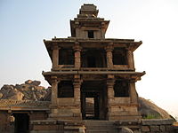 Entrance to Hidimbeswara Temple. Hidimba and Hidimbi are stated to have lived here
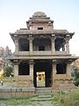
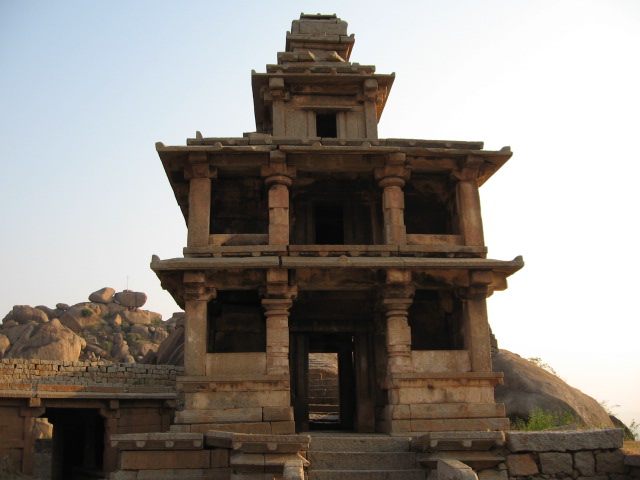
Eighteen temples were built in the upper fort. Some of the well known temples were: the Hidimbeswara (an ancient legend is linked to it), Sampige Siddeshwara, Ekanathamma, Phalguneshwara, Gopala Krishna, Lord Hanuman, Subbaraya and Nandi.[3]
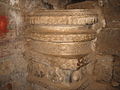
Hidimbeswara temple displays the tooth of Hidimba, the giant (Rakshasa in Sanskrit). It is said that Hidimba and his sister Hidimbi, a giantess, used to live in this temple. Hidimbi, who fell in love with Bhima (the second of the Pandava brothers of Mahabharata) married him and had a child by him named Ghatotkacha. A large cylinder about 3 metres (9.8 ft) in circumference and 2 metres (6.6 ft) high made of iron plates known as Bheri or Drum of Bheema is also located here.[3] A monolithic pillar and two swing frames are also seen at the gate to this temple. Sampige Siddheshvara temple can be seen at the foot of the hill. In the Gopalakrishna Temple, inscriptions date the idol to the early 14th century.[4]
In the lower fort, a temple dedicated to the tutelary deity of the Nayaka Palegars, the Uchchangiamma or Uthsavamba, was built, amidst the rocks of the fort complex on the hill.[3]
The Murugarajendra Matha, a famous religious institution of the Lingayats, which was originally located within the fort, is now situated about 2 kilometres (1.2 mi) to the northwest of Chitradurga.[3]
Other structures
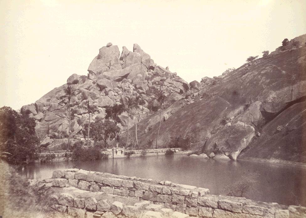
 One of the tanks in cascade development in the precincts of the fort
Rain water-harvesting structures were built in a cascade development, which ensured large storage of water in interconnected reservoirs. It is said that the fort precincts never faced any water shortage.[3]
Historical linkage has been established by an archeological inscription dated 1284 AD found in the Panchalinga (Five Lingas) cave in the Ankhi Matha area, to the west of Chitradurga. The inscription attributes the establishment of the Five Lingas, (aniconic symbols of Lord Shiva), to the Pandavas. At Ankhi Matha, approached by stone steps, a series of ancient subterranean chambers cut out at different levels are seen, in addition to several places of worship and platforms.[3]
In the lower fort, a Cutcherry (Administrative office) was added during Tippu Sultan’s rule. Another interesting find in the arsenal is a quadruple mill made of masonry of 3 metres (9.8 ft) depth and about 7 metres (23 ft) dia, which is inferred as a device used for preparing gun powder during Hyder Ali and Tippu Sultan’s rule.[3] In Kannada language, it is called 'Maddu Bisuva Kallu', which means "Gun Powder Grinding stone". The quadruple mill has four massive grinders with teeth or slots. These were rotated either by elephants or bullocks (in a central circular space) with independent collection point for each of the four slots to collect the explosive gun powder.[3]
Feature films
Several Kannada language feature films have been produced keeping the historicity of this Fort in view. 'Nagara Havu' (Cobra) and 'Hamse Geete' (Swan Song) are most famous films produced in the backdrop of the fort. Another film reportedly under production is called the 'Veera Madakari Nayaka', about the last ruler of the Nayaka kingdom.
Gallery
-
Chitradurga Fort
-
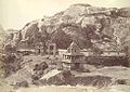
Inner Citadel of the Chitradurga Fort
-
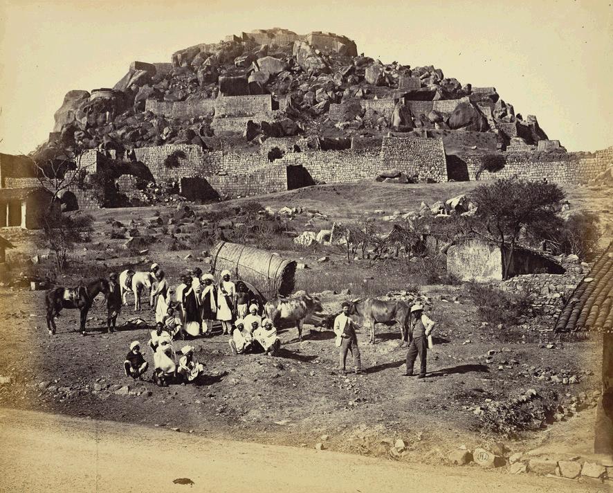
General view inside Fort, with Europeans and party posed in foreground, Chitradurga
-
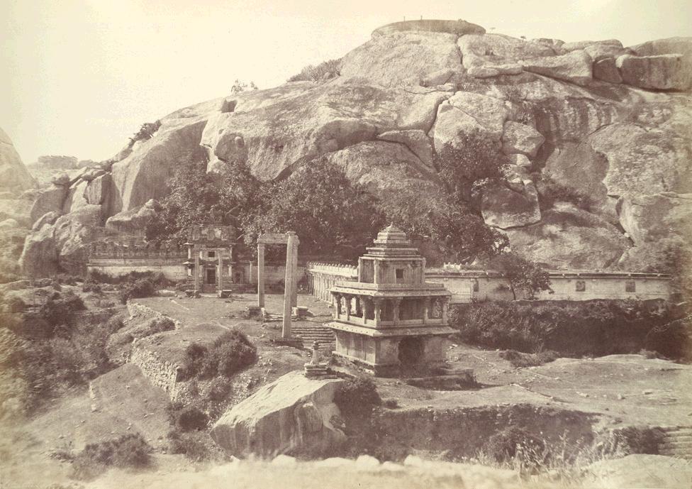
Chitradurga Temple, Chitradurga.
-

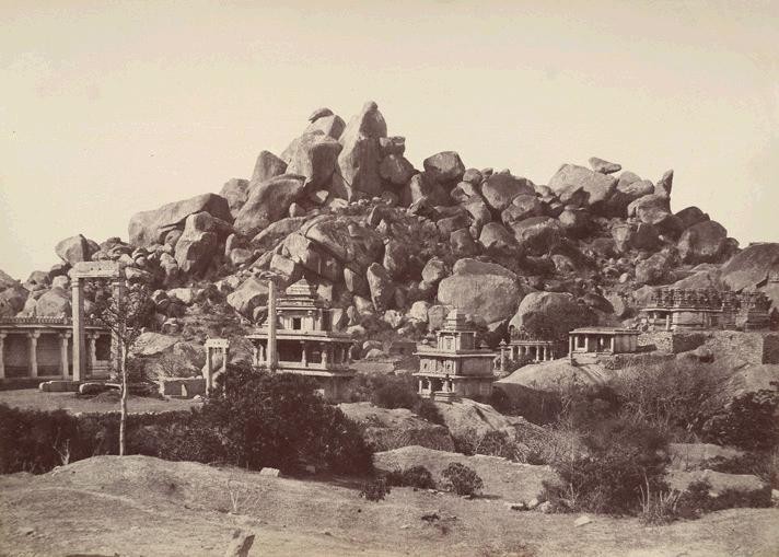
Temples of Chamondee and Hidambeswara
-
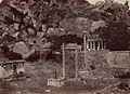
Pillar and swing in the court of the Hidambeshwara and Chamundi Temples, Chitradurga.
-
Vibhuti (Sanctified ashes) Ankali Matha
-

Wall of the fort – near the Entrance
-
Gali Mantapa
-
Onake Obavvana Kindi
-
Bandikhane (Jail)
References
- ^ a b c d e "Chitradurga". http://www.chitradurgacity.gov.in. Retrieved 2009-06-15.
- ^ a b c d "Chitraudurg city". http://www.chitradurgacity.gov.in/home.html. Retrieved 2009-06-15.
- ^ a b c d e f g h i j k l m n o Manohar Sajnani (2001). Encyclopedia of Tourism: Resources in India: v. 2. Gyan Publishing House. p. 159. ISBN 8178350173, 9788178350172. http://books.google.co.in/books?id=nxtnsT8CdZ4C&pg=PA159&dq=chitradurga+fort&ei=KyA1SsSGMYLGlQTX9NigBQ. Retrieved 2009-06-15.
- ^ a b c d e f g h i j k l m Barry Lewis. "An Informal History of the Chitradurga Nayakas". Urbana, IL 61801: UIUC Department of Anthropology. https://netfiles.uiuc.edu/blewis/www/chitradurga.htm. Retrieved 2009-06-15.
- ^ "Karnataka Jungle Lodges & Resorts". http://www.ttmi2.com/karnataka.html. Retrieved 2009-06-19.
- ^ a b "Chitradurga Fort – Bangalore". http://www.whereincity.com/photo-gallery/forts/chitradurga-fort-246.htm. Retrieved 2009-06-16.
- ^ a b "Chitradurga Paleyagar family". http://www.visitchitradurga.com/linkfiles/historyfiles/madakari.php. Retrieved 2009-06-17.
- ^ Sarojini Shintri; Kurukundi Raghavendra Rao (1983). Women freedom fighters in Karnataka. Prasaranga, Karnatak University. pp. 151. http://books.google.co.in/books?id=HwEtAAAAIAAJ&q=Chitradurg+fort&dq=Chitradurg+fort&ei=X_k5SqiEGoHKkAT4x8mKAw&pgis=1. Retrieved 2009-06-17.
- ^ "Ramparts of the Fort, Chitradurga". http://www.bl.uk/onlinegallery/onlineex/apac/photocoll/r/019pho001000s26u02578000.html. Retrieved 2009-06-14.
External links
- History of Nayakas of Chitradurga, Barry Lewis, Dept of Anthropology, University of Illinois
- Dr. Suryanath U. Kamath, A Concise history of Karnataka from pre-historic times to the present, Jupiter books, MCC, Bangalore, 2001 (Reprinted 2002)
- B.L.Lewis, Epigraphic Carnatica, Gazetter of Mysore- Volume XI, Chitaldroog (Chitradurga) district 1903. CD-Rom Published by the Indian Council of Historical Research (ICHR),Southern Regional Office, Bangalore
Forts in Karnataka Bangalore Fort · Belgaum Fort · Bellary Fort · Chitradurga Fort · Devanahalli Fort · Gajendragarh · Jaladurga · Jamalabad · Kittur Fort · Mudgal Fort · Parasgad Fort · Sadashivgad · Saundatti · Gulbarga Fort
 Forts in India
Vijayanagara Deccan sultanates Gujarat Sultanate Delhi Sultanate Aligarh Fort · Bandhavgarh Fort · Qila Mubarak · Siri Fort · Tughlaqabad · Salimgarh Fort · DaulatabadVarious Nayaks Chitradurga Fort · Bekal Fort · Dindigul Fort · Gingee Fort · Tiruchirapalli Rock Fort · Chandragiri fort · Hosdurg FortMalwa Sultanate Faruqi dynasty Rajput Achalgarh · Amber Fort · Chittorgarh Fort · Jaigarh Fort · Jaisalmer Fort · Jalore Fort · Junagarh Fort · Kankwadi · Kumbhalgarh · Nagaur FortTemplate:.w Nahargarh Fort · Taragarh Fort · Lal Kot · Gwalior Fort · Kalinjar · Hinglajgarh · Mehrangarh Fort · Narwar Fort · Senapati fortress · Bahu Fort · Kangra Fort · Ranthambore FortMaratha Dongri Fort · Harishchandragad · Kolaba Fort · Lohagad · Sudhagad · Sinhgad · Tikona · Panhala fort · Pratapgad · Vishalgad · Rajgad · Sindhudurg · Vijaydurg · Shivneri · Raigad · Gajendragarh · Gingee Fort · Shaniwar Wada · Jhansi Fort · Hinglajgarh · Manora · Visapur Fort · SadashivgadMughal Empire Old Fort, Delhi · Qila Rai Pithora · Chanderi fort · Agra Fort · Allahabad Fort · Fatehpur Sikri · Red Fort · Akola FortJat Mysore kingdom Siddi Travancore Portuguese Bassein Fort · Bombay Castle · Fort Arnala · Castella de Aguada · Korlai Fort · Madh Fort · St. Angelo Fort · Pallipuram Fort · Fort Aguada · Fort Anjediva · Cranganore Fort · Ghodbunder fort · Diu Fort · Terekhol fortBritish Raj Fort St. George · Fort William · Bombay Fort · Riwa Fort · Worli Fort · Mazagon Fort · Sion Hillock Fort · Sewri Fort · Mahim Fort · Thalassery Fort · Fort St. DavidDurrani Empire Suri dynasty Rohtasgarh · Munger Fort
Categories:- Forts in Karnataka


Wikimedia Foundation. 2010.