- Castella de Aguada
infobox building
building_name = Castella de Aguada
native_building_name= बांद्रा किल्ला
caption = Bandra Fort
former_names =
map_type = Mumbai
latitude = 19.041770
longitude = 72.818580
altitude = convert|13|m|ft|0|abbr=on
building_type = Fort
architectural_style =
structural_system =
cost =
location =Bandra ,Mumbai
address =
client = Portuguese
owner =Government of Maharashtra
current_tenants =
landlord =
start_date =
completion_date = 1640
inauguration_date =
demolition_date =
destruction_date =
height =
diameter =
other_dimensions =
floor_count =
floor_area =
main_contractor =
architect =
structural_engineer =
services_engineer =
civil_engineer =
other_designers =
quantity_surveyor =
awards =
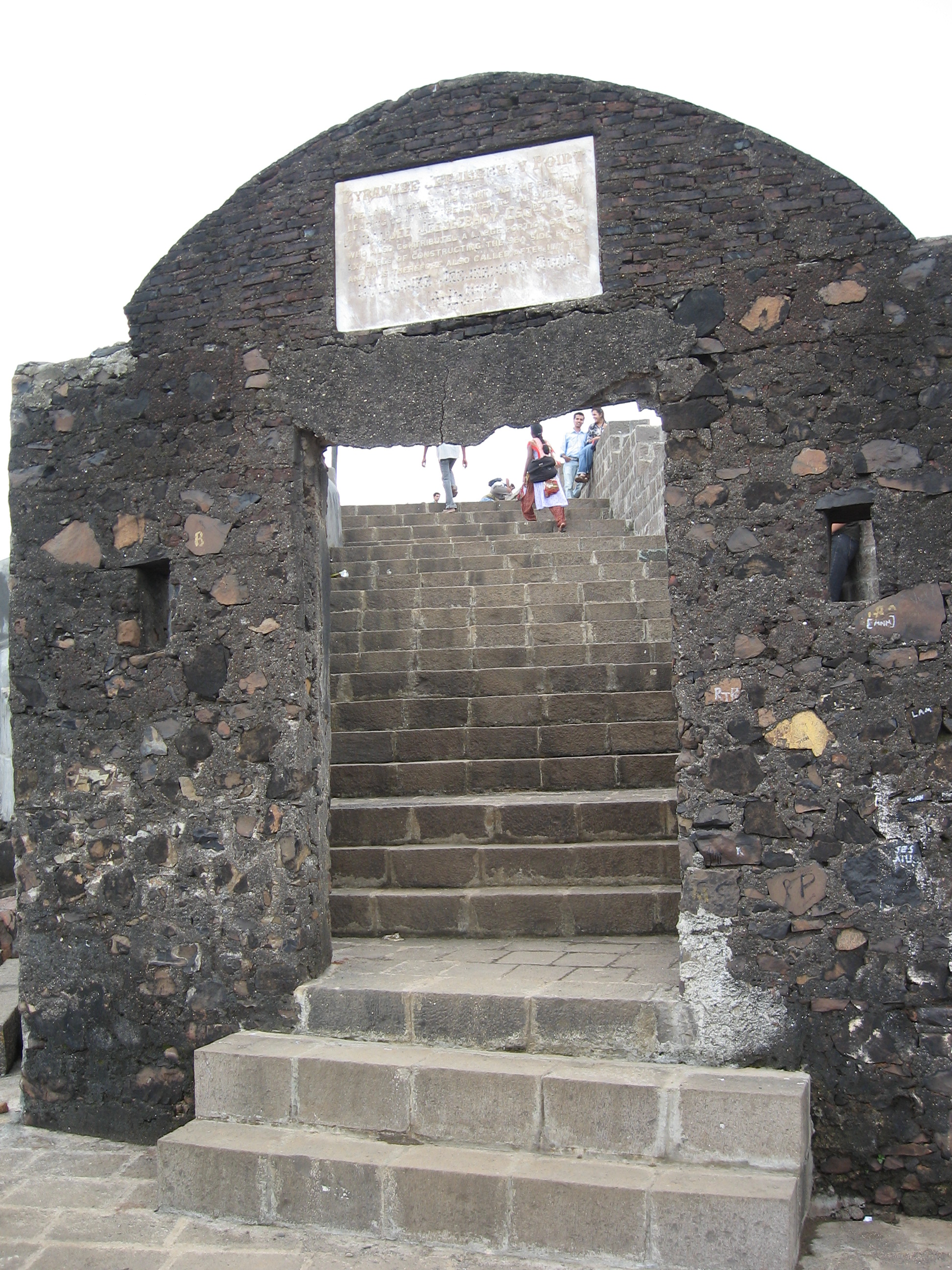
references =Castella de Aguada or the "Fort of the Waterpoint" (also known as the Bandra Fort) is a Portuguese fort at Land's End,
Bandra in the city ofMumbai (Bombay), India. The fort was built in 1640 as a watchtower overlooking theMahim Bay , theArabian Sea and the southern island ofMahim . The strategic value of the fort was enhanced in 1661, after the Portuguese ceded theseven islands of Bombay that lay to the immediate south to the British. The name indicates its origin as a place where fresh water was available in the form of a fountain ("Aguada") for Portuguese ships cruising the coasts in the initial period of Portuguese presence. The fort lies over several levels, from sea level to an altitude of convert|24|m|ft|0|.History
The Portuguese, who had established base in the area in 1534 after defeating
Bahadur Shah of Gujarat built several sea forts along the Indian coastline. Castella de Aguada was strategically located, it overlooked the Mahim Bay to the south, the Arabian Sea to the west, the islands of Worli to the south and Mahim to the south west. It also controlled the northern sea route into theMumbai Harbour . The sea passage is now reclaimed from the sea. During it's heyday it was armed with two cannons and supplied freshwater from nearby springs to passing ships.cite web|url=http://cities.expressindia.com/fullstory.php?newsid=46848|title=Local ‘army’ offers to protect Mumbai’s ‘Castella’|last=Ball|first=Iain|date=2003-03-19 |work=Mumbai Newsline|publisher=Express Group |accessdate=2008-09-16]In 1739 the island was invaded by the
Maratha Empire and was subsequently ruled by them until 1761 when the British evicted them off the island when the treatyTreaty of Bassein . In 1830, the British donated large parts of theSalsette Island , including Land's End toByramjee Jeejeebhoy , aParsi philanthropist. On the hill where the fort is located, Jeejeeboy established his residence. The cape was then named Byramjee Jeejeebhoy Point.cite web|url=http://timesofindia.indiatimes.com/articleshow/18005656.cms|title=Bandra to get back a chunk of its past glory|coauthors=TNN|date=2002-08-04 |work=Times of India |publisher=Times Group |accessdate=2008-09-16]Conservation
In 2003, a conservation program was started to save the fort spearheaded by local Member of Parliament,
Shabana Azmi . who funded part of the expenses. On the agenda were the brick arch of one of the gateways on the verge of collapse, and the foundation masonry of the fort wall that was in danger of being eroded by the sea. The nearby Taj Land's End hotel is responsible for maintenance of the fort, having inherited it from the previous owners.The fort is looked after by the
Archaeological Survey of India (ASI). Included in the makeover is the preservation of the natural rock formations, providing pathways, and the creation of an amphitheatre. The architect for the makeover was P.K. Das, who redesigned the Carter Road area.,cite web|url=http://timesofindia.indiatimes.com/articleshow/18005656.cms|title=Bandra to get back a chunk of its past glory|coauthors=TNN|date=2002-08-04 |work=Times of India |publisher=Times Group |accessdate=2008-09-16]ee also
*
Mahim Fort
*Worli Fort References
Wikimedia Foundation. 2010.