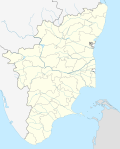
- Dindigul Fort
-
Dindigul Rock Fort Part of History of Tamil Nadu Dindigul Type Rock fort and temple complex Coordinates 10°21′N 77°57′E / 10.35°N 77.95°ECoordinates: 10°21′N 77°57′E / 10.35°N 77.95°E Built 1605 Built by Muttu Krishnappa Nayak Construction
materialsGranite Height 900 feet In use circa early 1800s Current
conditionUnder renovation Current
ownerArchaeological Survey of India Open to
the publicYes Controlled by Archaeological Survey of India The Dindigul Fort (Tamil: திண்டுக்கல் கோட்டை; formally known as Dindigul Malai Kottai) is a 17th-century hill fort situated in the town of Dindigul in the state of Tamil Nadu in India. The fort was built by the Madurai Nayak kings in 1605 and was later passed on to Kingdom of Mysore (Mysore Wodeyars) in the early 18th century. Later it became an important fort during Hyder Ali and Tipu Sultan reign of Mysore. In 1799 it went to the control of the British East India Company during the Polygar Wars. There is an abandoned temple on its peak apart from few cannons. Today the fort is maintained by the Archaeological Survey of India and is open to tourists.
Contents
Name and location
Approaching from Madurai (65 km), the huge rock emerges on the horizon like a "Dhindu" (pillow) — hence the city's name, Dindigul. Amidst paddy fields and coconut groves, it stands out like a welcome symbol, one kilometer short of the city centre. Under the Mysore reign in the 18th century, this fort marked the border between the Madurai and Mysore kingdoms. Dindugul town was not in existence at that time, whereas the region was an amalgamation of a few villages. Today the fort is an important landmark of Dindigul town.
Under Nayak rulers
The Madurai Nayak king Muthu Krishnappa Naicker started building the rock fort in 1605, and completed it in 1655 during the reign of Thirumalai Nayak. A temple (Abiramiamman) was later built on the tip of the rock. Rani Mangammal, during her regime, carved out 600 steps in the rock fort to reach a hill temple. During the Muslim invasions the Idol was relocated to the present Abiramiamman temple in Dindigul Bazaar.
Under Mysore rulers
Hyder Ali, after taking over the Mysore throne in 1755, made several additions and repairs. The fort played an important role in their campaigns.
Construction details
The rock fort is 900 feet high and its circumference is around 2.75 km. Cannon and gunfire artillery made its entry during the 17th century; hence the fort has double walls to withstand heavy artillery.
Cannons were installed at vantage points around the fort (still there) with an arms and ammunition godown built with modern safety measures. The double-walled room was fully protected against external threat and was well ventilated. A thin brick wall in one corner of the godown helped guards escape in case of emergency. The sloping ceiling of the godown prevented seepage of rainwater. It has 48 rooms that were once used as cells to lodge war prisoners and slaves, a spacious kitchen, a horse stable and a meeting hall of the army commanders of Hyder Ali and Tipu Sultan.
The fort also has its own rainwater reservoirs constructed by taking advantage of the steep gradient. The construction highlights the ingenuity of Indian kings in their military architecture.
Roles in war
The fort took 54 years to build. It was strategically important in several military operations from the Nayak dynasty till Tipu Sultan. The fort is known to have played a prominent role during the battles between the Madurai Nayaks and Mysore, Marathas armies, later between Hyder Ali, Tipu Sultan and British armies.
Hyder Ali's family lived here in 1755 along with his wife and then five-year-old son Tipu. From 1784 to 1790, the fort was under the rule of Tipu Sultan. His chief Commandant, Syed Ibrahim, under whose care the fort was entrusted, constructed several additional rooms, fortified the walls and repaired many parts. Hyder Ali had also constructed a mosque beneath the fort for his soldiers. After Tipu Sultan was defeated in the II Mysore War in 1790, the British took control of the fort.
Visiting the fort
The Archaeological Survey of India's familiar blue board declares the fort a "protected monument" and collects
 5 for an entry ticket (
 100 for foreigners, i.e. $2.00).
The fort receives few visitors — mainly the odd group of college and school students and the occasional foreign tourist. The steep climb is possibly a deterrent, but makes a good exercise. Once the visitor reaches the summit, a fresh breeze blowing across welcomes him even in the hot sun.
Visitors can walk around the tunnels and trenches en route that reveal how meticulously the ancient fort was constructed to safeguard its inhabitants. The empty temple has some elaborate sculptures and carvings, with the rock cuts still looking untarnished.
From the ruins within the fort walls, one can see structures (perhaps used as arsenal depots or animal stables) and damaged mandapams (decorated with carved stone columns, complete with dwarapalakas). One can go up to the cannon point and look through the spy holes imagining the sound, light and speed of the fireballs that were released. The view from the fort also offers a breathtaking view of Dindigul on the eastern side and villages and farmland on the other sides. Lack of funds and facilities has kept the fort misused by nearby dwellers. But in 2005, Keeranur-based ASI in Pudukkottai district fenced the entire surroundings and refurbished some of the dilapidated structures.
External links
Forts in Tamil Nadu Attur Fort · Dindigul Fort · Gingee Fort · Manora fort · Sankagiri Fort · Fort St. David · Fort St. George · Tiruchirapalli Rock Fort · Udayagiri Fort · Vattakottai Fort · Vellore Fort
Categories:- Forts in Tamil Nadu
- History of Tamil Nadu
- Madurai Nayak Dynasty
- Archaeological monuments in Tamil Nadu
Wikimedia Foundation. 2010.

