- Belapur Fort
infobox building
building_name = Belapur Fort
native_building_name= बेलापुर किल्ला
caption = Belapur Fort
former_names =
map_type = Mumbai
latitude = 19.0055241
longitude = 73.0284029
altitude = convert|27|m|ft|0|abbr=on
building_type = Fort
architectural_style =
structural_system =
structural_system =
cost =
location =Belapur ,Navi Mumbai
address =
client = Siddhis
owner =CIDCO
current_tenants =
landlord =
start_date = 1560
completion_date = 1570
inauguration_date =
demolition_date =
destruction_date = 1817
height =
diameter =
other_dimensions =
floor_count =
floor_area =
main_contractor =
architect =
structural_engineer =
services_engineer =
civil_engineer =
other_designers =
quantity_surveyor =
awards =
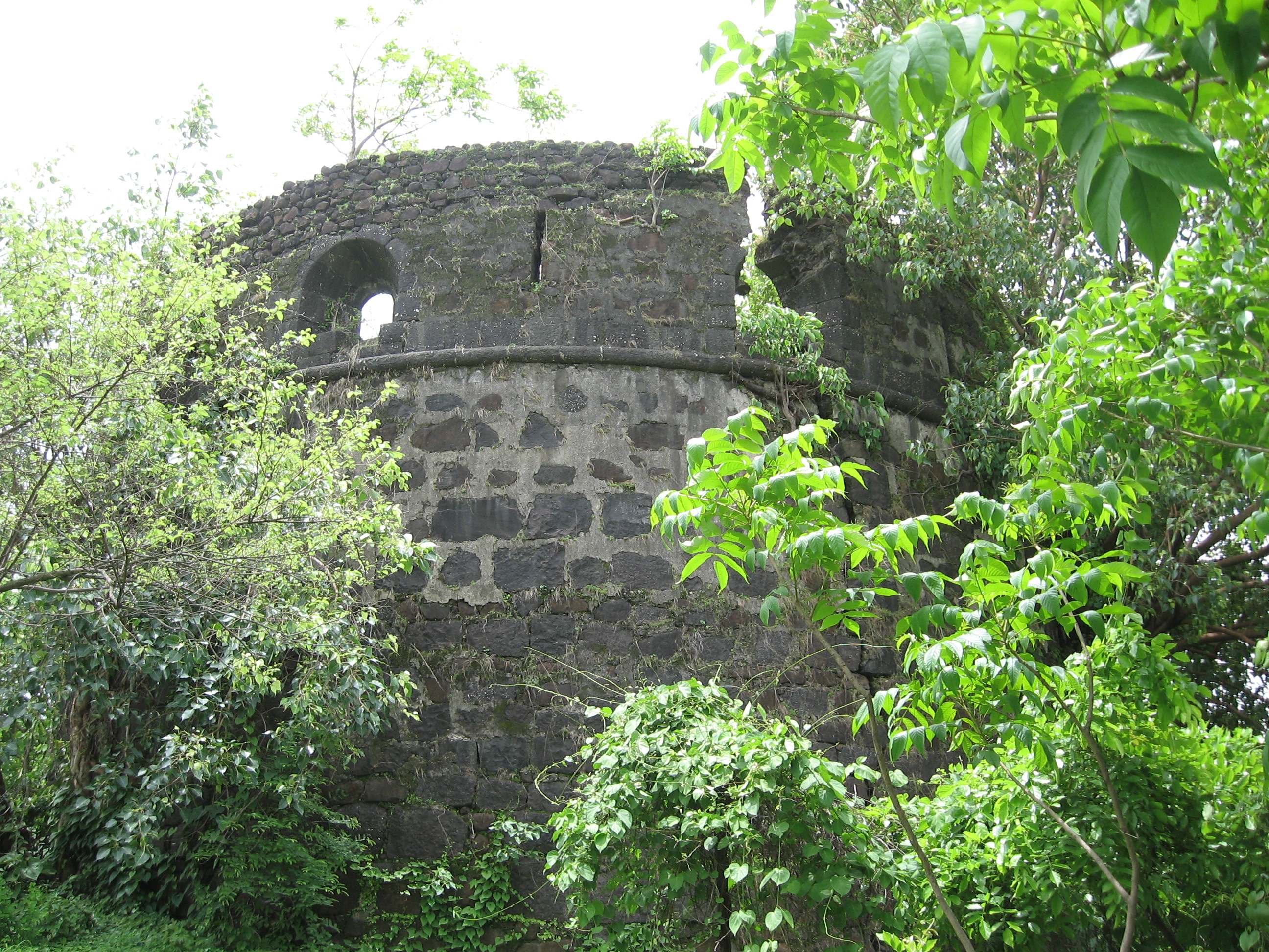
references =Belapur Fort is a fort near the township of
Belapur inNavi Mumbai (New Bombay). Built in 1560–1570 by theSiddi s ofJanjira , after they wrested control of the area from the Portuguese, it is located atop a hillock, near the mouth of thePanvel Creek . In 1682, the fort was recaptured by the Portuguese, who had managed to annex the regions controlled by the Siddis, near Belapur (at that time known as Shabaz).cite web|url=http://www.mid-day.com/metro/vashi/2004/december/98565.htm |title=Resident opens gates to Belapur Fort |accessdate=2006-06-25 |last=Ojha |first=Renu |date=2004-12-03 |publisher= [http://www.mid-day.com Mid-Day] ]In 1733, the
Maratha s, led byChimnaji Appa , wrested control of the fort from the Portuguese. He had made a vow that if it were to be successfully recaptured from the Portuguese, he would place a garland of beli leaves in a nearby Amruthaishwar temple, and after the victory the fort was christened as Belapur Fort. The Marathas ruled the area untilJune 23 ,1817 , when it was captured by Captain Charles Gray of theBritish East India Company . The British partially destroyed the fort under their policy of razing any Maratha stronghold in the area.During its active days, the fort stationed four companies each of 180 men, and 14 guns ranging from four to 12 pounds in weight (2–5 kg). The fort comes under the jurisdiction of
CIDCO , though it mostly lies in a deprecated state. Plans are underway to renovate it and restore it to its former state. An underground tunnel is also supposed to exist, which many locals believe connects it toGharapuri Island , the site of theElephanta Caves .References
Wikimedia Foundation. 2010.