- Marine Parade
-
Coordinates: 1°18′11″N 103°54′28″E / 1.30306°N 103.90778°E
For the record label, see Marine Parade Records.- Marine Parade is also the name of the main street of Napier, New Zealand.
Marine Parade 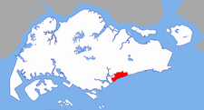
English Marine Parade Chinese 马林百列 (Pinyin Mălín Băiliè) Malay Marine Parade Tamil மரின் பரேட் Ruling party Places of Interest Marine Parade is a town and an urban planning area in Singapore directly to the east of the Central Area, Singapore's central business district.
Contents
Location
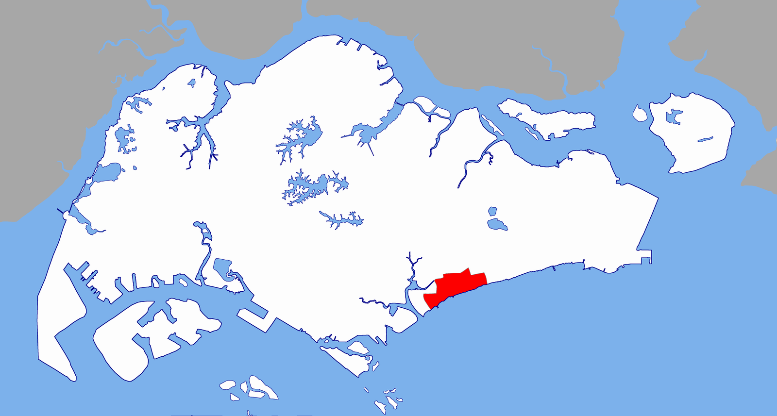
The name Marine Parade commonly refers to the neighbourhood encompassing the main HDB public housing estate and several private residences, bounded by Marine Parade Road, East Coast Parkway, Amber Road and Bedok South Avenue 1. Marine Parade was originally named after a promenade near the sea that was parallel to East Coast Road. It was built on reclaimed land completed in the mid-1970s.
The Marine Parade Planning Area, an urban planning zone under the Urban Redevelopment Authority, encompasses a much larger area, which includes the Marine Parade Housing Estate, the private residential areas in Joo Chiat and in Katong on both sides of Mountbatten Road. The planning area is located south of Geylang, southeast of Kallang, and northeast of Marina East, the latter both of which are part of the Central Area. To the east of Marine Parade lies the town and urban planning area of Bedok.
Township
Marine Parade Housing Estate
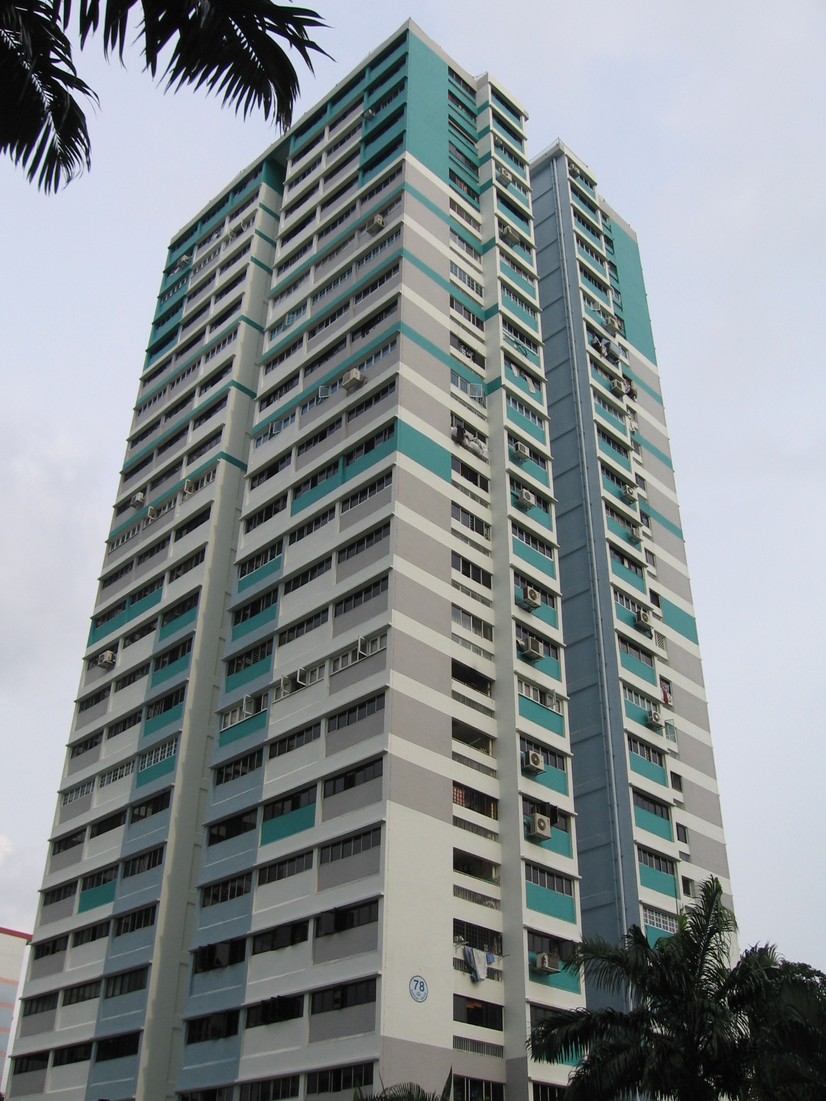
 A typical point block in Marine Parade Housing Estate
The main public housing estate, Marine Parade Housing Estate, comprises 58 blocks of HDB flats. The public estate is bisected by the arterial Still Road South that provides access to the major highway, East Coast Parkway, leading to the city area and to Singapore Changi Airport.
The main precincts of Marine Parade Housing Estate can be distinguished by the roads serving them:
- Marine Terrace
- Marine Crescent
- Marine Drive
- Marine Parade Central
Private Residences
The major private housing estates in Marine Parade include:
- Amberville
- Bayshore Park (not considered within MP)
- Coasta Del Sol
- Cote D'Azur
- D' Ecosia
- Fernwood Towers
- Laguna Park
- Lagoon View
- Mandarin Gardens
- Neptune Court
- Ocean Park
- Qifuat Terraces
- The Bayshore
- The Seaview
Town Centre
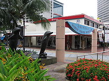 Marine Parade Promenade at the town centre
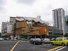 Marine Parade Community Building
Marine Parade is served by a town centre, Marine Parade Town Centre, which consists of several neighbourhood shops and a major commercial complex Parkway Parade that houses offices and a shopping centre.
East Coast Park
The town is also well-known to locals as it is adjacent to East Coast Park, a popular seaside weekend getaway for leisure and water sports.
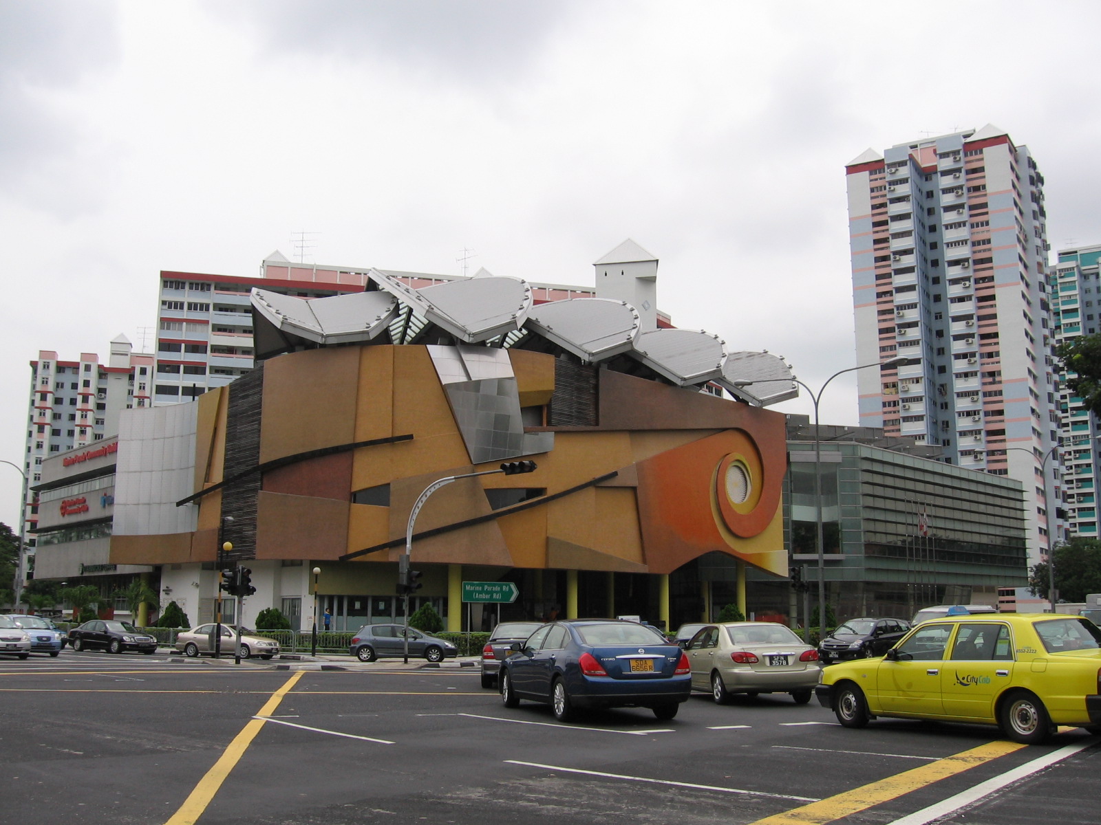
Marine Parade Community Building
The Marine Parade Community Building was completed in 2000. It houses the Marine Parade Community Club and the Marine Parade Community Library. Other facilities within the three-storey complex include a 263-seater theatrette, a glass-walled gymnasium, a covered basketball court on the rooftop, an air-conditioned and a sports hall.
Schools
As Marine Parade is primarily either recreational or residential, it is host to a variety of schools.
- Primary Schools
- CHIJ (Katong) Primary 圣婴女校(加东) (lies on the fringe of the town)
- Ngee Ann Primary School 义安小学
- Tao Nan School 道南学校
- Secondary Schools
- CHIJ Katong Convent 加东修道院女校
- St. Patrick's School 圣伯特理中学 (lies on the fringe of the town)
- Chung Cheng High School (Main) 中正中学(总校) (at Goodman Road)
- Tanjong Katong Secondary School 丹绒加东中学
- Tanjong Katong Girls' School 丹绒加东女校
- Victoria School 维多利亚学校
- Junior Colleges
- Victoria Junior College 维多利亚初级学院
Politics of Marine Parade
Marine Parade is a component division of the Marine Parade Group Representation Constituency, which also includes the Braddell Heights, Geylang Serai, Kembangan-Chai Chee and MacPherson divisions and elects five members to Singapore's Parliament. Singapore's former Prime Minister Goh Chok Tong is the Member of Parliament who represents the Marine Parade division.
External links
Major roads in Singapore Alexandra Road · Ang Mo Kio Avenue 6 · Balestier Road · Bartley Road · Beach Road · Boundary Road · Bras Basah Road · Bukit Batok Road · Bukit Panjang Road · Bukit Timah Road · Changi Road · Choa Chu Kang Road · Clementi Road · Commonwealth Avenue · Dunearn Road · East Coast Road · Eu Tong Sen Street · Geylang Road · Holland Road · Jalan Ahmad Ibrahim · Jalan Besar · Jalan Boon Lay · Jalan Bukit Merah · Jalan Kayu · Jurong Island Highway · Jurong Road · Jurong West Avenue 2 · Kallang Bahru · Kallang Road · Kallang Way · Lentor Avenue · Lim Chu Kang Road · Lorong Chuan · Loyang Avenue · Mandai Road · Marine Parade Road · New Bridge Road · New Upper Changi Road · Nicoll Highway · North Bridge Road · Orchard Road · Outer Ring Road System · Pasir Panjang Road · Pasir Ris Drive 3 · Paya Lebar Road · Punggol Road · Queensway · River Valley Road · Robinson Road · Scotts Road · Sembawang Road · Serangoon Road · Shenton Way · Simei Avenue · Sims Avenue · South Bridge Road · Sungei Road · Tampines Avenue 5 · Tampines Road · Telok Blangah Road · Thomson Road · Upper Changi Road East · Victoria Street · West Coast Road · West Coast Highway · Woodlands Road · Woodlands Avenue 3 · Yishun Avenue 2 · Yio Chu Kang Road

Public housing in Singapore Organisations 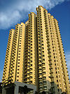
Building Programmes Build-To-Order (HDB) · Design, Build and Sell Scheme · Home Ownership Scheme · Selective En bloc Redevelopment Scheme · Walk In SelectionUpgrading Programmes Home Improvement Programme · Interim Upgrading Programme · Lift Upgrading Programme · Main Upgrading Programme · Neighbourhood Renewal ProgrammeOther Additional CPF Housing Grant · Lease Buyback Scheme · Pinnacle@Duxton · Treelodge@Punggol · Void deck
Categories:- Places in Singapore
- Housing estates in Singapore
- Central Region, Singapore
- Marine Parade


Wikimedia Foundation. 2010.