- Miami and Erie Canal
-
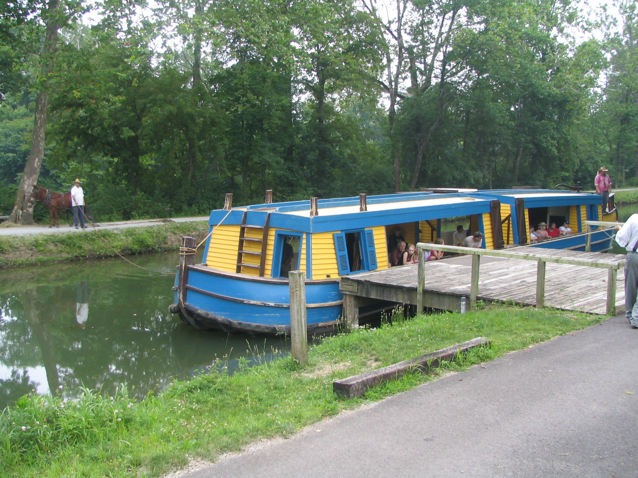
 Barge General Harrison of Piqua on the canal in the Piqua, Ohio, Historical Area, in July 2006. Note the captain steering the canal boat and the towing donkey on the towpath on the far side. The canal is wide enough to permit two barges to pass.
The Miami and Erie Canal was a canal that connected the Ohio River in Cincinnati, Ohio with Lake Erie in Toledo, Ohio. Construction on the canal began in 1825 and was completed in 1845.[1] It consisted of 19 aqueducts, three guard locks, and 103 canal locks. Each lock measured 90 feet (27 m) by 15 feet (4.6 m) and they collectively raised the canal 395 feet (120 m) above Lake Erie and 513 feet (156 m) above the Ohio River. The peak of the canal was called the Loramie Summit and extended 19 miles (31 km) between New Bremen, Ohio to lock 1-S in Lockington, north of Piqua, Ohio. The system consisted of 301.49 miles (485.20 km) of canal channel built at a cost of $8,062,680.07. Boats were towed along the canal using either donkeys or horses walking on a prepared towpath along the bank. The boats typically traveled at a rate of four to five miles per hour.
A topographical map showing the geography, path, and elevations of the entire canal can be found in the Heritage Museum,[2] located in the building also housing the Shrine of the Holy Relics, in Maria Stein, Ohio, a community 6 mi (10 km) from the canal and just south of Grand Lake St. Marys.
Grand Lake St. Marys, an artificial lake west of St. Marys, Ohio was originally constructed as a reservoir to supply water for the canal. Lake Loramie in Shelby County also was constructed as a reservoir for the canal. Indian Lake in Logan County was greatly enlarged to provide a steadier supply of water for the Sidney feeder canal. All three lakes are still used for recreation.
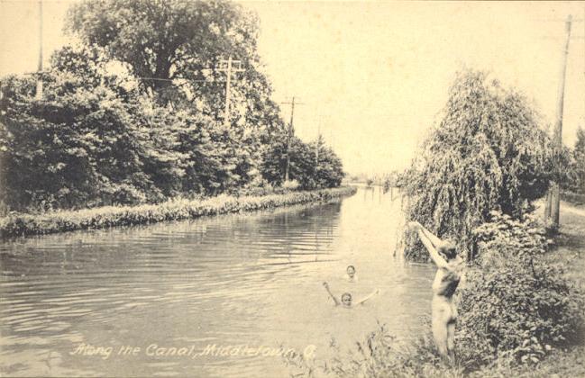
 Along the canal c.1910
A branch canal, the Warren County Canal, was constructed from the Miami and Erie Canal at Middletown, Ohio to Lebanon, Ohio. This branch was opened in 1840, but remained in operation less than 15 years before being abandoned.
A short branch, the Sidney or Port Jefferson feeder canal ran up the Miami Valley from Lockington through Sidney to a dam just upstream from Port Jefferson.
Much of the canal corridor remains a prosperous manufacturing area; today Interstate 75 and railroads provide transportation rather than the canal.
At Providence Metropark along the Maumee River near Grand Rapids, Ohio, there is a historical reenactment of the Miami-Erie canal. Historical actors dress and act as if it is 1876 during the months of May–October. Two mules pull the canal boat titled "The Volunteer" while workers till and provide commentary to the passengers. Providence Metroparks boasts using an original lock as part of the tour. That lock is the only working lock in the state of Ohio.
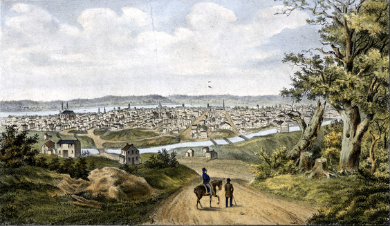
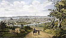 The canal figures prominently in this 1841 lithograph view of Cincinnati
Contents
Construction standards
NOTE: Standards varied by region of the state.
- 4 ft (1.2 m) water depth.
- 40 ft (12 m) wide at water level.
- 10 ft (3.0 m) wide towpath in addition to mandated outer slopes.
- All slopes are 4.5 ft (1.4 m) horizontal to 4 ft (1.2 m). perpendicular.
- The canal could accommodate boats up to 32 ft (9.8 m) long and 14 ft (4.3 m) wide.
Copies of the original survey plat maps for the construction of both Ohio canals are available on-line from the Ohio Department of Natural Resources.[3]
Decline and abandonment
Completed just before most of the railroads in Ohio were built, the canal competed with railroads through much of its useful life. Ice in the winter, as well as the slowness of the boats, made it less efficient than railroads, especially for perishable goods and passenger traffic. The canal was a cheaper means for carrying bulk cargoes, such as grain and salted pork, though by 1906, the canal had largely ceased to operate. A catastrophic flood of the Great Miami River in 1913 and the subsequent flood control measures constructed by the Miami Conservancy District destroyed much of the canal infrastructure along the southern portion of the route where it paralleled the Great Miami River.
One of the original locks (#17) is located in the Carillon Historical Park in Dayton, Ohio. An unrestored, but complete lock (#15) is located just off Main Street (State Route 571) in Tipp City. Remains of the Excello lock are still located in the Butler County Excello Locks Park near the intersection of State Route 73 and South Hamilton Middletown Road in Lemon Township.
Much of the original towpath served as the right-of-way for the Cincinnati and Lake Erie Railroad, an electric interurban streetcar that operated until 1940. Part of the right-of-way was converted to the Wright-Lockland Highway (now part of Interstate 75).[4]
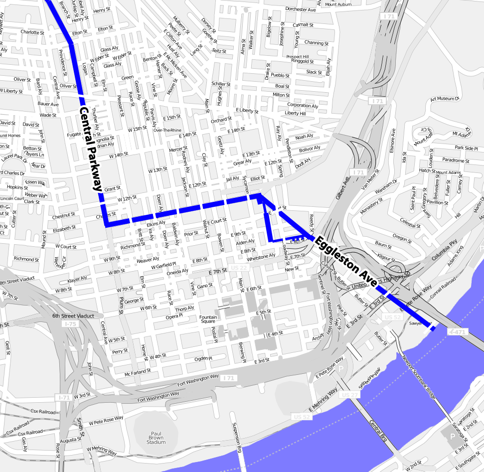
From 1920 to 1925, six million dollars was spent to use the bed of the canal to build a downtown subway in Cincinnati. The surface was later paved over to form Central Parkway as funds ran out before the Cincinnati Subway was completed.
 The Deep Cut as seen in 2008. A steep climb down is needed to reach the canal level from the parking area nearby.
Location
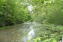
Urban redevelopment has eliminated the beginnings and ends of the canal. However, on the canal's southern end there is a drained section located in St. Bernard, Ohio's Ludlow Park where the canal bed is still visible. The canal remains in water (and navigable for canoes or kayaks) in the rural region between Delphos, Ohio and St. Marys, Ohio. South of St. Mary's, it has degraded to form a shallow ditch in most places, with some ruined locks remaining. From north to south along State Route 66, one can see pieces of the original canal in Delphos, at a small historic park located at the "Deep Cut," in Spencerville, Lock Two (a hamlet mostly consisting of period brick buildings), New Bremen, Minster, Fort Loramie, and Piqua. The Miami and Erie Canal Deep Cut is a U.S. National Historic Landmark near Spencerville that was designated in 1964. The Piqua Historical Area[5] features a replica canal boat and other related items. The Delphos Canal Commission also has a canal museum located on Main Street.
In addition, visitors to Providence Metropark, near Grand Rapids in the northwest part of the state, are able to ride a replica canal boat as it goes through lock number 44. Lock 44 is an original Miami and Erie canal lock and Providence Metropark is the only place in Ohio in which visitors are able to travel completely through a functioning canal lock.[6] Other sites of interest are listed.[7][8]
The northern portion of the towpath (from Fort Loramie to Delphos and beyond) is used as a hiking trail.[9] The massive west abutment of the Old Nine-mile Aqueduct over the Great Miami River is still present ca. 400 ft (120 m) upstream of the Taylorsville Dam east of Vandalia (Montgomery County). The aqueduct was destroyed by the Great 1913 Flood. The abutment terminates a fairly intact canal segment that extends at least 5 mi (8.0 km) north to Tipp City. This segment includes an intact concrete weir near the abandoned Vandalia water treatment plant (aka "Tadmore Station") and a ruined lock (#16, "Picayune") about halfway to Tipp City along Canal Road.
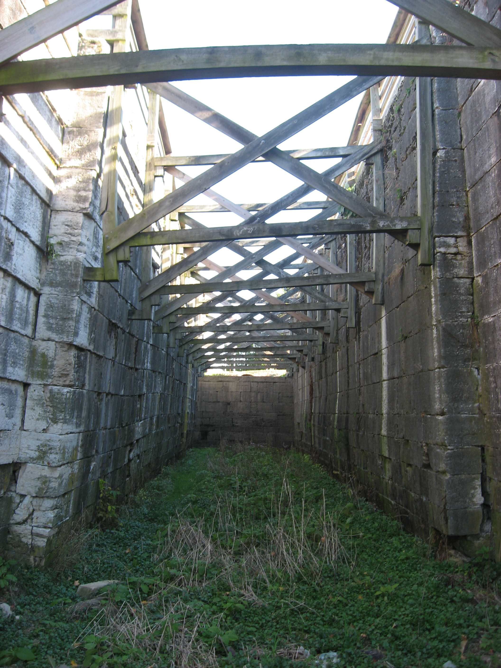
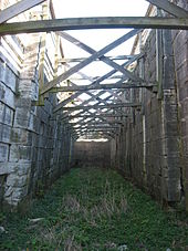 Interior of one of the Lockington Locks
A 28 page visitor's guide booklet to the Miami & Erie Canal Heritage Corridor, including numbered tour map, stories, photos and descriptions of canal features, local attractions, museums, parks, and hiking trails is available online from the Ohio Department of Natural Resources.[1] A map showing the disposition of the canal lands[10] is available online from the Ohio Department of Natural Resources.
Cities and towns along the canal
The following is a list of towns and cities (arranged North to South) along the Miami and Erie Canal.
- Toledo, Ohio
- Maumee, Ohio
- Waterville, Ohio
- Providence, Ohio
- Texas, Ohio
- Napoleon, Ohio
- Florida, Ohio
- Defiance, Ohio
- Junction, Ohio
- Melrose, Ohio
- Ottoville, Ohio
- Delphos, Ohio
- Spencerville, Ohio
- St. Marys, Ohio
- New Bremen, Ohio
- Minster, Ohio
- Fort Loramie, Ohio
- Port Jefferson, Ohio (North end of the Sidney Feeder)
- Sidney, Ohio (Middle section of the feeder)
- Lockington, Ohio (Southern end junction of the Sidney Feeder)
- Piqua, Ohio
- Troy, Ohio
- Tipp City, Ohio
- Huber Heights, Ohio
- Dayton, Ohio
- Moraine, Ohio
- Alexandersville, Ohio
- West Carrollton, Ohio
- Miamisburg, Ohio
- Franklin, Ohio
- Middletown, Ohio
- Sharonville, Ohio
- Lockland, Ohio (Site of the first set of locks)
- St. Bernard, Ohio
- Cincinnati, Ohio
References
- ^ a b "Discover Ohio’s Miami and Erie Canal". Department of Natural Resources of Ohio, USA. http://www.dnr.state.oh.us/Portals/7/canals/newcanalcover_lrg.jpg. Retrieved 2011-10-26.
- ^ "Maria Stein Heritage Museum". http://www.mariasteinshrine.org/?page_id=161/.
- ^ "Plat Maps of Miami & Erie and Ohio & Erie Canals". Department of Natural Resources of Ohio, USA. http://www.dnr.state.oh.us/water/cnlplatsa/tabid/3287/Default.aspx. Retrieved 2009-01-03.
- ^ "Interstate 75 — 1940s". Cincinnati Transit. http://www.cincinnati-transit.net/75-40.html. Retrieved 2009-01-03.
- ^ "The General Harrison of Piqua Arrives". Ohio Historical Society. http://www.ohiohistory.org/places/piqua/canalboat.html. Retrieved 2009-01-03.
- ^ "The Canal Experience (Miami & Erie Canal)". MetroParks, Toledo Area. http://www.metroparkstoledo.com/metro/parksandplaces/index.asp?page_id=527. Retrieved 2009-11-20.
- ^ "Miami & Erie Canal Scenic Byway". Ohio Byways. Archived from the original on 2008-06-18. http://web.archive.org/web/20080618055521/http://www.ohiobyways.com/Miami_and_Erie_Canal/miami_and_erie_canal_scenic_bywa.htm.
- ^ "Miami-Erie Canal Corridor Association". Rider Town. http://www.ridertown.com/news/pages/mecca.html. Retrieved 2009-11-20.
- ^ "Miami and Erie Canal". Ohio Hiking Trails. http://www.hiking.ohiotrail.com/. Retrieved 2009-01-03.
- ^ "Historic Canal System Current Status — Year 2000 Map". Department of Natural Resources of Ohio, USA. http://www.dnr.state.oh.us/water/realmap_a/tabid/3309/Default.aspx. Retrieved 2009-01-03.
External links
- Map of canals in Ohio, the Miami and Erie Canal is on the left
- Miami-Erie Canal Corridor Association History of the canal and description of current efforts to preserve historical features
- Piqua Historical Society images of the Miami-Erie Canal
- Current photos of the Miami-Erie canal from Ohio Byways
- Piqua Historical Area includes a stretch of canal and a functional replica canal boat
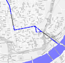
- Map - Miami and Erie Canal through Cincinnati
- Plat maps of canal by county - ODNR
- Ohio Canals Map
Coordinates: 39°06′03″N 84°29′49″W / 39.10083°N 84.49694°W
Categories:- Canals in Ohio
- Warren County, Ohio
- Butler County, Ohio
- Hamilton County, Ohio
- Montgomery County, Ohio
- Transportation in Auglaize County, Ohio
- Shelby County, Ohio

Wikimedia Foundation. 2010.