- St. Marys, Ohio
Infobox Settlement
official_name = St. Marys, Ohio
native_name =
settlement_type =City
nickname = Rider Town
motto =
imagesize =
image_caption =
image_
image_shield =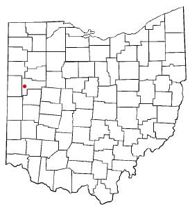
mapsize = 250px
map_caption = Location inOhio
mapsize1 =
map_caption1 =
subdivision_type = Country
subdivision_name =United States
subdivision_type1 = State
subdivision_name1 =Ohio
subdivision_type2 = County
subdivision_name2 = Auglaize
subdivision_type3 =
subdivision_name3 =
subdivision_type4 =
subdivision_name4 =
government_type =
leader_title =Mayor
leader_name = Greg Freewalt
leader_title1 = Director of Public Service and Safety
leader_name1 = Thomas J. Hitchcock
leader_title2 =
leader_name2 =
leader_title3 =
leader_name3 =
established_title = incorporated
established_date = 1834
established_title2 =
established_date2 =
established_title3 =
established_date3 =
area_magnitude =
area_total_km2 = 11.3
area_total_sq_mi = 4.4
area_land_km2 = 11.2
area_land_sq_mi = 4.3
area_water_km2 = 0.1
area_water_sq_mi = 0.0
area_water_percent =
area_urban_km2 =
area_urban_sq_mi =
area_metro_km2 =
area_metro_sq_mi =
population_as_of = 2000
population_note = census
population_total = 8342
population_density_km2 = 743.8
population_density_sq_mi = 1926.7
population_metro =
population_density_metro_km2 =
population_density_metro_sq_mi =
population_urban =
population_density_urban_km2 =
population_density_urban_sq_mi =
timezone = EST
utc_offset = -4
timezone_DST = EDT
utc_offset_DST = -4
latd = 40 |latm = 32 |lats = 39 |latNS = N
longd = 84 |longm = 23 |longs = 24 |longEW = W
elevation_m = 264
elevation_ft = 866
postal_code_type = Zip code
postal_code = 45885
area_code = 419
website = http://www.cityofstmarys.net/
blank_name = FIPS code
blank_info = 39-69680GR|2
blank1_name = GNIS feature ID
blank1_info = 1070921GR|3
footnotes =St. Marys is a city in Auglaize County,
Ohio , in theUnited States with a population of 8,342 [ [http://factfinder.census.gov/servlet/SAFFFacts?_event=Search&geo_id=16000US3969680&_geoContext=01000US%7C04000US39%7C16000US3969680&_street=&_county=St+Marys+city&_cityTown=St+Marys+city&_state=04000US39&_zip=&_lang=en&_sse=on&ActiveGeoDiv=geoSelect&_useEV=&pctxt=fph&pgsl=160&_submenuId=factsheet_1&ds_name=DEC_2000_SAFF&_ci_nbr=&qr_name=®=%3A&_keyword=&_industry= Census Bureau Fact Sheet of Saint Marys OH] ] as of the 2000 U.S. census. It is included in theWapakoneta, Ohio Micropolitan Statistical Area .History
St. Marys has gone by a variety of names, the first of which was the name of a Native American village on the same location—Kettletown.
Formerly known as "Fort Barbee" and "Girty's Town", St. Marys was the
county seat of Mercer County from 1824 until 1840 when the seat was moved to Celina. After Auglaize County was organized in 1848, St. Marys competed with Wapakoneta for the position as county seat, but was ultimately unsuccessful in a controversial countywide election. [http://contentdm.lib.byu.edu/cdm4/document.php?CISOROOT=/FH9&CISOPTR=38590&REC=8 Auglaize County, Ohio Atlas and History, Piqua: Magee Brother Publishing, 1917. Accessed5 July 2007 . Page 104.]Geography
St Marys is located at coor dms|40|32|39|N|84|23|24|W|city (40.544256, -84.390060)GR|1.
According to the
United States Census Bureau , the city has a total area of 4.4square mile s (11.3km² ), of which, 4.3 square miles (11.2 km²) of it is land and 0.04 square miles (0.1 km²) of it (0.69%) is water.Demographics
As of the
census GR|2 of 2000, there were 8,342 [ [http://factfinder.census.gov/servlet/SAFFFacts?_event=Search&geo_id=16000US3969680&_geoContext=01000US%7C04000US39%7C16000US3969680&_street=&_county=St+Marys+city&_cityTown=St+Marys+city&_state=04000US39&_zip=&_lang=en&_sse=on&ActiveGeoDiv=geoSelect&_useEV=&pctxt=fph&pgsl=160&_submenuId=factsheet_1&ds_name=DEC_2000_SAFF&_ci_nbr=&qr_name=®=%3A&_keyword=&_industry= Census Bureau Fact Sheet of Saint Marys OH] ] people, 3,218 households, and 2,240 families residing in the city. Thepopulation density was 1,926.7 people per square mile (743.8/km²). There were 3,479 housing units at an average density of 803.5/sq mi (310.2/km²). The racial makeup of the city was 97.49% White, 0.35% African American, 0.13% Native American, 0.98% Asian, 0.02% Pacific Islander, 0.14% from other races, and 0.88% from two or more races. Hispanic or Latino of any race were 0.46% of the population.There were 3,218 households out of which 35.1% had children under the age of 18 living with them, 54.9% were married couples living together, 10.6% had a female householder with no husband present, and 30.4% were non-families. 26.9% of all households were made up of individuals and 12.0% had someone living alone who was 65 years of age or older. The average household size was 2.55 and the average family size was 3.10.
In the city the population was spread out with 28.3% under the age of 18, 7.9% from 18 to 24, 28.5% from 25 to 44, 20.3% from 45 to 64, and 14.9% who were 65 years of age or older. The median age was 35 years. For every 100 females there were 94.2 males. For every 100 females age 18 and over, there were 88.5 males.
The median income for a household in the city was $38,673, and the median income for a family was $44,247. Males had a median income of $38,371 versus $22,080 for females. The
per capita income for the city was $17,682. About 5.7% of families and 7.3% of the population were below thepoverty line , including 9.8% of those under age 18 and 4.9% of those age 65 or over.ister cities
St. Marys has two sister cities, as designated by the [http://www.sister-cities.org/ Sister Cities International] :
ee also
References
External links
* [http://www.cityofstmarys.net City of Saint Marys Official Website]
* [http://www.theeveningleader.com/ The Evening Leader-local newspaper]
* [http://sm.k12.oh.us/ Saint Marys City Schools]
* [http://www.stmarys.lib.oh.us/ St. Marys Community Public Library]
* [http://www.dnr.state.oh.us/parks/parks/grndlake.htm Grand Lake St. Marys State Park]
* [http://www.seemore.org/index.html Auglaize and Mercer County Convention and Visitors Bureau]
* [http://www.stmarys.us/ Saint Marys Theater and Grand Opera House Official Website]
* [http://www.ridertown.com/ Ridertown, "virtual St. Marys, Ohio"]
Wikimedia Foundation. 2010.