- Chikusa-ku, Nagoya
-
Chikusa-ku
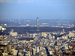
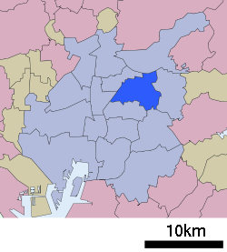
千種区— Ward — Higashiyama Sky tower and park as seen from Midland square Location of Chikusa-ku in Aichi Prefecture Coordinates: 35°10′12″N 136°58′1″E / 35.17°N 136.96694°ECoordinates: 35°10′12″N 136°58′1″E / 35.17°N 136.96694°E Country Japan Region Chūbu region
Tōkai regionPrefecture Aichi Prefecture Area – Total 18.23 km2 (7 sq mi) Population (September 2011 [1]) – Total 160,747 – Density 8,696/km2 (22,522.5/sq mi) Time zone Japan Standard Time (UTC+9) City symbols - Flower Hydrangea[2] - Flowering tree Flowering Dogwood Phone number 052-762-3111 Address 愛知県名古屋市千種区覚王山通8-37
464-8644Website city.nagoya.jp/chikusa/ (Japanese) Chikusa (千種区 chikusa-ku) is one of the 16 wards of the city of Nagoya in Aichi Prefecture, Japan, in the eastern part of the city.
Contents
Places
It has a number of large parks such as Higashiyama Park and Heiwa Park, is the home to the Higashiyama Zoo and Botanical Gardens, and contains the Higashiyama Sky Tower. The area also has a large number of educational institutions including Nagoya University, Aichi Gakuin University School of Dentistry and the Kita Chikusa campus of the Nagoya City University, as well as a handful of private secondary schools.
The postal code for most of Chikusa-ku begins with 464.
Transportation
The first line in the Nagoya Municipal Subway was built to link the neighbourhoods of Chikusa-ku to the city centre. The Line 1, later became known as the Higashiyama Line (or the "H" line), has seven stations in Chikusa-ku: H-12 Chikusa (connection to JR Central's Chūō line), H-13/S-08 Imaike (connection to the Sakura-dōri "S" Line, Line 6), H-14 Ikeshita (a major city bus terminus), H-15 Kakuōzan, H-16/M-17 Motoyama (connection to the Meijo "M" Line, Line 4), H-17 Higashiyama Kōen, and H-18 Hoshigaoka.
Economy
Major commercial centres are located around the Imaike and Hoshigaoka stations.
References
- ^ "平成23年9月1日現在の世帯数と人口(全市・区別)" (in Japanese). Nagoya City. 20 September 2011. http://www.city.nagoya.jp/somu/page/0000028476.html.
- ^ "千種区の概要" (in Japanese). Nagoya City. 1 October 2007. http://www.city.nagoya.jp/chikusa/category/73-3-3-0-0-0-0-0-0-0.html. Retrieved 7 January 2011.
External links
- Official website (Japanese)
- General information (Japanese)
 Aichi Prefecture
Nagoya (capital city) 
Other cities Aichi District Ama District Chita District Kitashitara District Nishikasugai District Niwa District Nukata District 
This Aichi Prefecture location article is a stub. You can help Wikipedia by expanding it.


