- Minato-ku, Nagoya
-
Minato-ku
港区— Ward — Location of Minato-ku in Aichi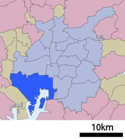

 Minato-ku
Coordinates: 35°6′28″N 136°53′8″E / 35.10778°N 136.88556°ECoordinates: 35°6′28″N 136°53′8″E / 35.10778°N 136.88556°E Country Japan Region Chūbu
Tōkai regionPrefecture Aichi Area – Total 45.69 km2 (17.6 sq mi) Population (September 2011 [1]) – Total 148,166 – Density 3,300/km2 (8,547/sq mi) Time zone Japan Standard Time (UTC+9) City symbols - Tree Camphor tree - Flower Hibiscus [2] - Flowering tree Camellia sasanqua [2] Phone number 052-651-3251 Address 愛知県名古屋市港区港明一丁目12-20
455-8520Website city.nagoya.jp/minato/ (Japanese) Minato-ku (港区 minato-ku) (lit: port ward) is one of 16 wards of the city of Nagoya, Aichi Prefecture, Japan
There is Nagoya Port in Minato ward.
Minato Ward is the largest ward in terms of area out of all 16 of the wards of Nagoya City at 45.69 square kilometres (17.64 sq mi).[1]
Festivals
There is an annual festival at Nagoya Port called the Marine Day Nagoya Port Festival. The first was held in 1946, as part of the postwar development plan. The festival is held on Marine Day.[3]
References
- ^ a b "平成23年9月1日現在の世帯数と人口(全市・区別)" (in Japanese). Nagoya City. 20 September 2011. http://www.city.nagoya.jp/somu/page/0000028476.html.
- ^ a b "港区のあらまし". Nagoya City. 10 March 2010. http://www.city.nagoya.jp/minato/page/0000001237.html. Retrieved 7 January 2011.
 Aichi Prefecture
Nagoya (capital city) 
Other cities Aichi District Ama District Chita District Kitashitara District Nishikasugai District Niwa District Nukata District 
This Aichi Prefecture location article is a stub. You can help Wikipedia by expanding it.

