- Kingborough Council
-
Kingborough Council
Tasmania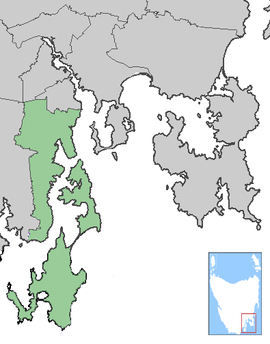
Kingborough CouncilPopulation: 34,171[1] Coordinates: 43°00′36″S 147°13′12″E / 43.01°S 147.22°ECoordinates: 43°00′36″S 147°13′12″E / 43.01°S 147.22°E Area: 717 km² (276.8 sq mi) Mayor: Graham Bury Council Seat: Kingston Region: Kingston and Channel State District: Franklin, Denison Federal Division: Franklin, Denison LGAs around Kingborough Council: Glenorchy Hobart Hobart Huon Valley Kingborough Council Storm Bay Huon Valley Southern Ocean Southern Ocean The Kingborough Council or Municipality of Kingborough is a Local Government Area of Tasmania, just to the south of Hobart, Tasmania.
It includes the Hobart satellite town of Kingston and its surrounding suburbs, as well as several surrounding towns including Kettering, Margate, and Snug. It also includes the whole of Bruny Island.
Contents
Environment
Mount Wellington, North West Bay River, D'Entrecasteaux Channel and Bruny Island are major features of the natural environment of the Kingborough Municipality.[2]
The Kingborough coastal regions are increasingly subject to rising sea levels and resultant foreshore erosion. Communities in some areas are starting to sandbag sections of coast to reduce the effects.[3]
See also
References
- ^ "3218.0 - Regional Population Growth, Australia, 2009-10". Australian Bureau of Statistics. 31 March 2011. http://www.abs.gov.au/AUSSTATS/abs@.nsf/DetailsPage/3218.02009-10?OpenDocument. Retrieved 23 August 2011. Estimated resident population (ERP) at 30 June 2010.
- ^ Kingborough Council, Kingborough Council Website 2011
- ^ Flora Fox, Flora Fox, News and Information about Southern Tasmania 2011
External links
Local Government Areas of Tasmania Central 
Hobart area Launceston area North-east area North-west and west coast South-east area Categories:- Local Government Areas of Tasmania
- Southern Tasmania
- Australia government stubs

Wikimedia Foundation. 2010.