- Central Highlands Council
Infobox Australian Place | type = lga
name = Central Highlands Council
state = Tasmania
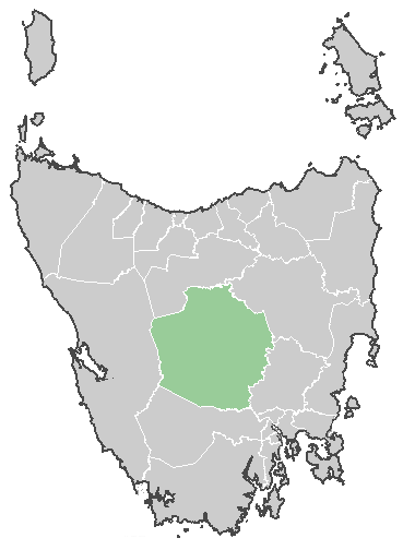
caption = Central Highlands Council
pop = 2,337 (est., June 5) [cite web|url=http://www.abs.gov.au/ausstats/abs@.nsf/Latestproducts/3218.0Main%20Features72004-05?opendocument&tabname=Summary&prodno=3218.0&issue=2004-05&num=&view=|title=Local Government Area populations and median ages - Tasmania]
area = 7976.4
est =
seat = Hamilton
mayor = Deirdre Flint
region = Central Highlands
logo =
url = http://www.centralhighlands.tas.gov.au
stategov = Lyons
fedgov = Lyons
near-nw = West Coast
near-n = Meander Valley
near-ne = Northern Midlands
near-w = West Coast
near-e = Southern Midlands
near-sw = West Coast
near-s = Derwent Valley
near-se = Southern MidlandsThe Central Highlands Council is a Local Government Area in the central highland region ofTasmania .Parks and reserves
It covers most of the mountainous centre of the state, also known as the Central Plateau which contains the
Central Plateau Conservation Area including sections of the Tasmanian Wilderness World Heritage Area, as well as theCradle Mountain-Lake St Clair National Park , andWalls of Jerusalem National Park . Other smaller reserves of different status occur in the region as well.Towns
The population of the area is small and quite decentralised, resulting in a large number of small towns - Bothwell, Bronte Park, Derwent Bridge, Ouse, Liawenee, Miena and Tarraleah. Some of these towns were founded as support sites for workers on the hydro-electric dams scattered along the upper Derwent River. Main towns are considered as Bothwell and Hamilton.
Population
Central Highlands Council have the second highest birth rate in all of Tasmania and one of the highest birth rates for all of Australia. The TFR was estimated at 3.20 in 2006. Source. Only George Town with a TFR of 3.75 had a higher birth rate than Central Highlands. [http://www.news.com.au/mercury/story/0,22884,20600554-5007221,00.html]
Region
Some tourism materials combine the LGA area with that of the Derwent Valley to call it "Derwent Valley and Highlands" region [ http://www.about-australia.com/tasmania/derwent-valley-highlands/ ]
References
External links
* [http://www.centralhighlands.tas.gov.au/ Central Highlands Council]
Further reading
* Jetson, Tim.(1989) "The roof of Tasmania: a history of the Central Plateau" Launceston, Tas.: Pelion Press. ISBN 0731672143
Wikimedia Foundation. 2010.