Waratah-Wynyard Council

Waratah-Wynyard Council

Infobox Australian Place | type = lga
name = Waratah-Wynyard Council
state = Tasmania


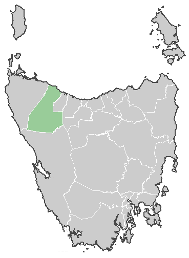
caption = Waratah-Wynyard Council
pop = 13,318 (est., June 05) [cite web|url=http://www.abs.gov.au/ausstats/abs@.nsf/Latestproducts/3218.0Main%20Features72004-05?opendocument&tabname=Summary&prodno=3218.0&issue=2004-05&num=&view=|title=Local Government Area populations and median ages - Tasmania]
area = 1187
est =
seat = Wynyard
mayor = Kevin Hyland
region = Wynyard and Waratah

url = http://www.warwyn.tas.gov.au
stategov = Braddon
fedgov = Braddon
near-nw = "Bass Strait"
near-n = "Bass Strait"
near-ne = Burnie
near-w = Circular Head
near-e = Central Coast
near-sw = West Coast
near-s = West Coast
near-se = Kentish
The Waratah-Wynyard Council is a Local Government Area of Tasmania, Australia. It is located in the north-west of the state, just to the west of Burnie.

It covers an area from Wynyard near the coast, to the inland mining towns of Waratah and Savage River. It also includes the Burnie satellite town of Somerset. The current mayor is Mayor Kevin Hyland.

The Council was formed in 1993 by the merger of the Municipality of Wynyard with the Municipality of Waratah. There has been suggestion of renaming the council to Table Cape, which was the former name of the Wynyard council.

Past mayors

*Roger Chalk (October 2000 - October 2005)

References

External links

* [http://www.warwyn.tas.gov.au Waratah-Wynyard Council]


Wikimedia Foundation. 2010.

Игры ⚽ Поможем написать реферат

Look at other dictionaries:

  • Waratah-Wynyard Municipality — Waratah Wynyard Lage der Waratah Wynyard Municipality in Tasmanien Gliederung …   Deutsch Wikipedia

  • Wynyard — Staat: Australien Bundesstaat …   Deutsch Wikipedia

  • Waratah, Tasmania — Waratah is a town in western Tasmania. It was constructed to support a tin mine at Mount Bischoff. The town is built at the top of a waterfall, and water was diverted from the stream to provide water for mine sluicing and processing.Waratah is… …   Wikipedia

  • Wynyard, Tasmania — Infobox Australian Place | type = town name = Wynyard state = tas caption = Table Cape as seen at dusk lga = Waratah Wynyard Council postcode = 7325 est = pop = 4,812 pop footnotes= elevation= 12 elevation footnotes= [… …   Wikipedia

  • Kingborough Council — Tasmania Kingborough Council Population: 34 …   Wikipedia

  • Brighton Council — Tasmania Brighton Council Population: 16,358 …   Wikipedia

  • Circular Head Council — Tasmania Circular Head Council Population …   Wikipedia

  • Northern Midlands Council — Tasmania Northern Midlands Council Population …   Wikipedia

  • Central Coast Council — Infobox Australian Place | type = lga name = Central Coast Council state = Tasmania caption = Central Coast Council pop = 20,914 (est., June 5) [cite web|url=http://www.abs.gov.au/ausstats/abs@.nsf/Latestproducts/3218.0Main%20Features72004… …   Wikipedia

  • Kentish Council — Infobox Australian Place | type = lga name = Kentish Council state = Tasmania caption = Kentish Council pop = 5,784 (est., June 05) [cite web|url=http://www.abs.gov.au/ausstats/abs@.nsf/Latestproducts/3218.0Main%20Features72004 05?opendocument… …   Wikipedia

Share the article and excerpts

Direct link
Do a right-click on the link above
and select “Copy Link”