- Warrane, Tasmania
-
Warrane
Hobart, Tasmania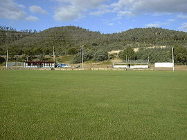
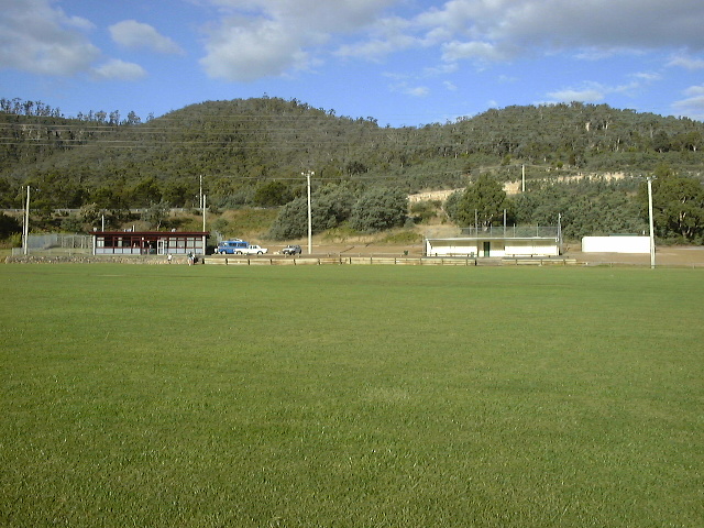
North Warrane Oval with the Meehan Ranges in the backgroundPopulation: 2194 (2006)[1] Postcode: 7018 Coordinates: 42°51′35″S 147°22′36″E / 42.85972°S 147.37667°ECoordinates: 42°51′35″S 147°22′36″E / 42.85972°S 147.37667°E LGA: City of Clarence Federal Division: Franklin Suburbs around Warrane: Rose Bay Lindisfarne Flagstaff Gully Montagu Bay Warrane Mornington Rosny Park Bellerive Mornington Warrane is a suburb of Hobart, Tasmania, in the City of Clarence. It is approximately 5 kilometres (3 mi) from Hobart's CBD. It is located between Rosny Park and Mornington and runs parallel to the Tasman Highway.
Warrane is a primarily residential suburb, and is served by Rosny Park for commercial services.
Public facilities include Warrane Primary School, Clarence Campus of The Tasmanian Polytechnic and the Tasmanian Academy (formerly TAFE Tasmania).
Contents
Sporting amenities include
The Warrane Sports Centre,
Warriors Park (Formerly the Warrane Hockey Centre) an AstroTurf Pitch and is the home of Hobart Olympia Warriors,
The North Warrane Oval is sheltered by the Meehan Range and is home to the Eastern Suburbs Rugby Union Football Club Inc., St. Aidans Cricket Club and Nelson Eastern Suburbs FC.
Meehan Range
On its north-eastern side, Warrane abuts the Meehan Range, a bushland area with bush walks, cliffs, and views of Mount Wellington and surrounding areas. The ranges are home to native wildlife including Tasmanian Devils and Tiger snakes.
References
- ^ Australian Bureau of Statistics (25 October 2007). "Warrane (State Suburb)". 2006 Census QuickStats. http://www.censusdata.abs.gov.au/ABSNavigation/prenav/LocationSearch?collection=Census&period=2006&areacode=SSC61351&producttype=QuickStats&breadcrumb=PL&action=401. Retrieved 6 June 2009.
External links
- TAFE Tasmania
- City of Clarence
- Eastern Suburbs Rugby Union Football Club
- Nelson Eastern Suburbs Football Club
- Olympia Football Club
- St. Aidans Cricket Club
Categories:- Suburbs of Hobart
- Tasmania geography stubs
Wikimedia Foundation. 2010.